Inner Harbor in Baltimore, Maryland — The American Northeast (Mid-Atlantic)
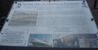
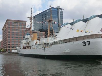
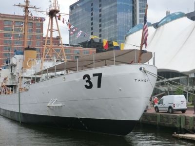
The Coast Guard Cutter Taney
The last surviving warship from the attack on Pearl Harbor
| — | "Saving One of America's Treasures" | — |
Photographed by Richard E. Miller, January 4, 2009
1. The Coast Guard Cutter Taney Marker
In 2003 TANEY underwent a major renovation at the Coast Guard Yard in Curtis Bay. The work begun there continues today. We would like to thank all those who made this restoration possible: Save America's Treasures (a program of the National Park Service), United States Coast Guard, Curtis Bay, General Ship Repair Corp., Middendorf Foundation, Hahn Foundation, Navy League of Baltimore, Chesapeake Coatings, Ameron International, Belzona, Moran Towing, Vane Brothers, Smith's Shipyard, Corman-Imbach Co., Neale Foundation, Propeller Club of Baltimore, USCGC Taney Association, USCGC Spencer Association, and all contributors to the CGC Taney Fund. ...
[Illustration caption:]
TANEY December 7, 1941 [by] Keith Ferris.
[Your ticket to the Maritime Museum includes
this page online
Erected by Baltimore Maritime Museum.
Topics and series. This historical marker is listed in these topic lists: War, Vietnam • War, World II • Waterways & Vessels. In addition, it is included in the National Historic Landmarks series list. A significant historical date for this entry is December 7, 1862.
Location. This marker has been replaced by another marker nearby. It was located near 39° 17.108′ N, 76° 36.37′ W. Marker was in Baltimore, Maryland. It was in the Inner Harbor. It could be reached from the intersection of Harbor Bridge Walk and Harbor Magic Drive. Touch for map. Marker was in this post office area: Baltimore MD 21202, United States of America. Touch for directions.

Regionally, this marker was in Central Maryland. It was also in the American Mid-Atlantic, in the Chesapeake Bay Region, and on the Eastern Seaboard. Globally, it was in the North Atlantic Region, North America, the Western Hemisphere, the Western World, and the Anglosphere. Historically, it found itself in what was once one of the original Thirteen Colonies and also
Photographed by Don Morfe, June 14, 2012
2. The Coast Guard Cutter Taney Marker
Other nearby markers. At least 8 other markers are within walking distance of this location: The Last Pearl Harbor Survivor (here, next to this marker); Tilly's Escape (within shouting distance of this marker); Pathways to Freedom (within shouting distance of this marker); Always Changing (about 400 feet away, measured in a direct line); How Can We All Help? (about 400 feet away); a different marker also named Seven Foot Knoll Lighthouse (about 600 feet away); Discover Baltimore: Four Centuries of Change (about 600 feet away); Discovering the Jones Falls (about 600 feet away). Touch for a list and map of all markers in Baltimore.
Other markers no longer nearby. Coast Guard Cutter Taney - WHEC-37 (was here, next to this marker but has been replaced with another marker now near it); Seven Foot Knoll Lighthouse (was about 500 feet away but has been replaced with another marker now near it); Seven-Foot Knoll Lighthouse (was about 500 feet away but has been replaced with another marker now near it); Water Power: Baltimore's Economic Engine (was about 600 feet away but has been replaced with another marker now near it); Living Classrooms Foundation (was about 600 feet away but
Photographed by Don Morfe, June 14, 2012
3. The Coast Guard Cutter Taney Marker
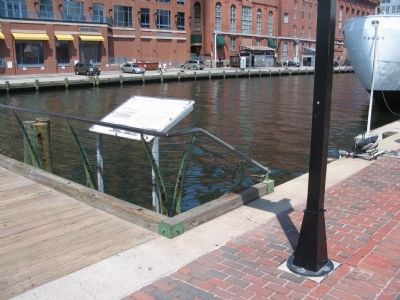
More about this marker. CGC Taney is moored in Baltimore's Inner Harbor at Pier 5. The marker is accessible to pedestrians at the east end of the Bridge walk which connects Piers 4 and 5, one block south of E. Pratt Street at the west end of Eastern Avenue - two blocks west of S. President Street.
Related marker. Click here for another marker that is related to this marker. This marker has been replaced by the linked marker.
Also see . . . USCGC Taney. (Submitted on January 4, 2009, by Richard E. Miller of Oxon Hill, Maryland.)
Additional keywords. WHEC-37; Okinawa; Operation Ma The Coast Guard Cutter Taney
Photographed by Craig Swain, May 16, 2010
4. The Coast Guard Cutter Taney Marker
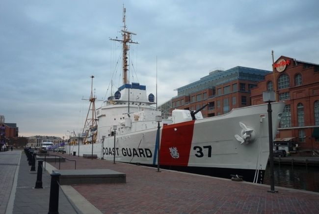
Photographed by Richard E. Miller, January 4, 2009
5. The Coast Guard Cutter Taney
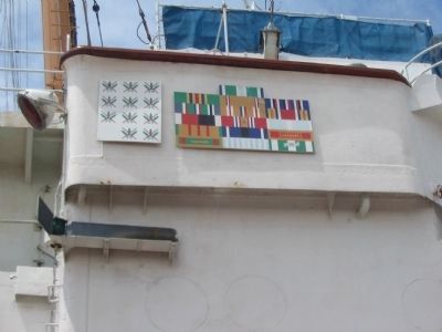
Photographed by Craig Swain, May 16, 2010
6. Battle Honors of the USCGC Taney
Credits. This page was last revised on October 8, 2021. It was originally submitted on January 4, 2009, by Richard E. Miller of Oxon Hill, Maryland. This page has been viewed 2,653 times since then and 50 times this year. Photos: 1. submitted on January 4, 2009, by Richard E. Miller of Oxon Hill, Maryland. 2, 3. submitted on September 26, 2012, by Don Morfe of Baltimore, Maryland. 4. submitted on August 24, 2010, by Craig Swain of Leesburg, Virginia. 5. submitted on January 4, 2009, by Richard E. Miller of Oxon Hill, Maryland. 6. submitted on August 24, 2010, by Craig Swain of Leesburg, Virginia. • Bill Pfingsten was the editor who published this page.
