Marker Logo
THE HISTORICAL
MARKER DATABASE
“Bite-Size Bits of Local, National, and Global History”
Near Buckholts in Milam County, Texas — The American South (West South Central)
 

Sharp Cemetery
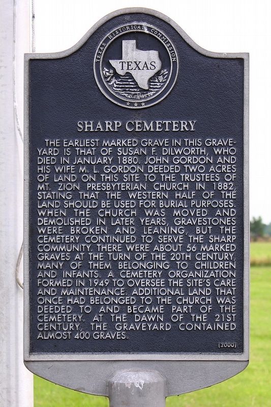
 
 
Sharp Cemetery Marker image. Click for full size.
Photographed by Larry D. Moore, June 1, 2020
1. Sharp Cemetery Marker
Inscription. The earliest marked grave in this graveyard is that of Susan F. Dilworth, who died in January 1880. John Gordon and his wife M. L. Gordon deeded two acres of land on this site to the trustees of Mt. Zion Presbyterian Church in 1882, stating that the western half of the land should be used for burial purposes. When the church was moved and demolished in later years, gravestones were broken and leaning, but the cemetery continued to serve the Sharp community. There were about 56 marked graves at the turn of the 20th century, many of them belonging to children and infants. A cemetery organization formed in 1949 to oversee the site's care and maintenance. Additional land that once had belonged to the church was deeded to and became part of the cemetery. At the dawn of the 21st century, the graveyard contained almost 400 graves.
 
Erected 2000 by Texas Historical Commission. (Marker Number 12315.)
 
Topics. This historical marker is listed in this topic list: Cemeteries & Burial Sites. A significant historical month for this entry is January 1880.
 
Location. 30° 44.989′ N, 97° 8.277′ W. Marker is near Buckholts, Texas, in Milam County. It is on Farm to Market Road 487 0.4 miles west of Farm to Market Road 486, on the right when traveling west. Marker is in front of the flag pole in the center of Sharp Cemetery. Touch for map. Marker is in this post office area: Buckholts TX 76518, United States of America. Touch for directions.

Regionally, this marker is in the Prairies & Lakes Region. It is also in the American South. Globally, it is in North America, a Gulf of Mexico state, the Western Hemisphere, the Western World, and the Anglosphere. Historically, it finds itself in what was once New Spain, the Republic of Texas, one of the Confederate States of America, and the Antebellum South.

Other nearby markers. At
Paid Advertisement
Click or scan to see
this page online
least 8 other markers are within 5 miles of this marker, measured as the crow flies: William Persky (within shouting distance of this marker); Sharp General Store (approx. 1.1 miles away); Sharp (approx. 1.1 miles away); Sharp Presbyterian Church (approx. 1.3 miles away); Apache Pass River Crossing (approx. 4.1 miles away); Worley Bridge (approx. 4.1 miles away); Site of Mission San Francisco Xavier de Los Dolores (approx. 4.3 miles away); Site of the Mission Nuestra Seρora de la Candelaria (approx. 4.4 miles away). Touch for a list and map of all markers in Buckholts.
 
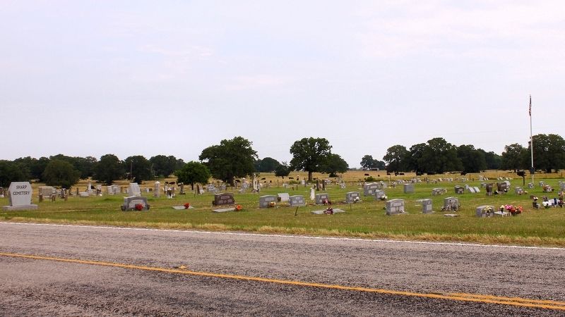
Sharp Cemetery Marker Area image. Click for full size.
Photographed by Larry D. Moore, June 1, 2020
2. Sharp Cemetery Marker Area
 
 
Credits. This page was last revised on June 2, 2020. It was originally submitted on June 2, 2020, by Larry D. Moore of Del Valle, Texas. This page has been viewed 532 times since then and 54 times this year. Photos:   1, 2. submitted on June 2, 2020, by Larry D. Moore of Del Valle, Texas.

m=150879

CeraNet Cloud Computing sponsors the Historical Marker Database.
This website earns income from purchases you make after using our links to Amazon.com. We appreciate your support.
Paid Advertisement
Aug. 21, 2026