Maryland Heights in St. Louis County, Missouri — The American Midwest (Upper Plains)
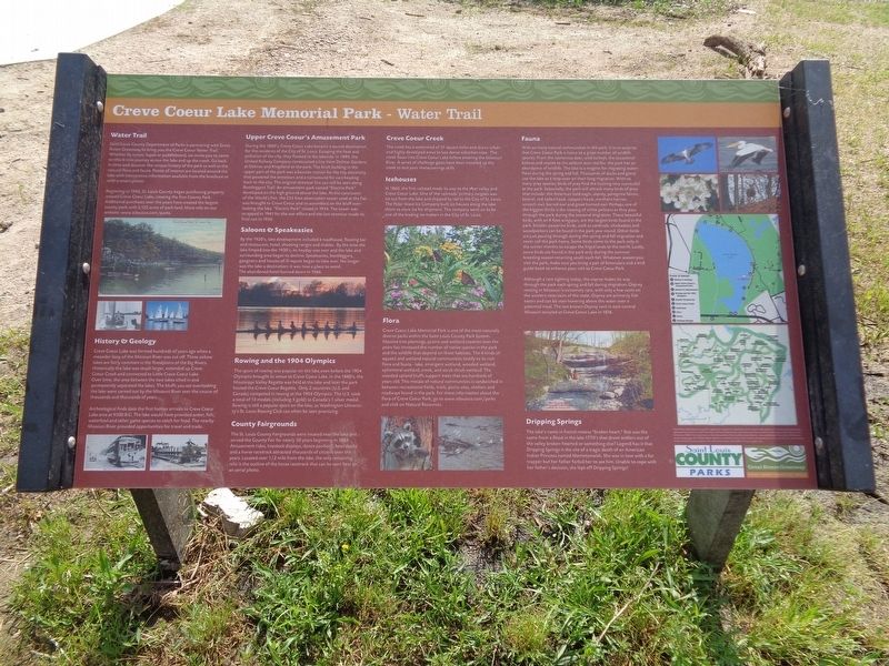
Creve Coeur Lake Memorial Park - Water Trail
Saint Louis County Department of Parks is partnering with Great Rivers Greenway to bring you the Creve Coeur Water Trail. Whether by canoe, kayak or paddleboard, we invite you to come on this 6 mile journey across the lake and up the creek. Go back in time and discover the unique history of the park as well as the natural flora and fauna. Points of interest are located around the lake with interpretive information available from the brochure or with a smart phone.
Beginning in 1945, St. Louis County began purchasing property around Creve Coeur Lake, creating the first County Park. Additional purchases over the years have created the largest county park with 2,122 acres of park land. More info on our website: www.stlouisco.com/parks.
History & Geology
Creve Coeur Lake was formed hundreds of years ago when a meander loop of the Missouri River was cut off. These oxbow lakes are fairly common in the floodplains of the Big Rivers. Historically the lake was much larger, extended up Creve Coeur Creek and connected to Little Creve Coeur Lake. Over time, the area between the two lakes silted in and permanently separated the lakes. The bluffs you see overlooking the lake were carved out by the Missouri River over the course of thousands and thousands of years.
Archeological finds date the first human arrivals to Creve Coeur Lake area at 9500 B.C. The lake would have provided water, fish, waterfowl and other game species to catch for food. The nearby Missouri River provided opportunities for travel and trade.
Upper Creve Coeur's Amusement Park
During the 1880's, Creve Coeur Lake became a tourist destination for the residents of the City of St. Louis. Escaping the heat and pollution of the city, they flocked to the lakeside. In 1899, the United Railway Company constructed a line from Delmar Gardens at Delmar and Kingsland to the park. The brick building in the upper part of the park was a booster station for the city electricity that powered the streetcars and a turnaround for cars heading back to the city. The original streetcar line can still be seen along Bootleggers Trail. An amusement park named "Electric Park" developed on the high ground above the lake. At the conclusion of the World's Fair, the 255 foot observation tower used at the Fair was brought to Creve Coeur and re-assembled on the bluff overlooking the lake. "Electric Park" closed in 1934. The tower was scrapped in 1941 for the war effort and the last streetcar made its final run in 1950.
Saloons & Speakeasies
By the 1920's, lake development included a roadhouse, floating bar and restaurant, hotel, shooting ranges and stables.
By the time the lake limped into the 1930's, its heyday was over and the lake and surrounding area began to decline. Speakeasies, bootleggers, gangsters and houses of ill repute began to take over. No longer was the lake a destination; it was now a place to avoid. The abandoned hotel burned down in 1966.
Rowing and the 1904 Olympics
The sport of rowing was popular on the lake even before the 1904 Olympics brought its venue to Creve Coeur Lake. In the 1880's, the Mississippi Valley Regatta was held at the lake and later the park hosted the Creve Coeur Regatta. Only 2 countries (U.S. and Canada) competed in rowing at the 1904 Olympics. The U.S. took a total of 13 medals (including 5 gold) to Canada's 1 silver medal. Rowing is still a popular sport on the lake, as Washington University's St. Louis Rowing Club can often be seen practicing.
County Fairgrounds
The St. Louis County Fairgrounds were located near the lake and served the County Fair for nearly 30 years beginning in 1889. Amusement rides, livestock displays, dance pavilions, boat docks and a horse racetrack attracted thousands of citizens over the years. Located over 1/2 mile from the lake, the only remaining relic is the outline of the horse racetrack that can be seen best on an aerial photo.
Creve Coeur Creek
The creek has watershed of 37 square miles and drains urban and highly developed areas to less dense suburban sites. The creek flows into Creve Coeur Lake before entering the Missouri River. A series of challenge gates have been installed up the creek to test your maneuverings skills.
Icehouses
In 1860, the first railroad made its way to the river valley and Creve Coeur Lake. One of the railroads' primary cargoes was ice cut from the lake and shipped by rail to the City of St. Louis. The Polar Wave Ice Company built ice houses along the lake shore to store ice for shipment. The company went on to be one of the leading ice makers in the City of St. Louis.
Flora
Creve Coeur Lake Memorial Park is one of the most naturally diverse parks within the Saint Louis County Park System. Massive tree plantings, prairie and wetland creation over the years has increased the number of native species in the park and the wildlife that depend on these habitats. The 6 kinds of aquatic and wetland natural communities testify to its rich flora and fauna - lake, emergent wetland, wooded wetland, ephemeral wetland, creek, and scrub shrub wetland. The wooded upland bluffs support trees that are hundreds of years old. This mosaic of natural communities is sandwiched in between recreational fields, trails, picnic sites, shelters and roadways found in the park. For more information about the flora of Creve Coeur Park, go to www.stlouis.com/parks and click on Natural Resources.
Fauna
With so many natural communties in the park; it is no surprise that Creve Coeur Park is home to a great number of wildlife species. From the numerous deer, wild turkeys, the occasional bobcat and coyote to the seldom seen red fox, the park has an abundance of wildlife. The lake is a magnet for migrating waterflow during the spring and fall. Thousands of ducks and geese use the lake as a stop-over on their long migration. With so many prey species, birds of prey find the hunting very successful at the park. Seasonally, the park will attrack many birds of prey that include: the American bald eagle, osprey, peregrine falcon, kestrel, red-tailed hawk, coopers hawk, northern harrier, screech owl, barred owl and great horned owl. Perhaps one of the biggest thrills is the viewing of white pelicans as they pass through the park during the seasonal migration. These beautiful birds, with an 8 foot wingspan, are the largest birds found in the park. Small passerine birds, such as cardinals, chickadees and woodpeckers can be found in the park year round. Other birds are just passing through during the spring and fall migration and never call the park home. Some birds come to the park only in the winter months to escape the frigid lands to the north. Lastly, some birds are found in the park only during the summer breeding season returning south each fall. Whatever season you visit the park, make sure you bring a pair of binoculars and a bird guide book to enhance your visit to Creve Coeur Park.
Although a rare sighting today, the osprey makes its way through the park each spring and fall during migration. Osprey nesting in Missouri is extremely rare, with only a few nests on the western reservoirs of the state. Osprey are primarily fish eaters and can be seen hovering above the water over a potential meal. The last known Osprey nest in east-central Missouri occurred at Creve Coeur Lake in 1876.
Dripping Springs
The lake's name in French means "broken heart." But was the name from a flood in the late 1770's that drove settlers out of the valley broken-hearted or something else? Legend has it that Dripping Springs is the site of a tragic death of an American Indian Princess named Memetonwish. She was in love with a fur trapper but her father forbid her to see him. Unable to cope with her father's decision, she lept off Dripping Springs!
Erected by Great Rivers Greenway and St. Louis County Parks.
Topics. This historical marker is listed in these topic lists: Animals • Parks & Recreational Areas • Railroads & Streetcars • Waterways & Vessels.
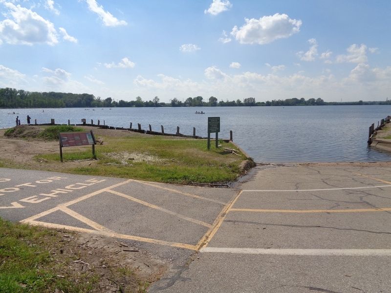
Location. 38° 42.88′ N, 90° 28.715′ W. Marker is in Maryland Heights, Missouri, in St. Louis County. Marker can be reached from Marine Avenue south of Crystal Springs Quarry Drive. Marker is located at Creve Coeur Lake Memorial Park. Touch for map. Marker is at or near this postal address: 13231 Marine Ave, Maryland Heights MO 63043, United States of America. Touch for directions.
Other nearby markers. At least 8 other markers are within 4 miles of this marker, measured as the crow flies. Dripping Springs (approx. ¼ mile away); Power Substation (approx. ¼ mile away); All Gave Some, Some Gave All (approx. 2.3 miles away); Tappmeyer Homestead (approx. 3.1 miles away); Centennial Greenway - Katy Trail State Park (approx. 3.1 miles away); Stan Musial (approx. 3.4 miles away); Lake School (approx. 3.6 miles away); St. Charles Rock Road (approx. 3.8 miles away). Touch for a list and map of all markers in Maryland Heights.
Also see . . .
1. Creve Coeur Lake Memorial Park on Wikipedia. (Submitted on June 3, 2020, by Jason Voigt of Glen Carbon, Illinois.)
2. Creve Coeur Park. From Saint Louis County's Parks website, this is general information and includes plenty of history about the park and lake. (Submitted on June 3, 2020, by Jason Voigt of Glen Carbon, Illinois.)
Credits. This page was last revised on June 4, 2020. It was originally submitted on June 3, 2020, by Jason Voigt of Glen Carbon, Illinois. This page has been viewed 632 times since then and 85 times this year. Photos: 1, 2. submitted on June 3, 2020, by Jason Voigt of Glen Carbon, Illinois. • J. Makali Bruton was the editor who published this page.

