Dieppe in Westmorland County, New Brunswick — The Atlantic Provinces (North America)
Les Acadiens / The Acadians
Riviére Petitcodiac River
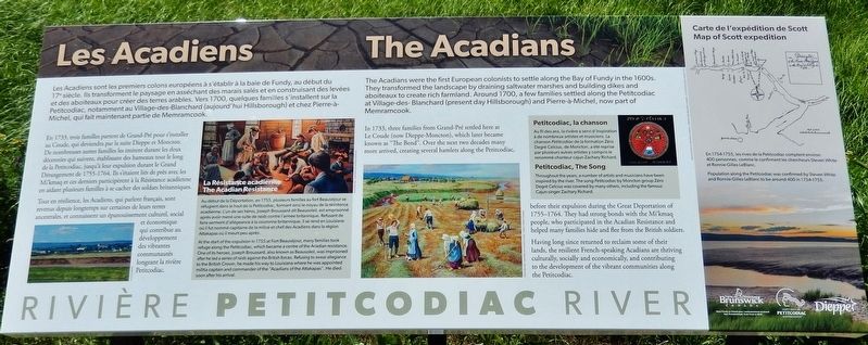
Les Acadiens sont les premiers colons européens à s'établir à la baie de Fundy, au début du 17e siècle. Ils transforment le paysage en asséchant des marais salés et en construisant des levées et des aboiteaux pour créer des terres arables. Vers 1700, quelques familles s'installent sur la Petitcodiac, notamment au Village-des-Blanchard (aujourd'hui Hillsborough) et chez Pierre-à-Michel, qui fait maintenant partie de Memramcook.
En 1733, trois familles partent de Grand-Pré pour s'installer au Coude, qui deviendra par la suite Dieppe et Moncton. De nombreuses autres familles les imitent durant les deux décennies qui suivent, établissant des hameaux tout le long de la Petitcodiac, jusqu'à leur expulsion durant le Grand Dérangement de 1755-1764. Ils s'étaient liés de près avec les Mi'kmaq et ces derniers participèrent à la Résistance acadienne en aidant plusieurs familles à se cacher des soldats britanniques.
Tout en résilience, les Acadiens, qui parlent français, sont revenus depuis longtemps sur certaines de leurs terres ancestrales, et connaissent un épanouissement culturel, social et économique qui contribue au développement des vibrantes communautés longeant la rivière Petitcodiac.
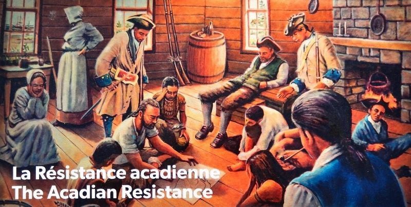
Au début de la Déportation, en 1755, plusieurs familles au fort Beauséjour se réfugient dans le haut de la Petitcodiac, formant ainsi le noyau de la résistance acadienne. L'un de ses héros, Joseph Broussard dit Beausoleil, est emprisonné après avoir mené une suite de raids contre l'armée britannique. Refusant de faire serment d'allégeance à la couronne britannique, il se rend en Louisiane où il fut nommé capitaine de la milice et chef des Acadiens dans la région Attakapas où il meurt peu après.
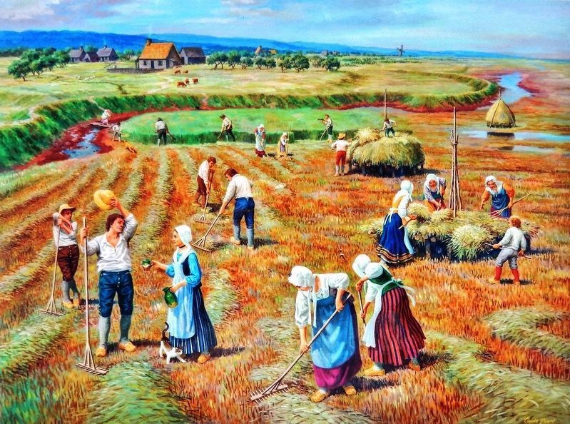
The Acadians were the first European colonists to settle along the Bay of Fundy in the 1600s. They transformed the landscape by draining saltwater marshes and building dikes and aboiteaux to create rich farmland. Around 1700, a few families settled along the Petitcodiac at Village-des-Blanchard (present day Hillsborough) and Pierre-A-Michel, now part of Memramcook.
In 1733, three families from Grand-Pre settled here at Le Coude (now Dieppe-Moncton), which later became known as "The Bend". Over the next two decades many more arrived, creating several hamlets along the Petitcodiac, before their expulsion during the Great Deportation of 1755-1764. They had strong bonds with the Mi'kmaq people, who participated in the Acadian Resistance and helped many families hide and flee from the British soldiers.
Having long since returned to reclaim some of their lands, the resilient French-speaking Acadians are thriving culturally, socially and economically, and contributing to the development of the vibrant communities along the Petitcodiac.
At the start of the expulsion in 1755 at Fort Beausejour, many families took refuge along the Petitcodiac, which became a centre of the Acadian resistance. One of its heroes, Joseph Broussard, also known as Beausoleil, was imprisoned after he led a series of raids against the British forces. Refusing to swear allegiance to the British Crown, he made his way to Louisiana where he was appointed militia captain and commander of the "Acadians of the Attakapas". He died soon after his arrival.
Topics and series. This historical marker is listed in these topic lists: Colonial Era • Settlements & Settlers • War, French and Indian. In addition, it is included in the Acadian History series list. A significant historical year for this entry is 1733.
Location. 46° 5.559′ N, 64° 45.69′ W. Marker is in Dieppe, New Brunswick, in Westmorland County. Marker can be reached from Champlain Street (New Brunswick Route 106) 0.1 kilometers east of Wheeler Boulevard, on the right when traveling east. Marker is located along the riverfront walkway just south of Champlain Street. Touch for map. Marker is at or near this postal address: 6 Champlain Street, Dieppe NB E1A 1N3, Canada. Touch for directions.
Other nearby markers. At least 8 other markers are within walking distance of this marker. The Grand Dérangement (a few steps from this marker); The Tidal Bore / le mascaret (about 180 meters away, measured in a direct line); Arrival and Survival (approx. 0.2 kilometers away); Journey to a New Country (approx. 0.2 kilometers away); The Moncton Settlement (approx. 0.3 kilometers away); Settlers Landing (approx. 0.3 kilometers away); First Settlers / Premiers Colons (approx. 0.8 kilometers away); Joseph Salter Moncton 100 Monument (approx. 0.8 kilometers away).
Related markers. Click here for a list of markers that are related to this marker. Riviére Petitcodiac River
Also see . . .
1. Moncton (Wikipedia). Acadians settled the head of the Bay of Fundy in the 1670s. The first reference to the "Petcoucoyer River" was on the De Meulles map of 1686. Settlement of the Petitcodiac and Memramcook river valleys began about 1700, gradually extending inland and reaching the site of present-day Moncton in 1733. The first Acadian settlers in the Moncton area established a marshland farming community and chose to name their settlement Le Coude (The Elbow), an allusion to the
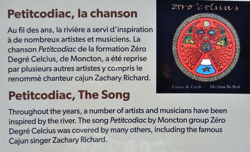
4. Marker detail: Petitcodiac, la chanson /
Petitcodiac, The Song
Petitcodiac, The Song
• • •
Throughout the years, a number of artists and musicians have been inspired by the river. The song Petitcodiac by Moncton group Zéro Degré Celcius was covered by many others, including the famous Cajun singer Zachary Richard.
2. Joseph Broussard (Wikipedia). Broussard became the leader of an armed resistance during the expulsion of the Acadians (1755–1764), leading assaults against the British on several occasions. After arming a ship in 1758, Broussard traveled through the upper Bay of Fundy region, where he attacked the British. His ship was seized in November 1758. He was then forced to flee and later imprisoned with other Acadians in Halifax, Nova Scotia. Released in 1764, he was among the first 200 Acadians to arrive in Louisiana on February 1765. (Submitted on June 7, 2020, by Cosmos Mariner of Cape Canaveral, Florida.)
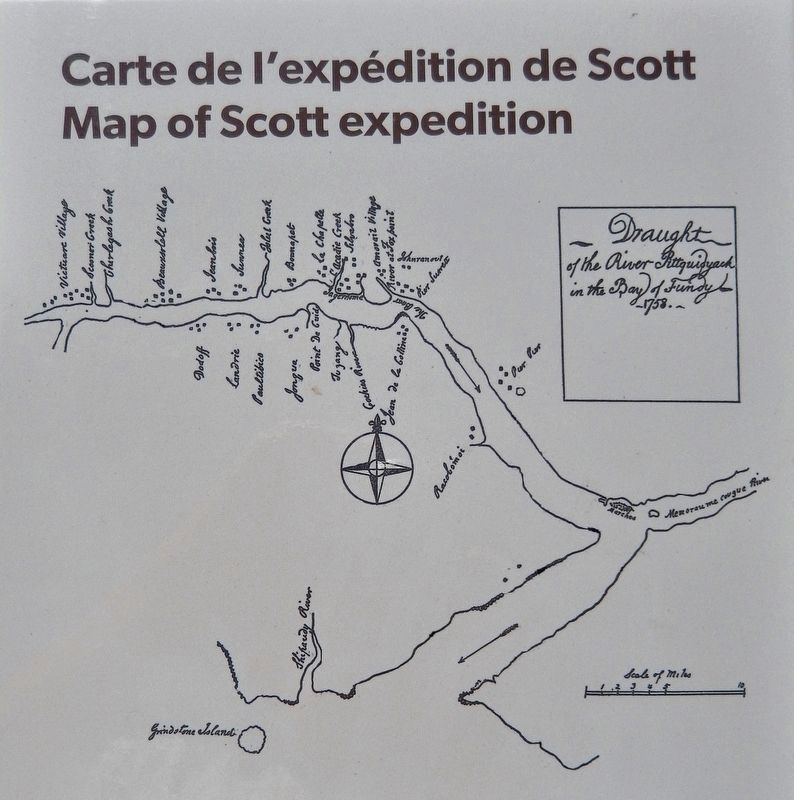
Library and Archives Canada, F/210/Petitcodiac River/1758
5. Marker detail: Carte de l'expédition de Scott /
Map of Scott expedition
Map of Scott expedition
• • •
(Population along the Petitcodiac was confirmed by Steven White and Ronnie-Gilles LeBlanc to be around 400 in 1754-1755.)
Credits. This page was last revised on June 8, 2020. It was originally submitted on June 6, 2020, by Cosmos Mariner of Cape Canaveral, Florida. This page has been viewed 357 times since then and 53 times this year. Photos: 1, 2, 3, 4, 5, 6. submitted on June 6, 2020, by Cosmos Mariner of Cape Canaveral, Florida.
