Moncton in Westmorland County, New Brunswick — The Atlantic Provinces (North America)
Arrival and Survival
Arrivée et survie
— Ankunft und Überleben —
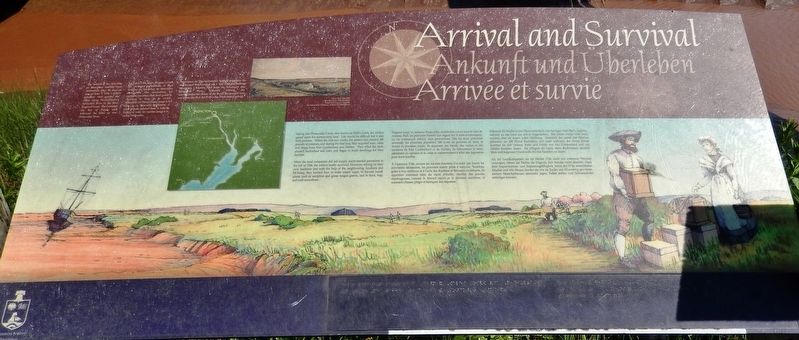
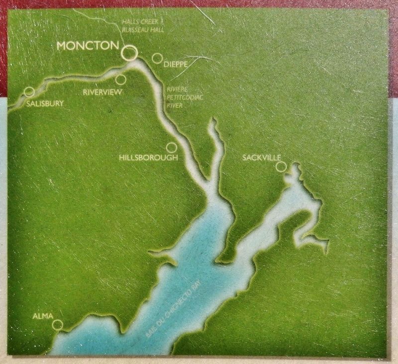
The Settlers of the Township of Monckton reached their destination after 44 days at sea, on June 3, 1766. Captain Jonathan Hall guided the sloop along Pennsylvania's Schuylkill River to the New England coast, then entered the Bay of Fundy and followed the tides up the Petitcodiac River.
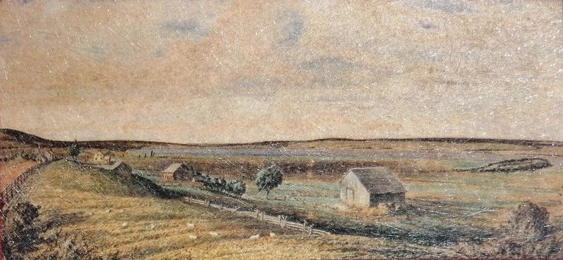
Sailing into Panaccadie Creek, now known as Hall's Creek, the settlers gazed upon the surrounding land. Life would be difficult but it also held promise. Within the first two weeks, the settlers had planted 200 pounds of potatoes, and during the first year, they acquired oxen, cattle and sheep from Fort Cumberland and Halifax. They tilled the land, planted buckwheat and corn, and began to build dwellings for their families.
When the land companies did not supply much-needed provisions in the fall of 1766, the settlers barely survived. However, relying on their own resilience and with the help of the neighbouring Acadians and Mi'kmaq, they learned how to make maple sugar, to harvest marsh plants such as samphire and goose tongue greens, and to hunt, trap, and craft snowshoes.
Le 3 juin 1766, après 44 jours en mer, le pionniers permanents et leurs familles du township de Monckton atteignirent leur destination. Le capitaine Jonathan Hall avait guide la chaloupe le long de la rivière Schuylkill en Pennsylvanie jusqu’à la côte de la Nouvelle-Angleterre; il avait ensuite pénétré dans la baie de Fundy et suivi les marées jusqu’à la rivière Petitcodiac.
Voguant jusqu'au ruisseau Panaccadie, maintenant connu sous le nom de ruisseau Hall, les pionniers fixèrent leur regard sur la terre environnante. La vie s'annonçait difficile mais prometteuse. Dès les deux premières semaines, les pionniers plantèrent 200 livres de pommes de terre, et durant la première année, ils acquirent des bœufs, des vaches et des moutons de Fort Cumberland et de Halifax. Ils labourèrent la terre, plantèrent du sarrasin et du maïs et commencèrent à bâtir des logements pour leurs familles.
À l'automne 1766, comme les sociétés foncières n'avaient pas fourni les provisions nécessaires, les pionniers eurent peine à survivre. Toutefois, grâce à leur résilience et à l'aide des Acadiens et Micmacs avoisinants, ils apprirent comment faire du sucre d'érable, récolter des plantes marécageuses, comme le fenouil marin et le plantain maritime, et comment chasser, piéger et fabriquer des raquettes.
Deutsch:
Nach einer 44 Tage wählenden Seereise erreichten Siedler und ihre
Familien am 3. Juni 1766 die Siedlung Monckton. Kapitän Hall hatte die Schaluppe den Schuylkill Fluss hinunter, entlang der neu-engländischen Küste in die Fundi Bai gesegelt und war später der Flut den Petitcodiac Fluss hinauf gefolgt.
Während die Siedler in den Panaccadie Bach, den heutigen Halls Bach, segelten, nahmen sie das Land um sich in Augenschein. Das Leben würde nicht leicht werden, aber sie waren voller Hoffnung. Innerhalb der ersten vier Wochen pflanzten sie 200 Pfund Kartoffeln, und noch während des ersten Jahres konnten sie sich Ochsen, Kühe und Schafe von Fort Cumberland und aus Halifax kommen lassen. Sie pflügten ihr Land, säten Buchweizen, steckten Mais und begannen Unterkünfte für ihre Familien zu bauen.
Als die Landkompanien sie im Herbst 1766 nicht mit weiterem Proviant versorgten, hätten die Siedler die folgende Zeit beinahe nicht überlebt. Dank ihrer lmprovisations- und Anpassungsfähigkeit, sowie der Hilfe benachbarter Akadier und Mik-Maque, lernten sie, wie sie Zucker aus Ahornsirup gewinnen, essbare Marschpflanzen sammeln, jagen, Fallen stellen und Schneeschuhe anfertigen konnten.
Erected by Permanent Settlers Association.
Topics. This historical marker is listed in these topic lists: Colonial Era • Settlements & Settlers • Waterways & Vessels. A significant historical date for this entry is June 2, 1766.
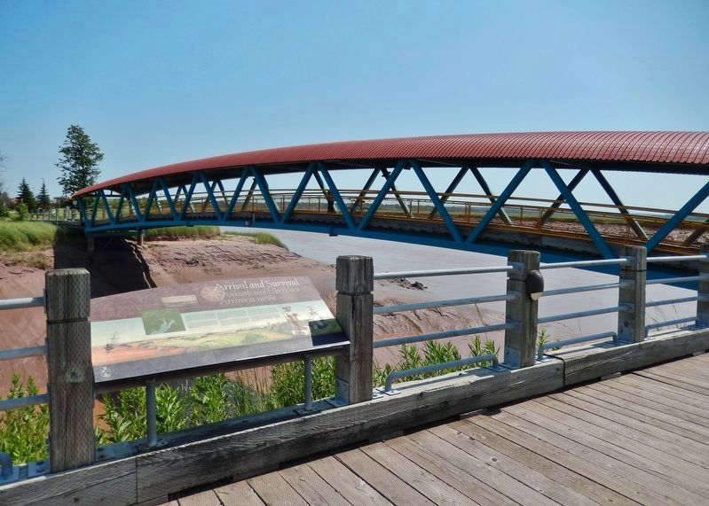
Location. 46° 5.549′ N, 64° 45.884′ W. Marker is in Moncton, New Brunswick, in Westmorland County. Marker can be reached from Main Street (New Brunswick Route 106) 0.1 kilometers west of Wheeler Boulevard, on the right when traveling east. Marker is located in a small plaza overlooking the Petitcodiac River. Touch for map. Marker is at or near this postal address: 100 Main Street, Moncton NB E1C 1B9, Canada. Touch for directions.
Other nearby markers. At least 8 other markers are within walking distance of this marker. Settlers Landing (a few steps from this marker); The Moncton Settlement (a few steps from this marker); Journey to a New Country (a few steps from this marker); The Tidal Bore / le mascaret (within shouting distance of this marker); Les Acadiens / The Acadians (approx. 0.2 kilometers away); The Grand Dérangement (approx. 0.3 kilometers away); First Settlers / Premiers Colons (approx. half a kilometer away); Joseph Salter Moncton 100 Monument (approx. 0.6 kilometers away). Touch for a list and map of all markers in Moncton.
Related markers. Click here for a list of markers that are related to this marker. Settlers Landing, Moncton, New Brunswick
Also see . . . German Settlement. The families settled on the lands in and around Moncton, at first they chose to live close together so they could help each other build houses and establish farms before the winter came. After arriving, the families
planted 200 pounds of potatoes and were able to get some supplies from Mr. Wethered, a man who lived near Fort Cumberland. In addition they also managed to get supplies from the "King's Stores" at Fort Cumberland, and from Anthony Wayne in Halifax. From these sources, they were able to receive livestock, flour, buckwheat seed, fish hooks and lines. Two years after the group arrived in the area, however, financial help ceased as the land company went bankrupt. A second ship carrying supplies did not arrive and local supplies were no longer available. (Submitted on June 9, 2020, by Cosmos Mariner of Cape Canaveral, Florida.)
Credits. This page was last revised on June 9, 2020. It was originally submitted on June 7, 2020, by Cosmos Mariner of Cape Canaveral, Florida. This page has been viewed 284 times since then and 6 times this year. Photos: 1. submitted on June 8, 2020, by Cosmos Mariner of Cape Canaveral, Florida. 2, 3, 4. submitted on June 9, 2020, by Cosmos Mariner of Cape Canaveral, Florida.


