Cumberland Township near Gettysburg in Adams County, Pennsylvania — The American Northeast (Mid-Atlantic)
Company D, 2nd U.S. Sharpshooters
Maine Volunteers
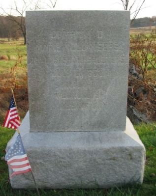
Photographed by Craig Swain, November 11, 2008
1. Company D, 2nd U.S. Sharpshooters Monument
Maine Volunteers
2nd U.S. Sharpshooters
July 2, 1863
Killed 1
Wounded 5
Missing 5
Erected 1889 by State of Maine.
Topics. This historical marker is listed in this topic list: War, US Civil. A significant historical month for this entry is July 1800.
Location. 39° 47.437′ N, 77° 15.007′ W. Marker is near Gettysburg, Pennsylvania, in Adams County. It is in Cumberland Township. It is on Slyder Lane, on the right when traveling east. Located on the ground between South Confederate Avenue and the Devil's Den in Gettysburg National Military Park. Touch for map. Marker is in this post office area: Gettysburg PA 17325, United States of America. Touch for directions.

Regionally, this marker is in South-Central Pennsylvania. It is also in the American Northeast, in the Mid-Atlantic, in Appalachia, and specifically in Northern Appalachia. Globally, it is in North America, the Western Hemisphere, the Western World, and the Anglosphere. Historically, it finds itself in what was once the Haudenosaunee (Iroquois) Confederacy and also one of the original Thirteen Colonies.
Other nearby markers. At least 8 other markers are
this page online
Also see . . . 2nd U.S. Sharpshooters. Reenactor page detailing the history of the 2nd U.S. Sharpshooters with special attention to Company D. (Submitted on January 7, 2009, by Craig Swain of Leesburg, Virginia.)
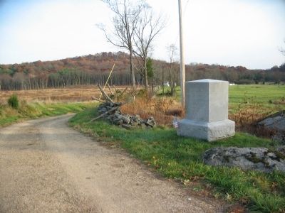
Photographed by Craig Swain, November 11, 2008
2. Company D, 2nd U.S. Sharpshooters Monument
Looking down the Slyder Farm Lane.
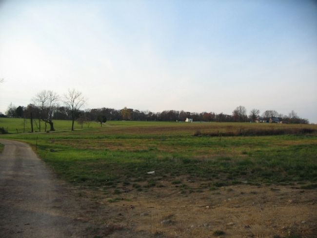
Photographed by Craig Swain, November 11, 2008
3. The Sharpshooters Delay Hood's Advance
Looking west from near the marker along Slyder Lane. The white building in the distant right center is the Snyder House, located the south end of Seminary Ridge along Emmitsburg Road. To the distant left is Warfield Ridge. Confederate General Hood's main line staged across that ridge on July 2. Several companies of U.S. Sharpshooters deployed in skirmish lines across these fields in front of the Confederates. The Sharpshooters played an important role delaying the advance.
Credits. This page was last revised on February 7, 2023. It was originally submitted on January 7, 2009, by Craig Swain of Leesburg, Virginia. This page has been viewed 1,607 times since then and 34 times this year. Photos: 1, 2, 3. submitted on January 7, 2009, by Craig Swain of Leesburg, Virginia.
