Near Ripon in San Joaquin County, California — The American West (Pacific Coastal)
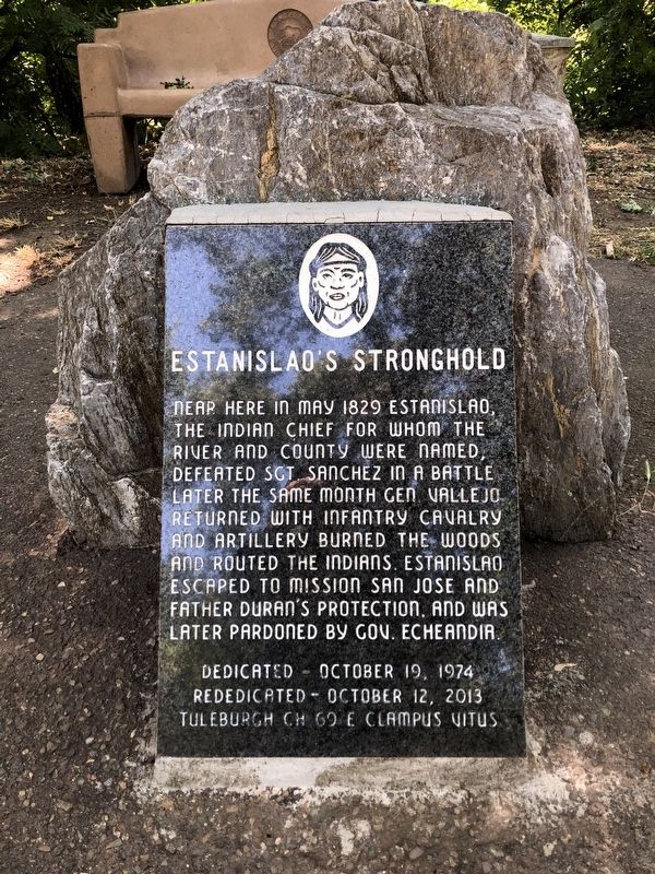
Estanislao's Stronghold
Erected 2013 by E Clampus Vitus, Tuleburgh Chapter No. 69. (Marker Number 214.)
Topics and series. This historical marker is listed in these topic lists: Native Americans • Wars, US Indian. In addition, it is included in the California Historical Landmarks, and the E Clampus Vitus series lists.
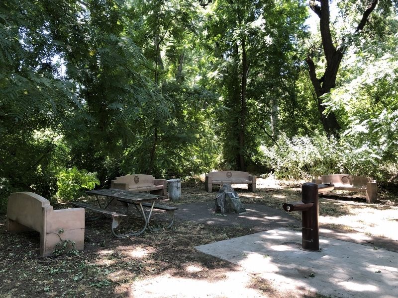
Location. 37° 41.633′ N, 121° 11.018′ W. Marker is near Ripon, California, in San Joaquin County. Marker can be reached from South Austin Road near Austin Road, on the left when traveling south. This marker is located at the picnic area in Caswell Memorial State Park. Touch for map. Marker is in this post office area: Ripon CA 95366, United States of America. Touch for directions.
Other nearby markers. At least 8 other markers are within 5 miles of this marker, measured as the crow flies. Durham Ferry (approx. 4.3 miles away); Ripon Memorial Library (approx. 4.4 miles away); New Hope – 1846 (approx. 4.4 miles away); 75MM Howitzer (approx. 4.4 miles away); Historic Ripon Jail (approx. 4.4 miles away); Ripon World War II Memorial (approx. 4.4 miles away); a different marker also named Ripon Memorial Library (approx. 4.4 miles away); Site of San Joaquin City (approx. 4.8 miles away). Touch for a list and map of all markers in Ripon.
Regarding Estanislao's Stronghold. In 1935 the battle site was designated California Historical Landmark No. 214 - SITE OF BATTLE BETWEEN FORCES UNDER GENERAL VALLEJO AND SAN JOAQUIN VALLEY INDIANS. “In 1829, the Governor-General of California directed Vallejo to punish the Cosumnes Indians for their raids on local ranches. The battle is one of the few fought in California in which cannons were actually used.”
Also see . . . Estanislao: Rebellious Indian Warrior -- HistoryNet. Although a major Indian resistance leader, little personal information is known about him. He was most likely born among the Yokuts in Califonria’s San Joaquin Valley in about 1800. Sometime thereafter, he was brought to Mission San Jose in the present San Francisco Bay area. Father Narcisco Duran, who was known for harsh discipline and flogging neophytes who disobeyed him, named Estanislao after a Polish saint and took a personal interest in him. The new convert to Catholicism adapted readily to mission life and demonstrated leadership qualities. (Submitted on June 10, 2020, by Barry Swackhamer of Brentwood, California.)
Credits. This page was last revised on January 23, 2024. It was originally submitted on June 10, 2020, by Barry Swackhamer of Brentwood, California. This page has been viewed 520 times since then and 62 times this year. Photos: 1, 2. submitted on June 10, 2020, by Barry Swackhamer of Brentwood, California.

