
Columbia in Maury County, Tennessee — The American South (East South Central)
The Polk Family

Photographed by Duane and Tracy Marsteller, June 6, 2020
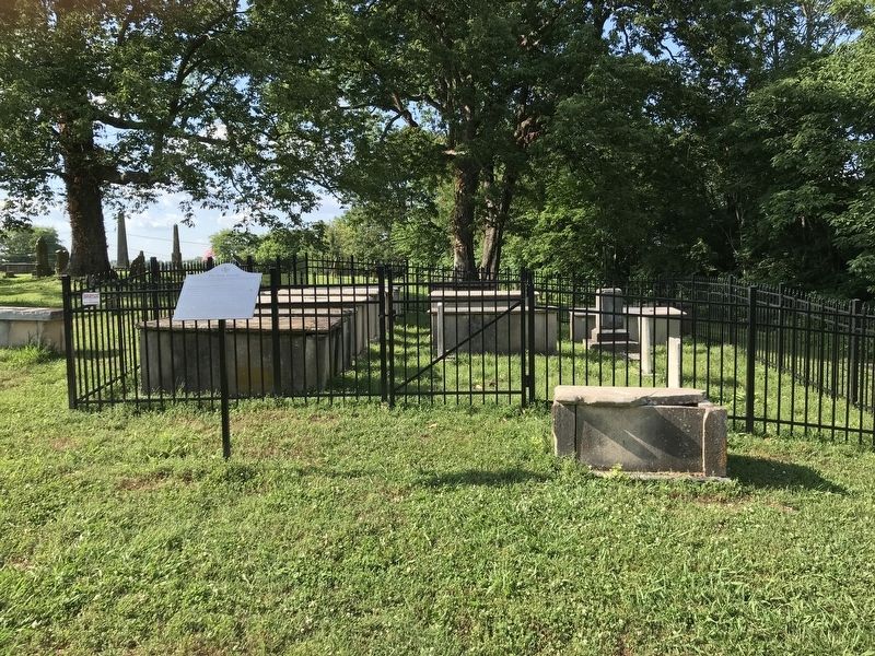
1. The Polk Family Marker
This is the final resting place of the parents and seven of nine siblings of James Knox Polk. Revolutionary War Major Samuel Polk and Jane Gracey Knox were married on Dec. 25th, 1794 at Hopewell Church, located in Mecklenburg County, North Carolina. Their first child was James K. Polk, the eleventh President of the United States.
Samuel Polk, July 5, 1772 - Nov. 5, 1827, Jane Gracey Knox Nov. 15, 1776 - Jan. 11, 1852
James Knox Polk Nov. 2, 1795 - June 15, 1849 his wife, Sarah Childress Polk Sept. 4, 1803 - Aug. 14, 1891 The Tennessee State Capitol Grounds in Nashville, Tennessee
Jane Maria Polk Walker Jan 14, 1798 - Oct 11, 1876 buried beside husband, James Walker 1792 - 1864
Lydia Eliza Polk Caldwell Richmond Feb 17, 1800 - May 29, 1864 Dancyville in Haywood County, Tennessee
Franklin Ezekiel Polk Aug 23, 1802 - Jan 21, 1831
Marshall Tate Polk January 17, 1805 - April 12, 1831 Old Settlers Cemetery, Charlotte, Mecklenburg County, North Carolina
John Lee Polk March 23, 1807 -Sept 28, 1831
Naomi Tate Polk Harris July 2, 1809 -Aug 6, 1836
Ophelia Clarissa Polk Hays Sept 6, 1812 - April 18, 1851 beside her husband,
this page online
William Hawkins Polk May 24, 1815 - Dec 16, 1862 beside his wife, Mary Corse Polk 1816-1851
Samuel Wilson Polk Oct 17, 1817- Feb 24, 1839
Samuel Polk reared his family in the 1816 home known today as the Ancestral home of James K. Polk. This home is the only remaining residence in which James Knox Polk resided other than the White House in Washington, D.C. One of President Polk's major lasting accomplishments was adding over one million square miles of land to the United States thus extending our nation's western boundary to the Pacific Ocean. In addition to serving as U.S. President from 1845 to 1849, Polk had also been a Tennessee State Legislator, a U.S. Congressman (including two terms as Speaker of the House of Representatives), and Governor of Tennessee.
Erected 2017 by Jane Knox Polk Chapter, National Society of the Daughters of the American Revolution.
Topics and series. This historical marker is listed in this topic list: Cemeteries & Burial Sites. In addition, it is included in the Daughters of the American Revolution (DAR), and the Former U.S. Presidents: #11 James K. Polk series
Photographed by Duane and Tracy Marsteller, June 6, 2020
2. The Polk Family Marker
Location. 35° 37.151′ N, 87° 2.021′ W. Marker is in Columbia, Tennessee, in Maury County. It can be reached from the intersection of West 4th Street and North Main Street. The marker is located in Greenwood Cemetery. Touch for map. Marker is in this post office area: Columbia TN 38401, United States of America. Touch for directions.

Regionally, this marker is in Middle Tennessee and in Greater Nashville. It is also in the American South and specifically in the Upper South. Globally, it is in North America, the Western Hemisphere, the Western World, and the Anglosphere. Historically, it finds itself in what was once the territory of the Mississippian Culture, one of the Confederate States of America, and the Antebellum South.
Other nearby markers. At least 8 other markers are within walking distance of this marker: Jane Knox Polk Chapter (here, next to this marker); Camille Leonie Herndon (a few steps from this marker); Greenwood (within shouting distance of this marker); The Duck River and Columbia (within shouting distance of this marker); Thank You (about 500 feet away, measured in a direct line); Riverside Bridge (about 600 feet away); Pillow Park (approx. 0.2 miles away); Saint Paul African Methodist Episcopal Church (approx. 0.2 miles away). Touch for a list and map of all markers in Columbia.
Credits. This page was last revised on June 10, 2020. It was originally submitted on June 10, 2020, by Duane and Tracy Marsteller of Murfreesboro, Tennessee. This page has been viewed 1,339 times since then and 137 times this year. Photos: 1, 2. submitted on June 10, 2020, by Duane and Tracy Marsteller of Murfreesboro, Tennessee. • J. Makali Bruton was the editor who published this page.
