Downtown Memphis in Shelby County, Tennessee — The American South (East South Central)
Union Avenue
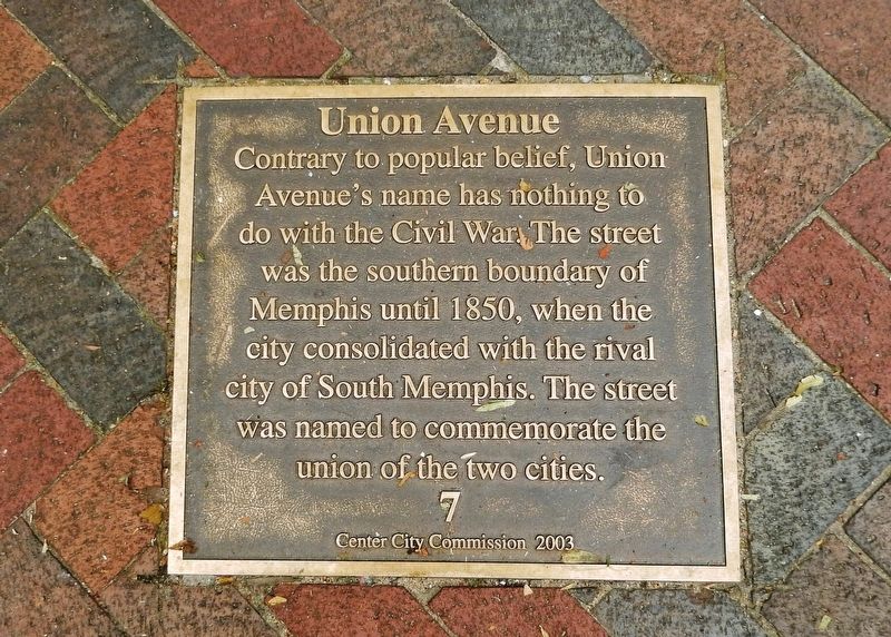
Photographed by Cosmos Mariner, May 14, 2015
1. Union Avenue Marker
Erected 2003 by Center City Commission. (Marker Number 7.)
Topics and series. This historical marker is listed in this topic list: Roads & Vehicles. In addition, it is included in the Tennessee, Memphis, Center City Commission series list. A significant historical year for this entry is 1850.
Location. 35° 8.586′ N, 90° 3.209′ W. Marker is in Memphis, Tennessee, in Shelby County. It is in Downtown Memphis. It is at the intersection of Union Avenue and South Main Street, on the right when traveling east on Union Avenue. Marker is on sidewalk near the southeast corner of the intersection. Touch for map. Marker is at or near this postal address: 82 South Main Street, Memphis TN 38103, United States of America. Touch for directions.

Regionally, this marker is in West Tennessee. It is also in the American South, specifically in the Deep South, in
this page online
Other nearby markers. At least 8 other markers are within walking distance of this marker: Farnsworth Building (within shouting distance of this marker); WDIA (within shouting distance of this marker); First Black Radio Station (within shouting distance of this marker); Barboro Grocery (within shouting distance of this marker); Cora James (within shouting distance of this marker); First "Talkies" (within shouting distance of this marker); The Fire of 1872 (about 300 feet away, measured in a direct line); John Grisham (about 300 feet away). Touch for a list and map of all markers in Memphis.
Also see . . . Union Avenue. From Stories of a Neighborhood: “Union Avenue evolved from a muddy, rutted country road in the early 1900’s into the major commercial thoroughfare of the Central Gardens area. Early photographs of Union show it as a residential street lined with stately mansions, and its shift to commercial use began gradually in the 1920’s when people just built their businesses onto the front of their houses.” (Submitted on June 12, 2020, by Cosmos Mariner of Cape Canaveral, Florida.)
Credits. This page was last revised on February 7, 2023. It was originally submitted on June 12, 2020, by Cosmos Mariner of Cape Canaveral, Florida. This page has been viewed 966 times since then and 81 times this year. Photo 1. submitted on June 12, 2020, by Cosmos Mariner of Cape Canaveral, Florida.
