Near Enochs in Bailey County, Texas — The American South (West South Central)
La Pista de Vida Agua
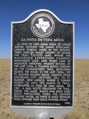
Photographed by Bill Kirchner, April 29, 2014
1. La Pista de Vida Agua Marker
Erected 2008 by Texas Historical Commission. (Marker Number 14640.)
Topics. This historical marker is listed in these topic lists: Exploration • Roads & Vehicles. A significant historical year for this entry is 1881.
Location. 33° 54.73′ N, 102° 45.408′ W. Marker is near Enochs, Texas, in Bailey County. It is on State Highway 214 0.2 miles south of Farm to Market
this page online

Regionally, this marker is on the South Plains. It is also on the American Great Plains and specifically on the Southern Plains. Globally, it is in North America, a Gulf of Mexico state, the Western Hemisphere, the Western World, and the Anglosphere. Historically, it finds itself in what was once New Spain, the Republic of Texas, and one of the Confederate States of America.
Other nearby markers. At least 8 other markers are within 12 miles of this marker, measured as the crow flies: Pastores of Bailey County (a few steps from this marker); Muleshoe National Wildlife Refuge (approx. 2.8 miles away); Enochs Cemetery (approx. 2.9 miles away); a different marker also named Enochs Cemetery (approx. 2.9 miles away); Quanah Parker Trail (approx. 3.2 miles away); Site of Virginia City (approx. 9.6 miles away); Maple Cemetery (approx. 10 miles away); Buffalo Soldier Tragedy of 1877 (approx. 11.6 miles away). Touch for a list and map of all markers in Enochs.
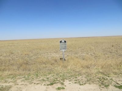
Photographed by Bill Kirchner, April 29, 2014
2. La Pista de Vida Agua Marker

Photographed by Jeff Leichsenring, December 14, 2025
3. La Pista de Vida Agua Marker
The marker is on the right and the Pastores of Bailey County Marker (22695) is on the left.
Credits. This page was last revised on July 23, 2026. It was originally submitted on May 12, 2014, by Bill Kirchner of Tucson, Arizona. This page has been viewed 1,282 times since then and 74 times this year. Last updated on June 14, 2020, by Allen Lowrey of Amarillo, Texas. Photos: 1, 2. submitted on May 12, 2014, by Bill Kirchner of Tucson, Arizona. 3. submitted on December 18, 2025, by Jeff Leichsenring of Garland, Texas. • J. Makali Bruton was the editor who published this page.
