Near Spotsylvania Courthouse in Spotsylvania County, Virginia — The American South (Mid-Atlantic)
Chancellorsville Campaign
Inscription.
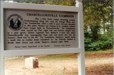
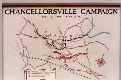
May 1, 1863, Union troops advancing toward Fredericksburg along this road, the Orange Plank, met the Confederates about a mile to your left and retreated to this point. Hooker, not waiting to be attacked, ordered these troops back to Chancellorsville. The Confederates then moved up. That night Lee and Jackson camped here in a pine grove.
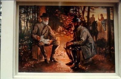
Scouts reported that Hooker's 7 - mile line about Chancellorsville was impregnable from east and south, but that his western flank was "in the air". The Confederate chieftains, seated beside a small fire on
cracker boxes abandoned by the Federals, decided to divide their forces and strike Hooker's exposed right flank.
Erected by United States Department of the Interior - National Park Service.
Topics. This historical marker is listed in this topic list: War, US Civil. A significant historical date for this entry is May 1, 1735.
Location. This marker has been replaced by another marker nearby. 38° 17.695′ N, 77° 37.519′ W. Marker is near Spotsylvania Courthouse, Virginia, in Spotsylvania County. Marker is on McLaws Drive near Old Plank Road, on the right when traveling south. Located at tour stop five of the Driving tour of the Battle of Chancellorsville. Touch for map. Marker is at or near this postal address: 8402 Furnace Rd, Spotsylvania VA 22553, United States of America. Touch for directions.
Other nearby markers. At least 8 other markers are within walking distance of this location. Bivouac (here, next to this marker); Final Meeting, Fateful March (a few steps from this marker); A Bold Plan (a few steps from this marker); a different marker also named Chancellorsville Campaign (within shouting distance of this marker); McLaws Trail (approx. half a mile away); Wounding of Jackson (approx. 0.7 miles away); a different marker also named Chancellorsville Campaign (approx. 0.7 miles away); Jackson on the Move (approx. 0.8 miles away). Touch for a list and map of all markers in Spotsylvania Courthouse.
More about this marker. This was an older marker placed at the battlefield in the 1950s, but was replaced recently by a more modern "wayside" type exhibit. These and similar old markers are called "Happel panels" after Ralph Happel, a historian who wrote the text.
Also see . . . Battle of Chancellorsville. National Park Service site. (Submitted on January 10, 2009, by Craig Swain of Leesburg, Virginia.)
Credits. This page was last revised on July 9, 2021. It was originally submitted on January 9, 2009, by Mike Stroud of Bluffton, South Carolina. This page has been viewed 936 times since then and 10 times this year. Photos: 1. submitted on January 9, 2009, by Mike Stroud of Bluffton, South Carolina. 2. submitted on January 10, 2009, by Craig Swain of Leesburg, Virginia. 3. submitted on January 9, 2009, by Mike Stroud of Bluffton, South Carolina. • Craig Swain was the editor who published this page.


