Clarendon in Donley County, Texas — The American South (West South Central)
Clarendon Cemetery
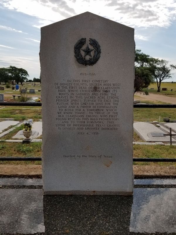
1878-1886
Photographed by Allen Lowrey, June 20, 2020
1. Clarendon Cemetery Marker
In this first cemetery of Donley County, sixteen rods west lie the first dead of Old Clarendon. Here white civilization sank its roots in sadness and from the graves in this sacred acre strong pioneer spirits turned to face the future with greater love for the land and a firmer determination to build for a tomorrow which we know today. To those of the Old Clarendon Colony who first found rest on this bold promontory and to their survivors, this stone of imperishable Texas granite is loyally and lovingly dedicated.
Erected by the State of Texas, July 4, 1938
Erected 1938 by State of Texas. (Marker Number 903.)
Topics and series. This historical marker is listed in these topic lists: Cemeteries & Burial Sites • Settlements & Settlers. In addition, it is included in the Texas 1936 Centennial Markers and Monuments series list. A significant historical date for this entry is July 4, 1938.
Location. 34° 55.08′ N, 100° 52.953′ W. Marker is in Clarendon, Texas, in Donley County. It is on State Highway 70, on the left when traveling south. The marker can be found from Clarendon, take SH 70 about 1 mile south to Citizens' Cemetery.
this page online

Regionally, this marker is on the Texas Panhandle. It is also on the American Great Plains and specifically on the Southern Plains. Globally, it is in North America, a Gulf of Mexico state, the Western Hemisphere, the Western World, and the Anglosphere. Historically, it finds itself in what was once New Spain, the Comanchería, the Dust Bowl, the Republic of Texas, and one of the Confederate States of America.
Other nearby markers. At least 8 other markers are within 2 miles of this marker, measured as the crow flies: James T. Patman (approx. 0.2 miles away); Quanah Parker Trail (approx. 0.6 miles away); St. Mary's Catholic Church (approx. one mile away); First United Methodist Church of Clarendon (approx. 1.4 miles away); Donley County Courthouse (approx. 1.4 miles away); Stockton P. Donley (approx. 1.4 miles away); Funeral Business in Clarendon (approx. 1.4 miles away); The Clarendon News (approx. 1½ miles away).
Photographed by Allen Lowrey, June 20, 2020
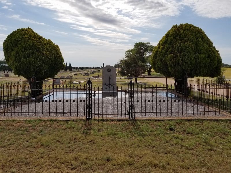
2. Clarendon Cemetery Marker

Photographed by Allen Lowrey, June 20, 2020
3. Clarendon Citizens' Cemetery entrance

Photographed by Jeff Leichsenring, April 25, 2026
4. Clarendon Cemetery Marker
Credits. This page was last revised on April 28, 2026. It was originally submitted on June 21, 2020, by Allen Lowrey of Amarillo, Texas. This page has been viewed 666 times since then and 58 times this year. Last updated on June 22, 2020, by Allen Lowrey of Amarillo, Texas. Photos: 1, 2, 3. submitted on June 21, 2020, by Allen Lowrey of Amarillo, Texas. 4. submitted on April 26, 2026, by Jeff Leichsenring of Garland, Texas. • J. Makali Bruton was the editor who published this page.
