
Juventino Rosas in Santa Cruz de Juventino Rosas, Guanajuato, Mexico — The Central Highlands (North America)
The Founding of Santa Cruz de Juventino Rosas
Photographed by J. Makali Bruton, June 21, 2020
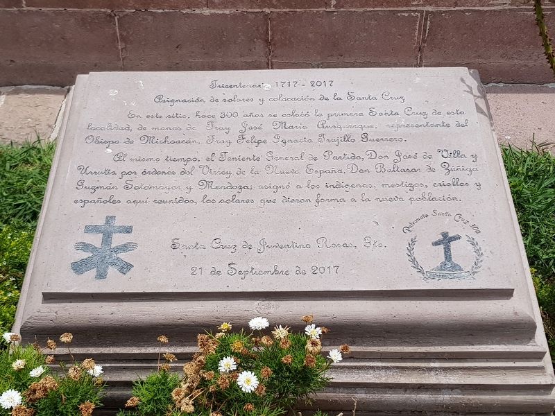
1. The Founding of Santa Cruz de Juventino Rosas Marker

Asignación de solares y colocación de la Santa Cruz
En este sitio, hace 300 años se colocó la primera Santa Cruz de esta localidad, de manos de Fray José María Ausquerque, representante del Obispo de Michoacán, Fray Felipe Ignacio Trujillo Guerrero.
Al mismo tiempo, el Teniente General de Partido, Don José de Villa y Urrutia por ordenes del Virrey de la Nueva España, Don Baltasar de Zúñiga Guzmán Sotomayor y Mendoza, asignó a los indígenas, mestizos, criollos y españoles aquí reunidos, los solares que dieron forma a la nueva población.
Santa Cruz de Juventino Rosas, Gto.
21 de Septiembre de 2017
Patronato Santa Cruz 300
Tricentennial - 1717-2017
The assignment of lots and placement of the Holy Cross
On this site, the first Holy Cross of this town was placed 300 years ago, by the hands of Friar José María Ausquerque, representative of the Bishop of Michoacán, Friar Felipe Ignacio Trujillo Guerrero.
At the same time, the Lieutenant General José de Villa y Urrutia, on the orders of the Viceroy of New Spain, Baltasar de Zúñiga Guzmán Sotomayor y Mendoza, assigned to the natives, mestizos, creoles and Spaniards gathered here, the plots that shaped the new population.
Santa Cruz de Juventino Rosas, Guanajuato
September 21, 2017
Patronato Santa Cruz 300
Erected 2017
this page online
Topics. This historical marker is listed in these topic lists: Colonial Era • Religion & Religious Structures • Settlements & Settlers. A significant historical date for this entry is September 21, 2017.
Location. 20° 38.64′ N, 100° 59.695′ W. Marker is in Juventino Rosas, Guanajuato, in Santa Cruz de Juventino Rosas. It is on Juárez just west of Amado Nervo, on the right when traveling west. Touch for map. Marker is in this post office area: Juventino Rosas GTO 38240, Mexico. Touch for directions.

Regionally, this marker is in Central Mexico and in the Bajío. Globally, it is in North America, on the Ring of Fire, and in the Western Hemisphere. Historically, it finds itself in what was once New Spain, a Spanish colony, and the Aztec Empire.
Other nearby markers. At least 8 other markers are within 24 kilometers of this marker, measured as the crow flies: 800th Anniversary of the Franciscan Order (within shouting distance of this marker); Temple of the Most Holy Conception (approx. 14.6 kilometers away); The Route of Hidalgo (approx. 14.8 kilometers away); The Old Temple (approx. 19 kilometers away);
Photographed by J. Makali Bruton, June 21, 2020
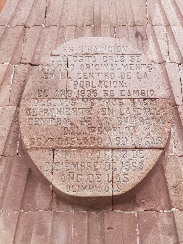
2. An additional inscription on the nearby Holy Cross monument
It is tradition that this cross was originally placed in the center of the population. In 1935, it was moved a few meters to the west on the central street of the temple entrance. It was moved to its original location on December 12, 1968, the year of the Olympics.

Photographed by J. Makali Bruton, June 21, 2020
3. The Founding of Santa Cruz de Juventino Rosas Marker
The Parish Church of the Santa Cruz can be seen in the background. Note also the cross mentioned in the marker text topping the nearby monument.
Photographed by J. Makali Bruton, June 21, 2020
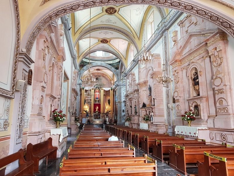
4. An interior view of the Parish Church of Santa Cruz de Juventino Rosas
Photographed by J. Makali Bruton, June 21, 2020
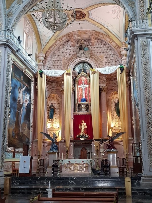
5. The altar of the Parish Church of Santa Cruz de Juventino Rosas
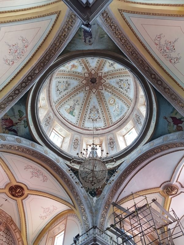
Photographed by J. Makali Bruton, June 21, 2020
6. The central dome of the Parish Church of Santa Cruz de Juventino Rosas
Credits. This page was last revised on June 23, 2020. It was originally submitted on June 23, 2020, by J. Makali Bruton of Washington, District of Columbia. This page has been viewed 1,009 times since then and 89 times this year. Photos: 1, 2, 3, 4, 5, 6. submitted on June 23, 2020, by J. Makali Bruton of Washington, District of Columbia.
