Rocky Point in Queens County, Prince Edward Island — The Atlantic Provinces (North America)
History All Around You / Quand l’histoire vous entoure
Inscription.
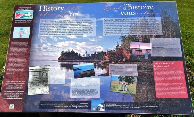
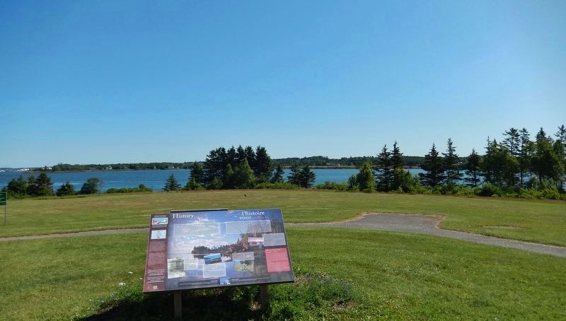
With Island history as your backdrop, you're looking out at Charlottetown Harbour, the Hillsborough River, Governors Island, and the bluffs of Keppoch. In the summertime, this waterway hosts an abundance of international cruise ships and local pleasure craft. Here, you might even spy a seal as its head rises above the water's surface. Your standing point is also in the vicinity of Port-la-Joye — Fort Amherst, a National Historic Site of Canada that was not only the first capital of the province, but that also illustrates the French-English struggle for sovereignty of Prince Edward Island. Its grounds are open in the summer through early fall, and are a must-see for visitors and for anyone with an interest in history. While in the area, you'll also have plenty of opportunities to golf one of the Island's renowned courses.
Port-la-Joye
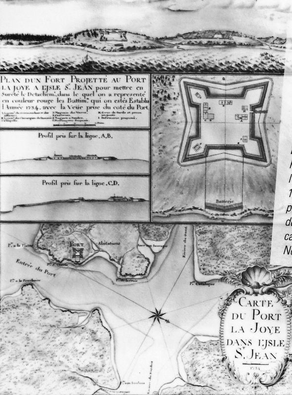
Port-la-Joye was chosen as the capital of Île Saint-Jean primarily for two reasons: 1) Its sheltered harbour and narrow entrance made it easier to defend than many other Island ports, and 2) It was seen as an agricultural region that could supply Île Royale (Cape Breton, Nova Scotia).
Fort Amherst
In 1758, the English built Fort Amherst close to the site that had recently been Port-la-Joye. The new fort was not large, however, it was protected by18 cannons and a waterless ditch running around its circumference. Entrance was gained through a drawbridge. In 1762, a mutiny amongst the soldiers was discovered and put down — an indication of conditions at the fort. When Charlottetown was named the new provincial capital in 1768, the military moved to Fort Edward, and Fort Amherst was torn down. Today, grass-covered ruins are all that remain.
The Acadians
The Acadians (Acadiens) are descendants of settlers from France who came primarily to Prince Edward Island, New Brunswick, Nova Scotia and Maine in the 17th Century. At the time, this area was known as Acadia (L'Acadie).
The Acadian Deportation
England and France had been fighting The Seven Years War since 1754. By 1758, Île Saint-Jean was surrendered to Great Britain. Within weeks, the English began rounding up all French and Acadian people on the Island. 13 ships arrived to carry more than 3,000 people across the sea to France, with another 1,600 escaping to other parts of the Island, New Brunswick or Quebec. The late fall sea voyage was dangerous with stormy seas, shipwrecks, and illness spreading among the deportees. In all, almost 900 French and Acadians died during the Expulsion of the Acadians.
Did you know that?
The French named Port-la-Joye capital of Île Saint-Jean (Prince Edward Island) in 1720. Though soldiers and settlers arrived, by the time France declared war on England in 1744, the port was almost deserted. During the conflict, the fort was destroyed and when the war ended in 1745, the Island was in British hands. Île Saint-Jean would later be returned to the French, only to eventually fall under British rule again. In 1758, the English carried out the Expulsion of the French, and built Fort Amherst close to the site of Port-la-Joye. After the capital of the province was moved to Charlottetown in 1768, Fort Amherst was demolished.
Along the Drive
Going west, be sure to visit picturesque Victoria-by-the-Sea and the Argyle Shore Provincial Park. If you’re heading north, pull off into our lay-by in West River for a spectacular view.
Central Coastal Drive — One Drive, Two Shores
Combining Red Sands Shore Drive and Green Gables Shore Drive, the Central Coastal Drive gives you the best that the core of PEI has to offer. Travel this loop around the heart of PEI and discover Charlottetown — the capital of the province, Cavendish — the birthplace of author L.M Montgomery and her greatest creation, Anne of Green Gables,
Port-la-Joye — Fort Amherst National Historic Site, and countless beach, golf, culinary and cultural experiences that reveal the essence of our Island.
For more information on the Central Coastal Drive and all it has to offer you to see and do, please visit www.centralcoastaldrive.com
Avec comme décor toute l'histoire de l’Île, vous regardez vers le port de Charlottetown, l'Île des Gouverneurs et les falaises de Keppoch. L'été, cette voie navigable accueille un grand nombre de croisières internationales et d'embarcations de plaisance locales. Ici, vous pouvez même apercevoir un phoque quand il se hisse à la surface des eaux. Vous vous trouvez aussi à proximité du site historique national de Port-la-Joye — Fort Amherst, qui fut non seulement la première capitale de la province, mais qui illustre aussi la lutte entre la France et l'Angleterre pour le contrôle de l'Île. L'endroit est accessible pendant tout l'été et jusqu'au début de l'automne, ce qui en fait un incontournable pour tous les férus d'histoire. Une fois dans la région, vous aurez beaucoup d'occasions de jouer au golf sur les parcours renommés de l'Île.
Port-la-Joye
Port-la-Joye fut choisie comme capitale de l'Île Saint-Jean pour deux raisons principales : 1) son port abrité à l'entrée étroite le rendait plus facile à défendre que bien d'autres ports de l'Île, et 2) on y voyait une région agricole capable d'approvisionner l'Île Royale (cap Breton, Nouvelle-Écosse).
Fort Amherst
En 1758, les Anglais construisirent Fort Amherst près de l'emplacement récent de Port-la-Joye. Le nouveau fort n'était pas imposant, mais il était défendu par 18 canons et un fossé sec en faisait le tour. On y accédait par un pont-levis. En 1762, une mutinerie de la garnison fut découverte et mâtée, ce qui indique les conditions de vie au fort. Quand Charlottetown fut nommée capitale de la province en 1768, les militaires sont déménagés au Fort Edward et Fort Amherst fut démantelé. Aujourd'hui, il n'en subsiste que des ruines recouvertes de végétation.
Les Acadiens
Les Acadiens sont des descendants de colons français établis principalement dans l'Île-du-Prince-Édouard, au Nouveau-Brunswick, en Nouvelle-Écosse et dans le Maine au cours du 17e siècle. À cette époque, toute la région s'appelait Acadie.
La déportation des Acadiens
L'Angleterre et la France se sont affrontées pendant la guerre de Sept Ans, depuis 1754. En 1758, l'Île-Saint-Jean fut cédée à la Grande-Bretagne. En quelques semaines, les Anglais ont entrepris de rassembler tous les habitants français et acadiens de l'Île. Treize navires ont servi à transporter plus de 3 000 personnes vers la France, tandis que 1 600 autres se sauvaient vers d'autres secteurs de l'Île, du Nouveau-Brunswick et du Québec. Ce voyage de fin d'automne fut dangereux en raison des mers agitées, des naufrages et de la maladie chez les déportés. En tout, quelque 900 Français et Acadiens périrent au cours de la Déportation des Acadiens.
Le saviez-vous?
Les Français firent de Port-la-Joye la capitale de L'Île Saint-Jean (Île-du-Prince-Édouard) en 1720. Malgré l'arrivée de soldats et de colons, au moment où la France déclare la guerre à l'Angleterre en 1744, le port est presque désert. Au cours du conflit, le fort fut détruit et à la fin du conflit en 1745, l'Île appartenait aux Britanniques. L'Île Saint-Jean serait par la suite rendue aux Français avant de revenir de nouveau aux Britanniques. En 1758, les Anglais ont procédé' à la Déportation des Acadiens et construit Fort Amherst près du site de Port-la-Joye. Une fois la capitale provinciale déménagée à Charlottetown en 1768, Fort Amherst fut démoli.
Sur Votre Chemin
En direction ouest, assurez-vous de visiter la pittoresque Victoria-by-the-Sea et le parc provincial d’Argyle Shore. En direction nord, faites un arrêt à West River pour une vue spectaculaire.
Promenade côtière centrale — Une randonnée, deux rives
En combinant la promenade côtière de Red Sands et celle de Green Gables, la promenade côtière centrale vous présente le meilleur de ce que le centre de l'ÎPÉ a à offrir. Parcourez cette boucle autour du cœur de l'ÎPÉ et découvrez Charlottetown, capitale de la province, Cavendish, lieu de naissance de l'auteure L.M. Montgomery et de sa plus fameuse création, Anne aux pignons verts, le site historique national de Port-la-Joye — Fort Amherst ainsi que d'innombrables expériences de plage, de golf, de cuisine et de culture gui révèlent le vrai visage de notre île.
Pour en savoir plus sur la promenade côtière centrale, ses attraits et ses activités, visitez le site www.centralcoastaldrive.com
Topics. This historical marker is listed in these topic lists: Colonial Era • Forts and Castles • Settlements & Settlers.
Location. 46° 11.659′ N, 63° 7.886′ W. Marker is in Rocky Point, Prince Edward Island, in Queens County. Marker can be reached from Hache Gallant Drive, 1.5 kilometers east of Prince Edward Island Route 19. Marker is located near the north end of the Skmaqn–Port-la-Joye–Fort Amherst National Historic Site parking lot, at the east end of Hache Gallant Drive. Touch for map. Marker is at or near this postal address: 191 Hache Gallant Drive, Rocky Point PE C0A 1H2, Canada. Touch for directions.
Other nearby markers. At least 8 other markers are within walking distance of this marker. Port-la-Joye – Fort Amherst (approx. 0.4 kilometers away); The Deportation of the Inhabitants of Île Saint-Jean (approx. 0.4 kilometers away); Michel Haché-Gallant et Anne Cormier (approx. 0.4 kilometers away); Place Yourself in History / Situez-vous dans l’histoire (approx. 0.4 kilometers away); The Mi'kmaq / Les Mi'kmaq (approx. 0.4 kilometers away); Port of Entry / Port d’entrée (approx. 0.4 kilometers away); A Great Survey / Un Arpentage de Taille (approx. half a kilometer away); The British Period / La période britannique (approx. half a kilometer away). Touch for a list and map of all markers in Rocky Point.
Related markers. Click here for a list of markers that are related to this marker. Skmaqn–Port-la-Joye–Fort Amherst National Historic Site
Credits. This page was last revised on June 27, 2020. It was originally submitted on June 23, 2020, by Cosmos Mariner of Cape Canaveral, Florida. This page has been viewed 102 times since then and 15 times this year. Photos: 1, 2, 3. submitted on June 27, 2020, by Cosmos Mariner of Cape Canaveral, Florida.


