Near Sturgeon Bay in Door County, Wisconsin — The American Midwest (Great Lakes)
Sturgeon Bay and Lake Michigan Ship Canal
Inscription.
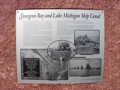
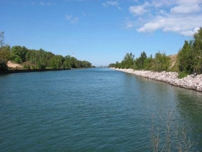
This canal was the dream of Joseph Harris, Sr., "the Father of the Sturgeon Bay and Lake Michigan Ship Canal." His intent was not only to provide a shorter and safer route for sailing vessels, but to also become rich by selling building lots along the canal in the town of "Harrisburg" that would surely result along the lake end of the canal. After much work, lobbying, and a change in the canal location, a state charter was granted in 1864 to his Sturgeon Bay and Lake Michigan Ship Canal and Harbor Company to begin work three-quarters of a mile south of the projected "Harrisburg." Harris never realized a financial gain on the sale of his property and "Harrisburg" was never built.
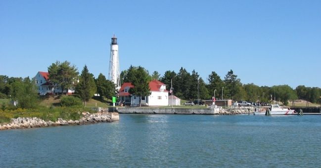
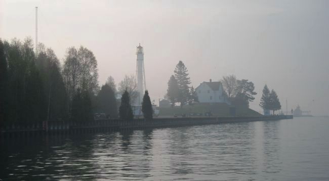
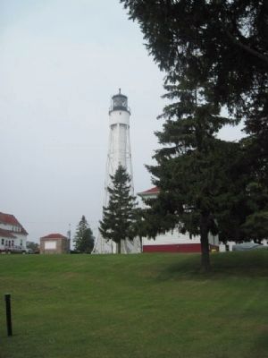
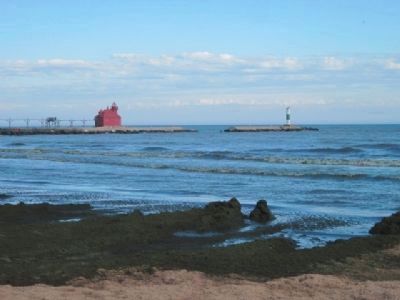
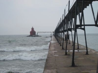
In 1871 the federal government constructed a harbor of refuge on Lake Michigan at the place where the canal would emerge. Construction of a lighthouse and fog signal at the end of the breakwater was recommended in 1873, but the light was not built until 1882.
Construction of the canal began on July 8, 1872, but the Depression of 1873 held up the work for three years. Construction resumed in 1877 and on June 28, 1878 at 7:30 p.m. the final shovelsful of dirt were removed to allow the mixing of the waters of Sturgeon Bay and Lake Michigan. There is little written record about the canal laborers, but we do know a fair number of local men were hired along with "men from the outside recruited by promises of good wages."
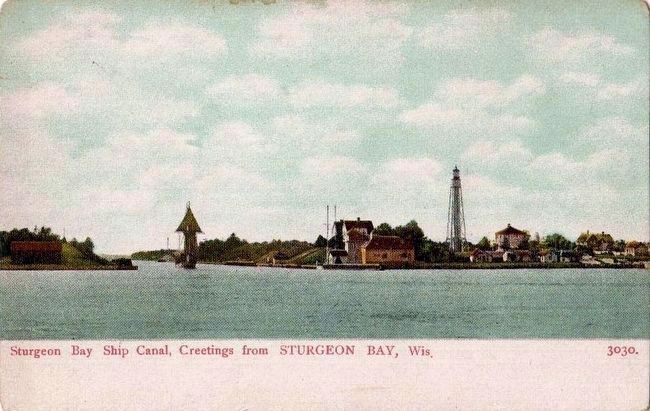
The first loaded ship towed through the canal was the three-masted schooner "America" bound for Chicago in 1879 with a load of lumber. It would take another four years to complete the 7,400-foot canal to the specifications needed for the sailing vessels of the 1880s to safely use the canal.
The first full year of operation in 1882 showed 415 ships passing through the canal. Ten years later that number had increased nearly tenfold to 3,949. During the early years of the canal, a tow charge was levied on ships passing through.
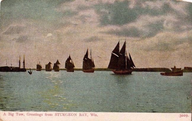
Local tug owners provided towing services for the ships using the canal and competition was keen as whoever got to a ship first got the job. The ship owners found that they could split the charges by linking up and being towed through in a group. The "Big Tow" shows a group of six sailing ships joined by tow ropes in their passage through the canal.
The completion of the canal reduced the trip distance from Green Bay to Milwaukee and Chicago by 150 miles and eliminated the dangerous journey through Death's Door passage at the tip of the Door Peninsula.
For more information about maritime history in Door County visit the Door County Maritime Museum & Lighthouse Preservation Society, Inc.
CANAL FACTS
AT A GLANCE
Construction began in 1872
Waters connected in 1878
Full operation of canal in 1882
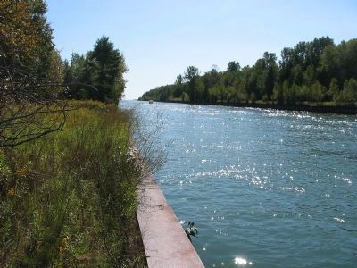
Canal length: 7,400 feet
Canal width: 100 feet
Canal depth: 22 feet
Costs
Excavation: $229,867.32
Docking, revetment, etc.: $24,113.71
Civil Engineer: $37,489.66
TOTAL: $291,461.69
This informational sign was made possible by a joint effort of the Door County Historical Society and the DCMM&LPS Maritime Friends.
Erected by the Door County Historical Society and the Door County Maritime Museum & Lighthouse Preservation Society Maritime Friends.
Topics and series. This historical marker is listed in these topic lists: Industry & Commerce • Man-Made Features • Waterways & Vessels. In addition, it is included in the Lighthouses series list. A significant historical date for this entry is June 28, 1878.
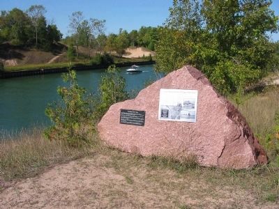
Location. This marker has been replaced by another marker nearby. It was located near 44° 47.965′ N, 87° 19.215′ W. Marker was near Sturgeon Bay, Wisconsin, in Door County. Marker could be reached from Canal Road east of Buffalo Ridge Road, on the right when traveling east. Marker is along the canal which can be reached from the parking
area of the Overlook Trail. Touch for map. Marker was at or near this postal address: 2627 Canal Road, Sturgeon Bay WI 54235, United States of America. Touch for directions.
Other nearby markers. At least 8 other markers are within 4 miles of this location, measured as the crow flies. Wisconsin State Rock (here, next to this marker); Portage Park (approx. half a mile away); Buoy and Sinker (approx. 3.6 miles away); Sturgeon Bay's Waterfront History (approx. 3.6 miles away); a different marker also named Sturgeon Bay's Waterfront History (approx. 3.6 miles away); The Fluke Anchor (approx. 3.6 miles away); a different marker also named Sturgeon Bay's Waterfront History (approx. 3.6 miles away); a different marker also named Sturgeon Bay's Waterfront History (approx. 3.6 miles away). Touch for a list and map of all markers in Sturgeon Bay.
Regarding Sturgeon Bay and Lake Michigan Ship Canal. Door County is named after a dangerous water passage at the tip of the peninsula, called by French explorers "Porte des Morts" or "Door of the Dead."
Also see . . . Sturgeon Bay Ship Canal. (Submitted on January 11, 2009.)
Credits. This page was last revised on October 23, 2021. It was originally submitted on January 11, 2009, by Keith L of Wisconsin Rapids, Wisconsin. This page has been viewed 3,970 times since then and 70 times this year. Photos: 1, 2, 3. submitted on January 11, 2009, by Keith L of Wisconsin Rapids, Wisconsin. 4. submitted on June 7, 2011, by Bob (peach) Weber of Dewey, Arizona. 5, 6. submitted on January 11, 2009, by Keith L of Wisconsin Rapids, Wisconsin. 7. submitted on November 1, 2009, by Nick Tamble of Sturgeon Bay, Wisconsin. 8. submitted on December 14, 2010, by Bob (peach) Weber of Dewey, Arizona. 9, 10. submitted on December 16, 2010, by Bob (peach) Weber of Dewey, Arizona. 11, 12. submitted on November 27, 2015. • Bill Pfingsten was the editor who published this page.
