Reservoir Hill in Baltimore, Maryland — The American Northeast (Mid-Atlantic)
Towers, Gates & Pavilions
Druid Hill Park
— Baltimore City Recreation & Parks —
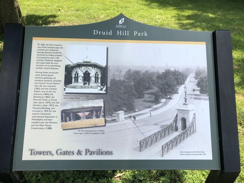
In 1862, the Park Commission hired nineteen-year-old architectural draftsman, George Aloysius Frederick. Directed by widely-traveled Commissioner John H.B. Latrobe, Frederick designed and supervised the construction of an astonishing number of park features.
Among these structures were several grand entrance gateways, six streetcar pavilions, including the Council Grove Station near the zoo entrance (1863) and the Chinese Station now at the zoo entrance (1864), the Bandstand (1865), the Moorish Tower at Druid Lake (about 1870), the Fish Hatchery (after 1872), the Maryland Building, constructed in 1876 for the nation's Centennial International Exposition in Philadelphia and later installed near the Mansion and the Palm House Conservatory (1888).
Erected by Baltimore City Recreation & Parks.
Topics. This historical marker is listed in these topic lists: Architecture • Parks & Recreational Areas. A significant historical year for this entry is 1862.
Location. 39° 18.92′ N, 76° 38.441′ W. Marker is in Baltimore, Maryland. It is in Reservoir Hill. Marker is on Madison Avenue just north of Cloverdale Road, on the left when traveling north. Touch for map. Marker is at or near this postal address: 1100 Cloverdale Rd, Baltimore MD 21217, United States of America. Touch for directions.
Other nearby markers. At least 8 other markers are within walking distance of this marker. This Panel by John Monroe (a few steps from this marker); These Citizens by Subscribing for the Park Stock in 1860 (within shouting distance of this marker); Emersonian Apartments (about 500 feet away, measured in a direct line); The Esplanade (about 600 feet away); Eli Siegel (about 600 feet away); William Wallace (about 800 feet away); Ponds, Springs & Fountains (approx. 0.3 miles away); A Memorial Rose Garden (approx. 0.3 miles away). Touch for a list and map of all markers in Baltimore.
More about this marker.
[Captions:]
Bandstand on Swann Drive, built about 1865, no longer standing.
The Main Entrance Gateway at Madison Avenue, begun in 1865, and completed in 1868.
Gates swing open at the Mount Royal Avenue entrance to the park, after 1904.
Credits. This page was last revised on June 26, 2020. It was originally submitted on June 26, 2020, by Devry Becker Jones of Washington, District of Columbia. This page has been viewed 133 times since then and 6 times this year. Photos: 1, 2. submitted on June 26, 2020, by Devry Becker Jones of Washington, District of Columbia.

