Near Taft in Lincoln County, Tennessee — The American South (East South Central)
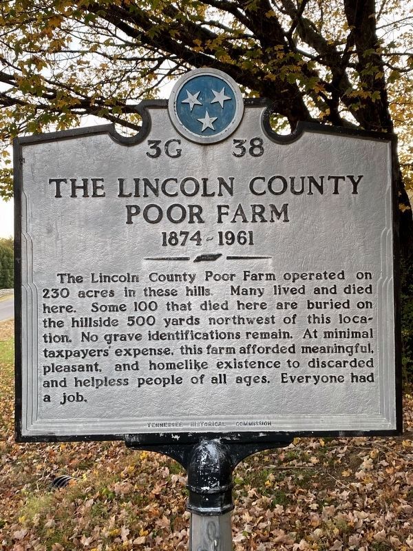
The Lincoln County Poor Farm
1874-1961
Erected by Tennessee Historical Commission. (Marker Number 3G 38.)
Topics and series. This historical marker is listed in these topic lists: Agriculture • Cemeteries & Burial Sites • Charity & Public Work. In addition, it is included in the Tennessee Historical Commission series list. A significant historical year for this entry is 1874.
Location. 35° 4.031′ N, 86° 40.777′ W. Marker is near Taft, Tennessee, in Lincoln County. Marker is on Poorhouse Road, 1.7 miles east of Good Hollow Road, on the right when traveling west. Touch for map. Marker is at or near this postal address: 108 Poorhouse Rd, Taft TN 38488, United States of America. Touch for directions.
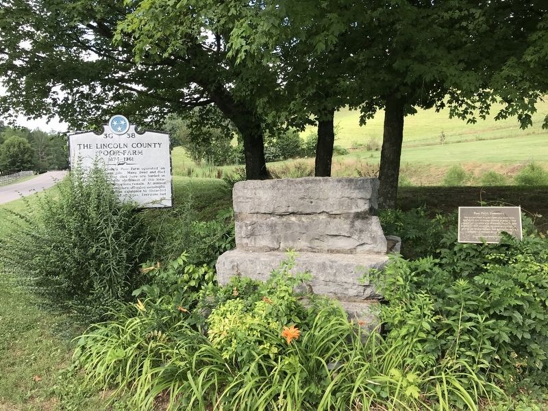
Other nearby markers. At least 8 other markers are within 9 miles of this marker, measured as the crow flies. Poor Farm Cemetery (here, next to this marker); Alfred Bearden (approx. 2.6 miles away); Pioneer (Routt - Wells) Cemetery (approx. 7.1 miles away); Camp Blount (approx. 8 miles away); Tennessee / Alabama (approx. 8.1 miles away in Alabama); Initial Survey Point (approx. 8.1 miles away in Alabama); a different marker also named Camp Blount (approx. 8.1 miles away); Camp Blount Historic Site (approx. 8.1 miles away). Touch for a list and map of all markers in Taft.
Credits. This page was last revised on October 17, 2022. It was originally submitted on June 29, 2020, by Duane and Tracy Marsteller of Murfreesboro, Tennessee. This page has been viewed 798 times since then and 184 times this year. Last updated on October 15, 2022, by Darren Jefferson Clay of Duluth, Georgia. Photos: 1. submitted on October 15, 2022, by Darren Jefferson Clay of Duluth, Georgia. 2. submitted on June 29, 2020, by Duane and Tracy Marsteller of Murfreesboro, Tennessee. • Mark Hilton was the editor who published this page.

