
Near North East in Cecil County, Maryland — The American Northeast (Mid-Atlantic)
An Earthly Paradise
Photographed by Carl Gordon Moore Jr., May 11, 2020
1. An Earthly Paradise Marker
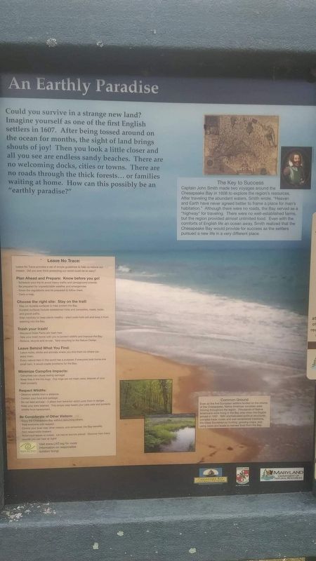
Captain John Smith made two voyages around the Chesapeake Bay in 1608 to explore the region's resources. After traveling the abundant waters, Smith wrote "Heaven and Earth have never agreed better to have a place for man's habitation." Although there were no roads, the Bay served as a "highway" for traveling. There were no well-established farms, but the region provided almost unlimited food. Even with the comforts of English life an ocean away, Smith realized that the Chesapeake Bay would provide for success as the settlers pursued a new life in a very different place.
Even as the first European settlers landed on the shores of the Chesapeake, Native American societies were thriving throughout the region. Thousands of Native Americans were living in the Bay area when the English arrived in 1607. With sophisticated political structures, complex trade routes and well-established traditions, the tribes flourished by hunting, growing crops and using weirs and boats to harvest food from the Bay.
Topics. This historical marker is listed in these topic lists: Exploration • Indigenous Peoples and Communities • Settlements & Settlers. A significant historical year for this entry is 1607.
Location. 39° 29.574′ N, 75° 59.282′ W. Marker is near North East, Maryland, in Cecil County. It is on North East Beach Road, on the left when traveling
this page online

Regionally, this marker is in Greater Wilmington, on the Eastern Shore, and in Greater Philadelphia. It is also in the American Mid-Atlantic, on the Delmarva Peninsula, in the Tidewater, in the Chesapeake Bay Region, and on the Eastern Seaboard. Globally, it is in the North Atlantic Region, North America, the Western Hemisphere, the Western World, and the Anglosphere. Historically, it finds itself in what was once one of the original Thirteen Colonies and also the Antebellum South.
Other nearby markers. At least 8 other markers are within 6 miles of this marker, measured as the crow flies: Bird’s Eye View (within shouting distance of this marker); Overlook of General Howe’s Landing (approx. 2.3 miles away); Sentinel on the Bay (approx. 2½ miles away); Why Build a Lighthouse? (approx. 2½ miles away); Welcome to Turkey Point! (approx. 3.2 miles away); The Enemy Returns (approx. 3.2 miles away); Cherry Grove (approx.
Photographed by Carl Gordon Moore Jr., June 27, 2020
2. An Earthly Paradise Marker
Credits. This page was last revised on July 1, 2020. It was originally submitted on July 1, 2020, by Carl Gordon Moore Jr. of North East, Maryland. This page has been viewed 418 times since then and 18 times this year. Photos: 1, 2. submitted on July 1, 2020, by Carl Gordon Moore Jr. of North East, Maryland. • Bill Pfingsten was the editor who published this page.
