Near Perry Hall in Baltimore County, Maryland — The American Northeast (Mid-Atlantic)
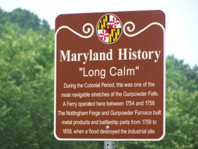
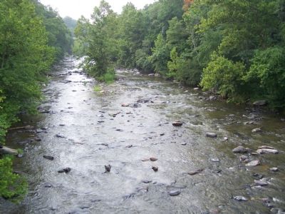
“Long Calm”
Maryland History
Erected 2004 by Maryland State Highway Administration.
Topics. This historical marker is listed in these topic lists: Colonial Era • Industry & Commerce • Waterways & Vessels. A significant historical year for this entry is 1754.
Location. 39° 24.814′ N, 76° 24.425′ W. Marker is near Perry Hall, Maryland, in Baltimore County. Marker is on Philadelphia Road (Maryland Route 7) 0.1 miles north of Forge Road, on the left when traveling north. Touch for map. Marker is in this post office area: Perry Hall MD 21128, United States of America. Touch for directions.
Other nearby markers. At least 8 other markers are within 3 miles of this marker, measured as the crow flies. Union of Brother and Sisters of Ford’s Asbury Lodge No. 1 (approx. ¼ mile away); The Sweathouse Road (approx. 2 miles away); Camp Chapel (approx. 2.1 miles away); Harry Dorsey Gough (approx. 2.2 miles away); a different marker also named Harry Dorsey Gough (approx. 2.2 miles away); Gunpowder Falls State Park (approx. 2.2 miles away); Joppa Town (approx. 2.4 miles away); “Whitemarsh” (approx. 2.4 miles away). Touch for a list and map of all markers in Perry Hall.
Credits. This page was last revised on July 1, 2020. It was originally submitted on July 29, 2007, by Bill Pfingsten of Bel Air, Maryland. This page has been viewed 2,558 times since then and 47 times this year. Last updated on July 1, 2020, by Carl Gordon Moore Jr. of North East, Maryland. Photos: 1, 2. submitted on July 29, 2007, by Bill Pfingsten of Bel Air, Maryland.

