Dover in Strafford County, New Hampshire — The American Northeast (New England)
The Dover Community Trail
History and Environment
Community Trail History
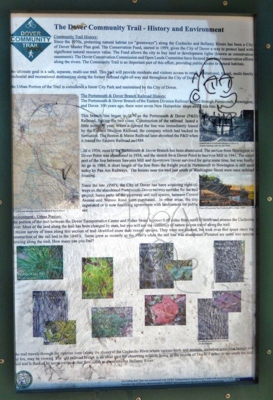
Since the 1970s, protecting natural habitat (or "greenways") along the Cochecho and Bellamy Rivers has been a City of Dover Master Plan goal. The Conservation Fund, started in 1999, gives the City of Dover a way to protect land with significant natural resource value. The Fund allows the city to buy land or development rights (known as conservation easements). The Dover Conservation Commission and Open Lands Committee have focused their land conservation efforts along the rivers. The Community Trail is an important part of this effort, providing public access to natural habitats.
The ultimate goal is a safe, separate, multi-use trail. This trail will provide residents and visitors access to retail, institutional, transit, multi-family residential and recreational destinations along the former railroad right-of-way and throughout the City of Dover.
The Urban Portion of the Trail is considered a linear City Park and maintained by the City of Dover.
The Portsmouth & Dover Branch Railroad History
The Portsmouth & Dover Branch of the Eastern Division Railroad passed through Portsmouth, Newington, and Dover. 100 years ago, there were seven New Hampshire stops along this line.
This branch line began in 1874 as the Portsmouth & Dover (P&D) Railroad, linking the two cities. Construction of the railroad lasted a little over one year. When it opened the line was immediately leased by the Eastern Division Railroad, the company which had backed its formation. The Boston & Maine Railroad later absorbed the P&D when it leased the Eastern Railroad in 1884.
Since 1934, most of the Portsmouth & Dover Branch has been abandoned. The section from Newington to Dover Point was abandoned in 1934, and the stretch from Dover Point to Sawyers Mill in 1941. The small part of the line between Sawyers Mill and downtown Dover survived for quite some time, but was finally let go in 1986. A short length of the line from the freight yard in Portsmouth to Newington is still used today by Pan Am Railways. The houses near the trail just south of Washington Street were once railroad housing.
Since the late 1990's, the City of Dover has been acquiring right-of-ways on the abandoned Portsmouth-Dover railway corridor for the trail project. Some parts of the greenway and trail system, between Central avenue and Watson Road were purchased. In other areas, the city negotiated or is now finalizing agreements with landowners for public use.
Environment - Urban Portion
The portion of the trail between the Dover Transportation Center and Fisher Street is about 0.69 miles from north to south and crosses the Cochecho River. Most of the land along the trail has been changed by man, but you will still see the resiliency of nature is you travel along the trail. A recent survey of trees along this section of trail identified more than twenty species. They were not planted, but took over that space since the construction of the rail bed in the 1840's. Some grew as recently as the 1980's when the rail line was abandoned. Pictured are some tree species growing along the trail. How many can you find?
The trail travels through the riparian zone (along the shore) of the Cochecho River where various birds and animals, including great blue herons and red fox, may be viewed. The old railroad bridge is an ideal spot for observing wildlife living in the middle of Dover. Further to the south the trail rises and is flanked by some wetlands that flow south to drain into the Bellamy River.
(photo captions)
• Undated photo of railroad underpass at Silver Street. Granite retaining walls are still visible.
• Photo of Community Trail Cochecho River Bridge – 2010
• USGS map showing route of Portsmouth & Dover Branch
• Eastern White Pine (Pinus strobus)
• American Beech (Fagus grandifolia)
• Gray Birch (Betula populifolia)
• Black Cherry (Prunus serotine)
• Black Locust (Robinia pseudoacacia)
• Red Spruce (Picea rubens)
• Red Maple (Acer rubrum)
• White Ash (Fraxinus Americana)
*Tree photos and identification courtesy of Gabriel Roxby
Topics. This historical marker is listed in these topic lists: Environment • Horticulture & Forestry • Parks & Recreational Areas • Railroads & Streetcars.
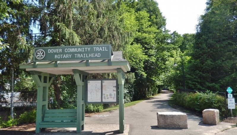
Location. 43° 11.825′ N, 70° 52.739′ W. Marker is in Dover, New Hampshire, in Strafford County. Marker can be reached from the intersection of Chestnut Street and Third Street, on the right when traveling south. Marker is located at the Dover Community Trail Trailhead, near the southwest corner of the Dover Transportation Center parking lot. Touch for map. Marker is at or near this postal address: 33 Chestnut Street, Dover NH 03820, United States of America. Touch for directions.
Other nearby markers. At least 8 other markers are within walking distance of this marker. Dover's Early Settlers (approx. ¼ mile away); Dover's Black Day (approx. ¼ mile away); Early 19th Century Storefronts (approx. ¼ mile away); The American House Hotel (approx. ¼ mile away); Central (Lower) Square (approx. ¼ mile away); The Dover Mill Girls (approx. ¼ mile away); Merchants National Bank (approx. ¼ mile away); The New Depot on Third Street (approx. ¼ mile away). Touch for a list and map of all markers in Dover.
Also see . . . The Eastern Division. Abandoned Rails website entry:
The Eastern Railroad was the primary arch-rival of the Boston and Maine Railroad in the mid-1800s, until it suffered financial decline and was acquired by the B&M in the late 1880s. Completed in the early 1840s, the Eastern RR ran right along the seacoast between Boston, MA, and Portland, ME, serving such cities and towns as Salem and Newburyport, MA, and Seabrook, Hampton, and Portsmouth, NH. (Submitted on July 5, 2020, by Cosmos Mariner of Cape Canaveral, Florida.)
Credits. This page was last revised on July 6, 2022. It was originally submitted on July 2, 2020, by Cosmos Mariner of Cape Canaveral, Florida. This page has been viewed 155 times since then and 12 times this year. Photos: 1, 2. submitted on July 5, 2020, by Cosmos Mariner of Cape Canaveral, Florida.

