Mechanicsville in Hanover County, Virginia — The American South (Mid-Atlantic)
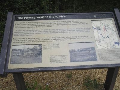
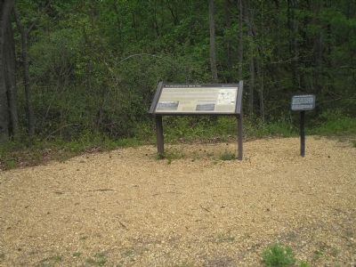
The Pennsylvanians Stand Firm
As soon as they reached rifle range our men opened upon them such a destructive fire from the rifle pits and the old mill dam that they were forced back with terrible slaughter, the artillery keeping up the fire with shell when they were beyond musket range. Notwithstanding the fearful slaughter in the ranks the enemy renewed several times the attempt to reach the creek and force a passage.
Despite the odds, Confederate infantry made several desperate attempts to break through. No attack ever reached beyond the mill race. One Union observer credited success to, “a good position, plenty of artillery, rifle pits and last but not least the men were fresh, anxious and determined.”
Erected by Richmond National Battlefield Park - National Park Service.
Topics. This historical marker is listed in this topic list: War, US Civil. A significant historical year for this entry is 1862.
Location. This marker has been replaced by another marker nearby. It was located near 37° 35.711′ N, 77° 21.482′ W. Marker was in Mechanicsville, Virginia, in Hanover County. Marker could be reached from Cold Harbor Road (Virginia Route 156), on the right when traveling east. Marker is in the Beaver Dam Creek Unit of Richmond National Battlefield Park. Touch for map. Marker was in this post office area: Mechanicsville VA 23111, United States of America. Touch for directions.
Other nearby markers. At least 8 other markers are within walking distance of this location. Site of Ellerson’s Mill (here, next to this marker); Holding the High Ground (here, next to this marker); Historic Cold Harbor Road (within shouting distance of this marker); Lee’s First Strike (about 300 feet away, measured in a direct line); Beaver Dam Creek (about 300 feet away); a different marker also named Beaver Dam Creek (about 600 feet away); Ellerson's Mill (about 700 feet away); Seven Days Battles (approx. ¼ mile away). Touch for a list and map of all markers in Mechanicsville.
More about this marker. The lower left of the marker features a picture of Ellerson’s Mill. It has a caption of “This April 1865 image looks eastward and shows Ellerson’s Mill, part of the mill race, and the slope occupied by Brigadier General Truman Seymour’s Pennsylvania brigade. Note the battle damage to the structure.” Next to this is a photograph with the caption “This photograph, taken about 1885, shows the Federal position in more detail. Ellerson’s Mill had been rebuilt by the time this view was recorded. You are standing on the far right edge of the photograph. (The foundation of the mill is in the woods about 30 yards to your front)
Related marker. Click here for another marker that is related to this marker. New Marker At This Location titled "Holding the High Ground".
Also see . . .
1. Beaver Dam Creek. CWSAC Battle Summaries website. (Submitted on January 4, 2009, by Bill Coughlin of Woodland Park, New Jersey.)
2. Places To Go in Richmond National Battlefield Park. National Park Service website. (Submitted on January 4, 2009, by Bill Coughlin of Woodland Park, New Jersey.)
3. The Seven Days Battle. HistoryCentral.com website. (Submitted on January 4, 2009, by Bill Coughlin of Woodland Park, New Jersey.)
Photographed By Bill Coughlin, April 24, 2007
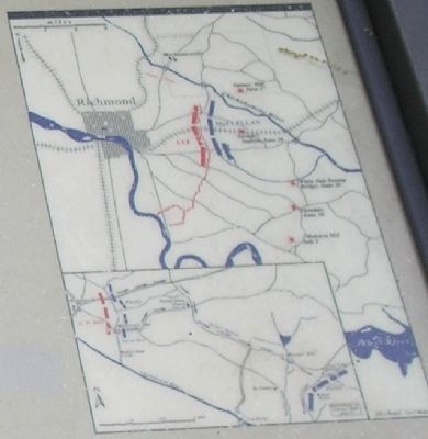
6. Maps from Marker
The large map above shows the general shape of the lines south of the Chichahominy River on June 27. On that morning (see inset), Porter’s Union forces abandoned this position and moved eastward, eventually taking an even stronger position behind Boatswain’s Creek four miles east of here. Lee’s army pursued on four parallel roads and reached New Cold Harbor in time to fight the Battle of Gaine’s Mill. The driving tour follows Porter’s line of retreat past historic Walnut Grove and Gaines’ Millpond to the Watt House.
Credits. This page was last revised on February 19, 2023. It was originally submitted on January 4, 2009, by Bill Coughlin of Woodland Park, New Jersey. This page has been viewed 1,035 times since then and 9 times this year. Last updated on January 12, 2009, by Bernard Fisher of Richmond, Virginia. Photos: 1, 2, 3, 4, 5, 6. submitted on January 4, 2009, by Bill Coughlin of Woodland Park, New Jersey. • Kevin W. was the editor who published this page.
