Saint John in Saint John County, New Brunswick — The Atlantic Provinces (North America)
Fort La Tour
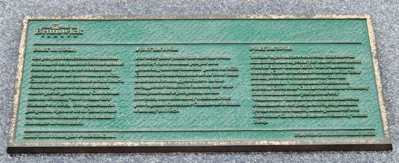
Les peoples des Premières nations ont utilisé cet endroit comme lieu de rassemblement et de cérémonie pendant plus de 4000 ans. En 1631, Charles de Sainte-Étienne de La Tour a établi un poste de traite fortifié. Alors que le gouverneur Charles de Menou d'Aulnay vise à contrôler l'Acadie en 1645, Françoise-Marie Jacquelin, épouse de La Tour, tente en vain de défendre le fort durant l’absence de son mari.
Lieu Historique Provincial
For over 4000 years this site has been used by First Nations people as a gathering and ceremonial place. In 1631 Charles de Sainte-Étienne de La Tour built a fortified trading post here. In the struggle for control of Acadie, his wife Françoise-Marie Jacquelin, in his absence, unsuccessfully defended the post against Governor Charles de Menou d'Aulnay in 1645.
Provincial Historic Site
Erected by Province of New Brunswick.
Topics. This historical marker is listed in these topic lists: Colonial Era • Forts and Castles • Native Americans • Settlements & Settlers. A significant historical year for this entry is 1631.
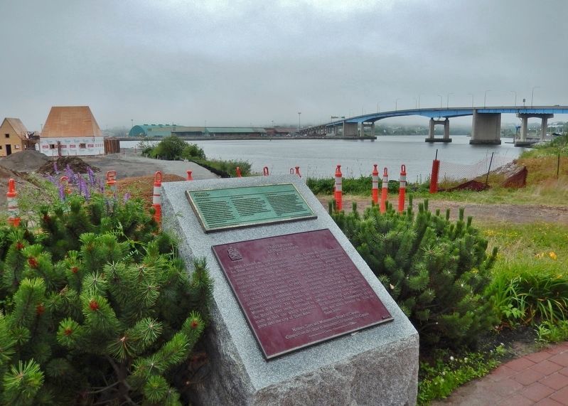
Location. 45° 16.385′ N, 66° 4.385′ W. Marker is in Saint John, New Brunswick, in Saint John County. Marker can be reached from the intersection of Fort Latour Drive and Navy Way, on the right when traveling east. Marker is located along the Harbour Passage Trail, about 2/10 kilometer east of Navy Way. Touch for map. Marker is at or near this postal address: 124 Chesley Drive, Saint John NB E2K 1K7, Canada. Touch for directions.
Other nearby markers. At least 8 other markers are within walking distance of this marker. A different marker also named Fort La Tour (here, next to this marker); Menahkwesk "Saint John" (within shouting distance of this marker); a different marker also named Fort La Tour (within shouting distance of this marker); The Shards of Time (within shouting distance of this marker); The Tides of Fundy (approx. 0.3 kilometers away); The Saint John Harbour Bridge | Le pont du port de Saint John (approx. 0.3 kilometers away); Fort Howe (approx. 0.4 kilometers away); Saint John – The Working Port (approx. half a kilometer away). Touch for a list and map of all markers in Saint John.
Related markers. Click here for a list of markers that are related to this marker. Fort La Tour
Also see . . . Fort La Tour National Historic Site of Canada
. Aboriginal traders carried furs down the Saint John River to trade at the fort for goods such as beads, iron spear points and arrow heads. It also provided a strategically located, fortified stronghold against La Tour’s rival, Charles de Menou d’Aulnay. In 1645, d’Aulnay attacked the fort during Sieur de La Tour’s absence. Sieur de La Tour’s wife, Françoise-Marie Jacquelin, led a defence of the garrison for four days, until finally surrendering to d’Aulnay. Jacquelin’s bravery, and her death while in d’Aulnay’s custody, have made her a Canadian heroine. The fort itself was destroyed at an unknown date in the 17th or early-18th century. (Submitted on July 6, 2020, by Cosmos Mariner of Cape Canaveral, Florida.)
Credits. This page was last revised on July 6, 2020. It was originally submitted on July 5, 2020, by Cosmos Mariner of Cape Canaveral, Florida. This page has been viewed 131 times since then and 4 times this year. Photos: 1. submitted on July 5, 2020, by Cosmos Mariner of Cape Canaveral, Florida. 2. submitted on July 6, 2020, by Cosmos Mariner of Cape Canaveral, Florida.

