Near Centreville in Fairfax County, Virginia — The American South (Mid-Atlantic)
Civil War Winter Quarters
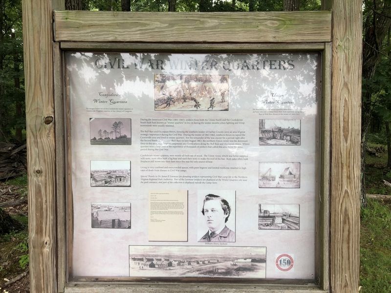
During the American Civil War (1861-1865), soldiers from both the Union North and the Confederate South built huts known as "winter quarters" to live in during the winter months when fighting and troop movements were usually minimal.
The Bull Run and Occoquan Rivers, forming the southern border of Fairfax County, were an area of great strategic importance during the Civil War. During the winter of 1861/1862, southern forces occupied the Centreville area and lived in winter quarters. For the remainder of the war, except for a period right after the Second Battle of Manassas (Bull Run) in July/August 1862, the northern Union Army was the dominant force in the area, with large encampments and fortifications along the Bull Run and Occoquan rivers. Winter quarters were a large part of the experience of thousands of soldiers that called this area home for some period during the Civil War.
Confederate winter quarters, were mostly all built out of wood. The Union Army, which was better supplied with tents, most often built a log base and used their tents to make the roof of the hut. Both sides often built fireplaces and
this page online
Living in very confined and overcrowded spaces, with poor hygiene and limited medicine, resulted in high rates of death from disease in Civil War camps.
Erected by NOVA Parks.
Topics and series. This historical marker is listed in these topic lists: War, US Civil • Waterways & Vessels. In addition, it is included in the NOVA Parks series list. A significant historical year for this entry is 1862.
Location. 38° 48.073′ N, 77° 29.447′ W. Marker is near Centreville, Virginia, in Fairfax County. It is on Bull Run Drive 0.1 miles south of Bull Run Drive, on the left when traveling south. Touch for map. Marker is at or near this postal address: 7700 Bull Run Dr, Centreville VA 20121, United States of America. Touch for directions.

Regionally, this marker is in the Washington Metropolitan Area and in Northern Virginia. It is also in the American South, specifically in the Upper South, in the Mid-Atlantic, and on the Eastern Seaboard. Globally, it is in the North Atlantic Region, North America, the Western Hemisphere, the Western World, and the Anglosphere.
Other nearby markers. At least 8 other markers are within 2 miles of this marker, measured as the crow flies: Headwaters to Baywaters (approx. ¼ mile away); a different marker also named Cavalry Clash (approx. 0.9 miles away); Confederate Headquarters (approx. 0.9 miles away); Portici (approx. one mile away); Ben Lomond Farm (approx. 1.1 miles away); Jackson’s Route (approx. 1.2 miles away); Ben Lomond (approx. 1.2 miles away); The Ben Lomond Manor House (approx. 1.2 miles away).
Other markers no longer nearby. Cavalry Clash (was approx. 0.9 miles away but has been replaced with another marker now near it); a different marker also named Confederate Headquarters (was approx. 0.9 miles away but has been replaced with another marker now near it).
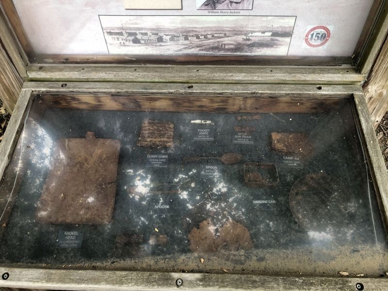
Regarding Civil War Winter Quarters. Special Thanks to Dr. James P. Larmour for donating artifacts representing Civil War camp life to the Northern Virginia Regional Park Authority. Part of the Larmour artifacts are displayed at the Winter Quarters site near the park entrance, and part of the collection is displayed outside the Camp Store.
Credits. This page was last revised on July 7, 2021. It was originally submitted on July 5, 2020, by Devry Becker Jones of Washington, District of Columbia. This page has been viewed 920 times since then and 76 times this year. Photos: 1, 2, 3. submitted on July 5, 2020, by Devry Becker Jones of Washington, District of Columbia.
