Crawfordville in Taliaferro County, Georgia — The American South (South Atlantic)
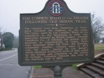
The Common Road of the English Following Old Indian Trail
Inscription.
The colonial road from Charleston to Vicksburg followed the highway at this point. The route, used by Col. Langdon Welch on his expedition to the Mississippi in 1698, was thereafter followed by British traders. Through Taliaferro Co., it followed the present route, Raytown to Crawfordville to Union Point, then Ogeechee River Old Town. Wm. Bartram, celebrated traveler, crossed here in 1773 with the party, headed by Col. Barnett, which surveyed 2,000,000 acres of land ceded by the Creeks and Cherokees to the Colony of Georgia. Lafayette followed this road on his American tour in 1825.
Erected 1956 by Georgia Historical Commission. (Marker Number 131-9.)
Topics and series. This historical marker is listed in these topic lists: Colonial Era • Native Americans. In addition, it is included in the Georgia Historical Society, the Lafayette’s Farewell Tour, and the William Bartram Trails series lists. A significant historical year for this entry is 1698.
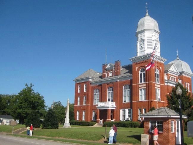
Location. 33° 33.256′ N, 82° 53.796′ W. Marker is in Crawfordville, Georgia, in Taliaferro County. Marker is at the intersection of Broad Street (U.S. 278) and Monument street, on the right when traveling west on Broad Street. Touch for map. Marker is in this post office area: Crawfordville GA 30631, United States of America. Touch for directions.
Other nearby markers. At least 8 other markers are within walking distance of this marker. Taliaferro County (here, next to this marker); Crawfordville Confederate Memorial (a few steps from this marker); Taliaferro County World Wars Memorial (within shouting distance of this marker); Taliaferro County World War I Memorial (within shouting distance of this marker); Roselle Mercier Montgomery (about 300 feet away, measured in a direct line); Old Tavern Site (about 300 feet away); Crawfordville Methodist Church (about 400 feet away); Site of Childhood Home of Richard Malcolm Johnston (approx. 0.2 miles away). Touch for a list and map of all markers in Crawfordville.
Additional keywords. The Common Road of the English Following Old Indian Trail
Credits. This page was last revised on July 3, 2016. It was originally submitted on January 12, 2009, by Tristan Budd of Kingsland, Georgia. This page has been viewed 1,561 times since then and 31 times this year. Photos: 1. submitted on January 12, 2009, by Tristan Budd of Kingsland, Georgia. 2, 3. submitted on June 27, 2010, by Glenn Sheffield of Tampa, Florida. • Bill Pfingsten was the editor who published this page.


