
Atlas District in Northeast Washington in Washington, District of Columbia — The American Northeast (Mid-Atlantic)
Mediterranean Imports
Hub, Home, Heart
| — | Greater H Street NE Heritage Trail | — |
Photographed by Craig Swain, September 29, 2012
1. Mediterranean Imports Marker
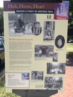
Maryland Avenue in the 1930s was home to immigrants from around the Mediterranean. Evelyn Kogok Hier grew up at 1328 Maryland Avenue. She remembered her next-door neighbor, the Right Reverend Ayoub (Job) Salloom, hosting after-church gatherings where men shared a hookah, the ancient water pipe for smoking tobacco. Rev. Salloom ministered to the tight-knit "Little Lebanon" community at St. George's Syrian Orthodox Church on Eighth Street, NW. As a child, Kogok remembered, she would cut through Linden Court to H Street and the candies at Lebanese-owned Farris & Son's Confectioners. The Atlas movie house replaced Farris's in 1938.
Many of the neighborhood's Greek immigrants started up the economic ladder selling produce from huckster wagons, then renting stalls at the wholesale markets before opening their own, often food-related, businesses. In the 1940s the Pappas and Callas families operated produce stands at Union Terminal Market on Florida Avenue. The Cokinos family ran the nearby Goody Shop confectionery beginning in 1910. Greeks owned the Rendezvous Club and the Paramount, Kavakos, Chaconas, and Bacchus grills along
this page online
Although African American families had long lived in the neighborhood, deeds originally restricted some blocks, including this on, to whites. African American educators James L., and Gustava Eubanks operated Washington Junior College of Music at 12th and G before moving it to 1252 Maryland Avenue in 1947.
Noted African American architect Lewis Giles, Sr. (1893-1974) grew up on Linden Place, which you will pass on your left as you walk to Sign 13.
To reach Sign 13, turn right on 13th Street, cross H, and turn left.
Discover More ...
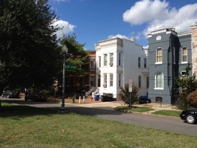
Just across G Street from this sign is Linden Court, one of the area's inhabited alleys. In 1897 more than 100 African American families lived in tiny, flat-fronted rowhouses alongside stables and workshops. The houses on the north side of the alley were demolished in 1937 to make way for the Atlas Theater, but enough remain to give the flavor of the old community.
Erected 2012 by Cultural Tourism DC. (Marker Number 12.)
Topics and series.
Photographed by Craig Swain, September 29, 2012
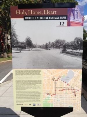
2. Back of Marker
Location. 38° 53.932′ N, 76° 59.208′ W. Marker is in Northeast Washington in Washington, District of Columbia. It is in the Atlas District. It is at the intersection of Maryland Avenue Northeast and G Street Northeast, on the right when traveling west on Maryland Avenue Northeast. Touch for map. Marker is at or near this postal address: 1338 G Street Northeast, Washington DC 20002, United States of America. Touch for directions.

Regionally, this marker is in the Washington Metropolitan Area. It is also in the American Northeast, in the Upper South, in the Mid-Atlantic, in the Tidewater, and in the Chesapeake Bay Region. Globally, it is in North America, the Western Hemisphere, the Western World, and the Anglosphere.
Other nearby markers. At least 8 other markers are within walking distance of this marker: Culture and Commerce (about 600 feet away); Henrietta Vinton Davis Residence
Photographed by Craig Swain, September 29, 2012
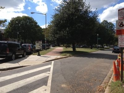
3. Mediterranean Imports Marker
Another marker is no longer nearby. A Quiet Place (was about 500 feet away, measured in a direct line but has been permanently removed).
Photographed by Craig Swain, September 29, 2012
4. Linden Court Alley entrance
Between the white and the blue-gray buildings.
Credits. This page was last revised on February 12, 2024. It was originally submitted on October 7, 2012, by Craig Swain of Leesburg, Virginia. This page has been viewed 842 times since then and 13 times this year. Last updated on July 7, 2020, by Bruce Guthrie of Silver Spring, Maryland. Photos: 1, 2, 3, 4. submitted on October 7, 2012, by Craig Swain of Leesburg, Virginia. • Devry Becker Jones was the editor who published this page.
