Montrose in Effingham County, Illinois — The American Midwest (Great Lakes)
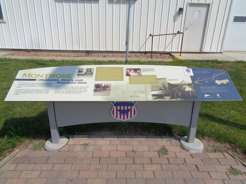
Montrose
Drummers, Drays and Railroad Days
At the depot, the drummers' trunks, samples and suitcases were loaded onto low, sturdy, horse-drawn carts called drays. A driver, or drayman, transported the cargo to a hotel, where he unloaded the freight.
In Montrose, a drummer unpacked his bags at the Brazil House, James House, or Steger Hotel. Once settled, he hired a horse and buggy from a livery stable owned by Faber Bros. or Louis Fearington & Son, then peddled his products to merchants on Main Street, and in neighboring towns and hamlets.
Commerce Comes Calling
In 1845, Abraham Marble established a stagecoach stop on the National Road east of present-day Montrose. But the area wouldn't wake to commercial development until 1870, when land owner J.B. Johnson platted Montrose on the St. Louis, Vandalia and Terre Haute rail line.
By 1873, the village was home to Nelson Shull's Brazil House hotel, storehouses built by Browning, Schooley, and Van Sandt, and Phillip Wiwi's general store, granary, and livestock market.
The village prospered during the final decade of the 1800s. At the turn of the 20th century, Montrose supported implement and blacksmith shops, a hotel, bank, and six general stores.
Motoring Into Montrose
In 1926, the National Road became US 40, a cross-country highway carrying traffic from Atlantic City, N.J., to San Francisco, Calif. Montrose offered motorists their choice of four filling stations during the '20s, including a Linco service station to the west, and Shell and Phillips 66 stations at the east end of town.
(photo captions:)
Crews Bank opened during the town's prosperous years at the turn of the 20th century. The bank operated from 1902 to 1949.
This street view of the Steger Hotel in 1907 hints at challenges faced by smartly dressed salesmen. Depending on the season, roads were made of mud or dust. The National Road was paved through Montrose in 1920.
Built in 1937, Fletcher's Garage operated on the National Road until 2003. Owner RJ Fletcher (pictured) frequently towed stranded motorists from muddy, rural roads. In addition to cash, Fletcher accepted produce, goods, and services as payment.
Meislahn's store opened in 1907 during the Golden Age of rail travel.
(aside:)
A Road of Dirt, Rock, And Dreams
In 1806, President Thomas Jefferson signed legislation to provide federal funding for a National Road. Surveyed from Cumberland, Md., to the Mississippi River, the National Road was a highway for pioneers eager to settle the West.
Today, as US 40, the National Road in Illinois spans 164 miles. From Indiana to East St. Louis, you can still see how the ambitions and accomplishments of early Illinois immigrants shaped our communities. You'll find their influence in our art and architecture, our industry and agriculture, and in our way of life. Enjoy your time on the Road.
Erected 2015 by National Road Association of Illinois.
Topics and series. This historical marker is listed in these topic lists: Industry & Commerce • Railroads & Streetcars • Roads & Vehicles. In addition, it is included in the The Historic National Road series list.
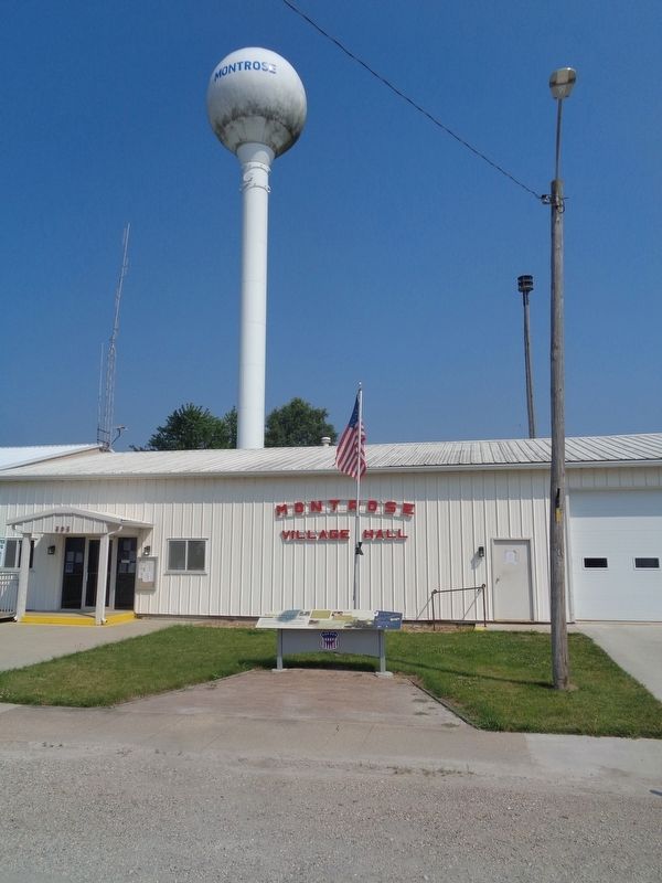
Location. 39° 9.879′ N, 88° 22.843′ W. Marker is in Montrose, Illinois, in Effingham County. Marker is on National Road (U.S. 40) east of Montgomery Street, on the left when traveling east. Marker is in front of Montrose Village Hall and Fire Department buildings. Touch for map. Marker is at or near this postal address: 203 National Rd, Montrose IL 62445, United States of America. Touch for directions.
Other nearby markers. At least 8 other markers are within 10 miles of this marker, measured as the crow flies. A Salute to All Veterans (about 700 feet away, measured in a direct line); Teutopolis (approx. 5˝ miles away); Veterans Memorial (approx. 7.2 miles away); Lord Thomas Howard, Earl of Effingham (approx. 9.1 miles away); Effingham (approx. 9.1 miles away); Yates Post No. 88 W.R.C. (approx. 9.1 miles away); Effingham County Courthouse (approx. 9.1 miles away); a different marker also named Veterans Memorial (approx. 9.1 miles away).
Also see . . . Jewett and Montrose (video). From the Illinois National Road's YouTube channel, this is a short video that talks about the two villages that were on the Historic National Road. It is worth noting that Jewett does not have a National Road marker (or what they call, an interpretive kiosk). The segment on Montrose is at 0:47. (Submitted on July 10, 2020, by Jason Voigt of Glen Carbon, Illinois.)
Credits. This page was last revised on July 10, 2020. It was originally submitted on July 10, 2020, by Jason Voigt of Glen Carbon, Illinois. This page has been viewed 211 times since then and 37 times this year. Photos: 1, 2. submitted on July 10, 2020, by Jason Voigt of Glen Carbon, Illinois.

