Stevensburg in Culpeper County, Virginia — The American South (Mid-Atlantic)
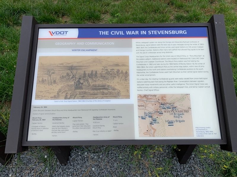
The Civil War in Stevensburg
Geography and Communication
— Winter Encampment —
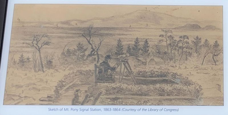
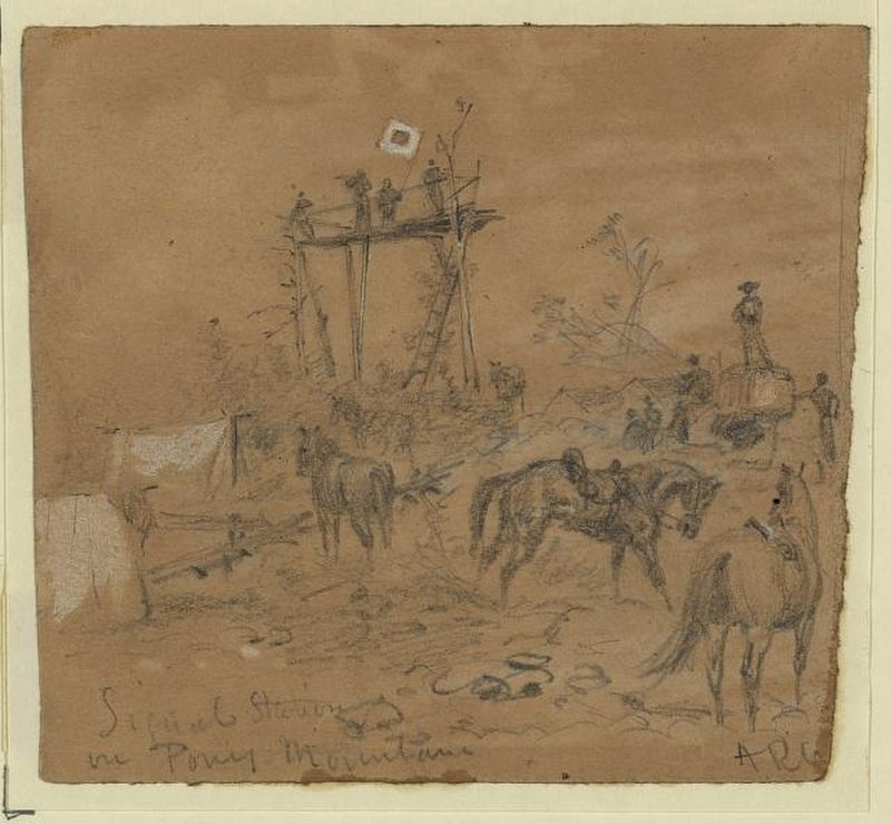
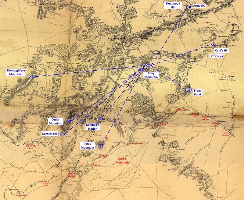
The Signal Corps Headquarters for the Union was on Mount Pony, or "Pony Mountain" as the soldiers called it. Additional stations were located on Fleetwood Hill, Cole's Hill, Cedar Mountain and Culpeper Courthouse. The Mount Pony station was first held by the Confederates in 1862 and later in the 1863 Battle of Brandy Station. By the winter of 1863-1864, the Union used Mount Pony as the central relay station, within view of army headquarters to the north and stations overlooking Confederate positions to the south. Meanwhile, the Confederate forces used Clark Mountain as their central station during the winter encampment.
On a clear day, the rotating Confederate guards were easily viewed from Union-held signal stations watching each ford across the Rapidan River. Conversations between signalers discussed troop movements and any other useful intelligence. The Union Signal Corps was staffed entirely with military personnel, unlike the telegraph lines, and led by Captain Lemuel North, Chief Signal Officer.
Sidebar:
February 24, 1864
Union discussion between Mount Pony and Army Headquarters near Fleetwood Hill regarding Confederate Movements
Excerpt of signal communication:
Mount Pony, February 24, 1864
Captain Norton:
A brigade of infantry moving down in direction of Morton's Ford.
-Bartley.
Headquarters Army of the Potomac.
Lieutenant Bartley:
Watch that brigade closely. How far from Morton's Ford are they, and where did they come from?
-Norton
Mount Pony.
Captain Norton:
They were pickets. They came from Clark Mountain. The others have gone back.
-Bartley.
Headquarters Army of the Potomac
10.50 a.m.
Lieutenant Bartley,
Mount Pony:
Was it our infantry or rebel?
-Norton
Mount Pony.
11 a.m.
Captain Norton:
Rebel.
-Barley
Erected 2020 by Virginia Department of Transportation.
Topics. This historical marker is listed in this topic list: War, US Civil. A significant historical date for this entry is February 24, 1864.
Location. 38° 26.51′ N, 77° 53.449′ W. Marker is in Stevensburg, Virginia, in Culpeper County. Marker is at the intersection of York Road (State Road 600) and Germanna Highway (State Highway
3), on the right when traveling east on York Road. Located at an interpretive pull off on the east end of Stevensburg. Touch for map. Marker is in this post office area: Stevensburg VA 22741, United States of America. Touch for directions.
Other nearby markers. At least 8 other markers are within walking distance of this marker. A different marker also named The Civil War in Stevensburg (here, next to this marker); a different marker also named The Civil War in Stevensburg (here, next to this marker); a different marker also named The Civil War in Stevensburg (a few steps from this marker); Battlefield Preservation (a few steps from this marker); Religion in Stevensburg (a few steps from this marker); a different marker also named Religion in Stevensburg (a few steps from this marker); Historic Stevensburg (a few steps from this marker); Welcome to Historic Stevensburg, Virginia (about 500 feet away, measured in a direct line). Touch for a list and map of all markers in Stevensburg.
Also see . . .
1. A fine network of wig-wags: Signal stations for the Army of the Potomac, Winter 1864. First part of two in a series detailing Signal Corps operations during the encampment of 1863-1864. (Submitted on July 14, 2020, by Craig Swain of Leesburg, Virginia.)
2. Intelligence forwarded by wig-wag: Signal Stations as Observation Posts. Part 2 of the set detailing Signal Corps Operations during the encampment. (Submitted on July 14, 2020, by Craig Swain of Leesburg, Virginia.)
Credits. This page was last revised on July 14, 2020. It was originally submitted on July 12, 2020, by Craig Swain of Leesburg, Virginia. This page has been viewed 518 times since then and 49 times this year. Photos: 1. submitted on July 12, 2020, by Craig Swain of Leesburg, Virginia. 2, 3. submitted on July 14, 2020, by Craig Swain of Leesburg, Virginia. 4. submitted on July 12, 2020, by Craig Swain of Leesburg, Virginia. 5, 6. submitted on July 14, 2020, by Craig Swain of Leesburg, Virginia.
