Golden in Jefferson County, Colorado — The American Mountains (Southwest)
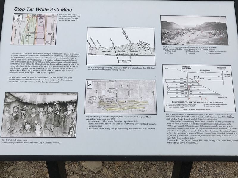
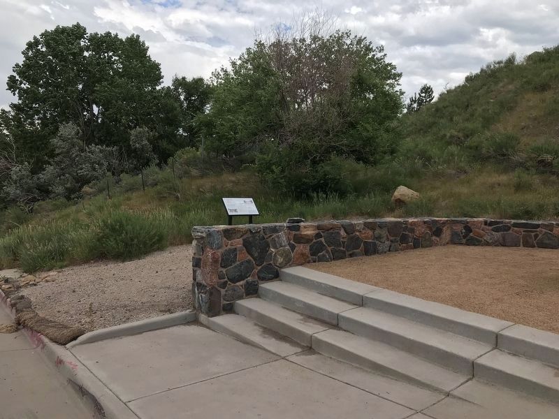
Stop 7a: White Ash Mine
On September 9, 1889, the White Ash mine flooded. Ten men lost their lives under hundreds of feet of water and the mine closed. It was a tragic and sudden loss to the families of the lost and the community. See the adjacent memorial.
[Captions:]
Top left: Fig. 1: You are at Stop 7a on the Mines Geology Trail. The map locates all of the stops and the bedrock geology.
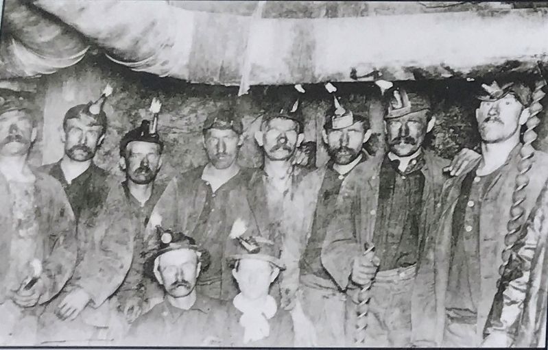
Bottom left: Fig. 2: White Ash miners photo (Photo courtesy of Golden History Museums, City of Golden Collection)
Top middle: Fig. 3: Sketch geology section by Arthur Lakes (1889) of overturned strata along 12th Street with outline of White Ash mine workings for coal.
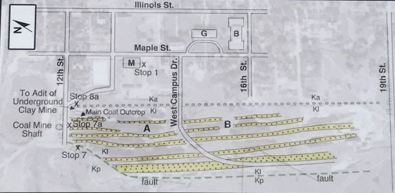
Bottom middle: Fig. 4: Sketch map of sandstone ridges in yellow and Clay Pits Fault in green. Map is overlaid over aerial photo from 1948.
Ka = Arapahoe Kl = Laramie Formation Kp = Pierre Shale
— Rubey Mine Area A between 12th Street and West Campus Drive was largely mined by surface methods
— Rubey Mine Area B was by underground mining with the entrance near 12th Street
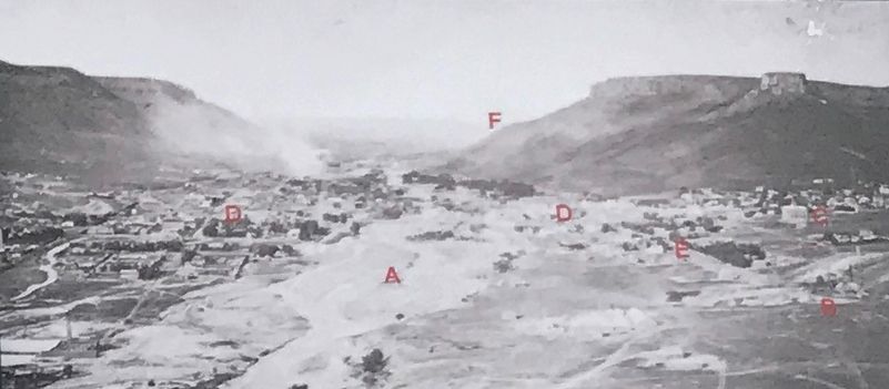
Top right: Fig. 5: Golden panorama photograph looking east in 1892 by W.H. Jackson (Photo courtesy of Golden History Museums, City of Golden Collection)
A: Clear Creek B: White Ash mine C: Colorado School of Mines D: Golden E: 12th Street F: Downtown Denver
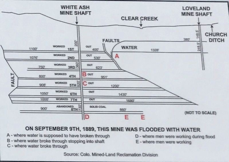
Bottom right: Fig. 6: Above is a south to north section diagram of the White Ash mine drawn along the coal seam occurring from 750 to 1076 feet south of 12th Street and from 400 to 1660 feet north of Clear Creek. Below is a technical description of the mine.
"A longitudinal cross-section of the Old White Ash mine at the date of abandonment shows the collar of the shaft to be 135 feet west of the main worked seam, and at the 600-foot
level was still 39 feet to the west. Below this the strata became vertical with indication of an easterly turn, so that the shaft will nowhere cut the main seam. the seam is opened from the shaft by cross-cuts, levels being driven from these. The main coal seam 6 to 8 feet thick was mined to a depth of 730 feet. A second seam, 3 feet thick, lies from 10 to 20 feet west of that worked. This has been found to vary considerably in thickness, but has never fallen below workable limits."
(Emmons, S.F., Cross, W., and Eldridge, G.H., 1896, Geology of the Denver Basin, United States Geology Survey Monograph 27)
Topics. This historical marker is listed in these topic lists: Disasters • Industry & Commerce.
Location. 39° 45.131′ N, 105° 13.624′ W. Marker is in Golden, Colorado, in Jefferson County. Marker is on 12th Street, 0.1 miles west of Maple Street, on the left when traveling west. Touch for map. Marker is in this post office area: Golden CO 80401, United States of America. Touch for directions.
Other nearby markers. At least 8 other markers are within walking distance of this marker. White Ash Mine Disaster (here, next to this marker); Stop 7: Laramie Formation (68 mya) Clay Pits Fault, Fire Clay Mining, Reclamation (within shouting distance of this marker); Billy Drew Bridge (approx. 0.2 miles away); Rock Flour Millstone (approx. 0.3 miles away);
Down by the Old Mill Stream (approx. 0.3 miles away); Colorado National Guard Armory (approx. 0.3 miles away); Castle Rock (approx. 0.3 miles away); The Astor House (approx. 0.3 miles away). Touch for a list and map of all markers in Golden.
Photographed By Duane and Tracy Marsteller, July 3, 2020
5. Stop 7a: White Ash Mine Marker Detail
Fig. 4: Sketch map of sandstone ridges in yellow and Clay Pits Fault in green. Map is overlaid over aerial photo from 1948.
Ka = Arapahoe Kl = Laramie Formation Kp = Pierre Shale
— Rubey Mine Area A between 12th Street and West Campus Drive was largely mined by surface methods
— Rubey Mine Area B was by underground mining with the entrance near 12th Street
Ka = Arapahoe Kl = Laramie Formation Kp = Pierre Shale
— Rubey Mine Area A between 12th Street and West Campus Drive was largely mined by surface methods
— Rubey Mine Area B was by underground mining with the entrance near 12th Street
Photographed By Duane and Tracy Marsteller, July 3, 2020
6. Stop 7a: White Ash Mine Marker Detail
Fig. 5: Golden panorama photograph looking east in 1892 by W.H. Jackson (Photo courtesy of Golden History Museums, City of Golden Collection)
A: Clear Creek B: White Ash mine C: Colorado School of Mines D: Golden E: 12th Street F: Downtown Denver
A: Clear Creek B: White Ash mine C: Colorado School of Mines D: Golden E: 12th Street F: Downtown Denver
Photographed By Duane and Tracy Marsteller, July 3, 2020
7. Stop 7a: White Ash Mine Marker Deatil
Fig. 6: Above is a south to north section diagram of the White Ash mine drawn along the coal seam occurring from 750 to 1076 feet south of 12th Street and from 400 to 1660 feet north of Clear Creek. Below is a technical description of the mine.
"A longitudinal cross-section of the Old White Ash mine at the date of abandonment shows the collar of the shaft to be 135 feet west of the main worked seam, and at the 600-foot level was still 39 feet to the west. Below this the strata became vertical with indication of an easterly turn, so that the shaft will nowhere cut the main seam. the seam is opened from the shaft by cross-cuts, levels being driven from these. The main coal seam 6 to 8 feet thick was mined to a depth of 730 feet. A second seam, 3 feet thick, lies from 10 to 20 feet west of that worked. This has been found to vary considerably in thickness, but has never fallen below workable limits."
(Emmons, S.F., Cross, W., and Eldridge, G.H., 1896, Geology of the Denver Basin, United States Geology Survey Monograph 27)
Credits. This page was last revised on August 9, 2020. It was originally submitted on July 14, 2020, by Duane and Tracy Marsteller of Murfreesboro, Tennessee. This page has been viewed 241 times since then and 73 times this year. Photos: 1, 2, 3, 4, 5, 6. submitted on July 14, 2020, by Duane and Tracy Marsteller of Murfreesboro, Tennessee. 7, 8. submitted on July 15, 2020, by Duane and Tracy Marsteller of Murfreesboro, Tennessee. • Andrew Ruppenstein was the editor who published this page.
