Lewes in Sussex County, Delaware — The American Northeast (Mid-Atlantic)
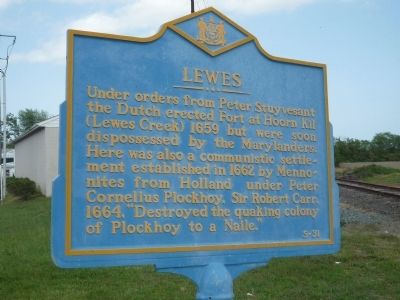
Lewes
Erected by Delaware Public Archives. (Marker Number S-31.)
Topics and series. This historical marker is listed in these topic lists: Colonial Era • Forts and Castles • Settlements & Settlers. In addition, it is included in the Delaware Public Archives series list. A significant historical year for this entry is 1659.
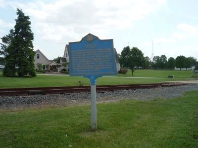
Location. 38° 45.816′ N, 75° 9.021′ W. Marker is in Lewes, Delaware, in Sussex County. Marker is on Savannah Road (U.S. 9) north of Donovan Road/N. Atlantic Drive (Delaware Route 263), on the right when traveling north. Touch for map. Marker is in this post office area: Lewes DE 19958, United States of America. Touch for directions.
Other nearby markers. At least 8 other markers are within walking distance of this marker. A History of the Junction & Breakwater Railroad (about 300 feet away, measured in a direct line); a different marker also named Lewes (about 600 feet away); Beebe Medical Foundation (approx. 0.3 miles away); a different marker also named Lewes (approx. 0.4 miles away); The Legacy of Ted Freeman (approx. 0.4 miles away); Transit of Venus Observatory (approx. half a mile away); 1917 Pennsylvania Railroad Caboose (approx. half a mile away); Beebe Hospital (approx. 0.7 miles away). Touch for a list and map of all markers in Lewes.
Also see . . .
1. New Netherland. (Submitted on May 27, 2009, by Richard E. Miller of Oxon Hill, Maryland.)
2. Plockhoy. (Submitted on May 31, 2009, by Richard E. Miller of Oxon Hill, Maryland.)
Additional keywords. New Netherland
Credits. This page was last revised on August 19, 2020. It was originally submitted on May 27, 2009, by Richard E. Miller of Oxon Hill, Maryland. This page has been viewed 1,608 times since then and 27 times this year. Last updated on July 15, 2020, by Carl Gordon Moore Jr. of North East, Maryland. Photos: 1, 2. submitted on May 27, 2009, by Richard E. Miller of Oxon Hill, Maryland. • Bill Pfingsten was the editor who published this page.

