Wartrace in Bedford County, Tennessee — The American South (East South Central)
Tullahoma Campaign
June 24-July 4, 1863
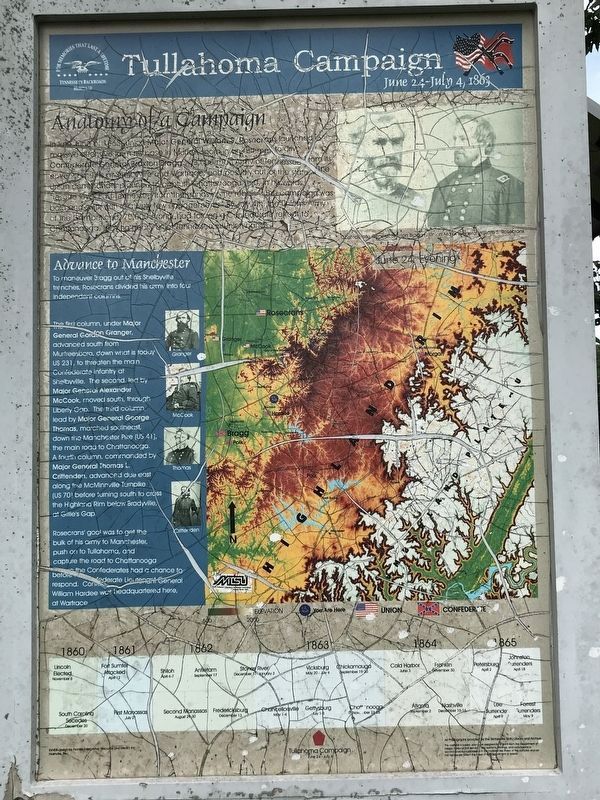
Anatomy of a Campaign
In late June of 1863, Union Major General William S. Rosecrans launched a massive offensive from his base in Murfreesboro in an attempt to drive Confederate General Braxton Bragg’s 43,000-man Army of Tennessee from its entrenchments at Shelbyville and Wartrace, and possibly out of the state. The Union commander planned to capture Chattanooga and, in his words, “rescue loyal East Tennessee from the hands of the rebels.” The campaign was bold and swift, with relatively few engagements. By July 4th, the Union’s Army of the Cumberland, 70,000 strong, had forced a Confederate retreat to Chattanooga, leaving nearly all of Tennessee in Union hands.
Advance to Manchester
To maneuver Bragg out of his Shelbyville trenches, Rosecrans divided his army into four independent columns.
The first column, under Major General Gordon Granger, advanced south from Murfreesboro, down what is today US 231, to threaten the main Confederate infantry at Shelbyville. The second, led by Major General Alexander McCook, moved south, through Liberty Gap. The third column, lead by Major General George Thomas, marched southeast, down the Manchester Pike (US 41), the main road to Chattanooga. A fourth column, commanded by Major General Thomas L. Crittenden, advanced due east along the McMinnville Turnpike (US 70) before turning south to cross the Highland Rim below Bradyville, at Gillie’s Gap.
Rosecrans' goal was to get the bulk of his army here, to Manchester, push on to Tullahoma, and capture the road to Chattanooga before the Confederates had a chance to respond. Only rain and the poor conditions of the roads slowed the Union advance.
(captions)
(Top right) Confederate General Braxton Bragg; Union Major General William S. Rosecrans
(Left) Granger; McCook; Thomas; Crittenden
(Timeline)
1860 Lincoln Elected November 6 • South Carolina Secedes December 20
1861 Fort Sumter Attacked April 12 • First Manassas July 21
1862 Shiloh April 1-7 • Second Manassas August 29-30 • Antietam September 11 • Fredericksburg December 13 • Stones River December 31-January 3
1863 Chancellorsville May 1-4 • Vicksburg May 20-July 4 • Tullahoma Campaign June 24-July 4 • Gettysburg July 1-3 • Chickamauga September 19-20 • Chattanooga November 23-25
1864 Cold Harbor June 3 • Atlanta September 2 • Franklin November 30 • Nashville December 15-16
1865 Petersburg April 2 • Lee Surrenders April 9 • Johnston Surrenders April 18 • Forrest Surrenders May 9
(side 2)
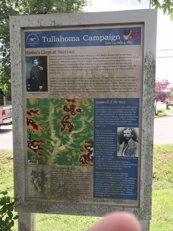
Hardee's Corps at Wartrace
Following the Battle of Stones River in early January of 1863, Braxton Bragg's Army of Tennessee retreated south to Tullahoma before establishing a defensive line running from Shelbyville to the vicinity of Wartrace. Lieutenant General William J. Hardee, headquartered at nearby Beechwood, the plantation home of Colonel Andrew Erwin, held the line around Wartrace with two divisions, one commanded by Major General Patrick Cleburne, the other by Major General A. P. Stewart. From this position, his 14,000-man corps guarded both Liberty Gap above Bell Buckle and Hoover's Gap at Beech Grove.
As the Union advance on June 24th and 25th pushed through the gaps toward Manchester, Hardee's position in Wartrace was turned and he ordered a general retreat south to Tullahoma. The two days of rain that marked the opening of the campaign turned the roads to mud. Often, the men marched without shoes. As Cleburne noted of the men, they "had no changes of clothing, no tents, and could not even light fires to dry themselves." Yet, spirits remained determined. Despite the "retrograde," as one Confederate soldier described it, "look out for hot work at Tullahoma...We are prepared for the Yanks at that place."
Stonewall of the West
Patrick Cleburne was one of the most notable general officers the Confederacy produced. He was born in 1828 in Ireland and joined the British army when the Irish potato famine struck. In 1849 he emigrated to America, moving to Arkansas. Cleburne enlisted in the Confederate army as a private in 1861, but made a spectacular rise to Major General by late 1862, becoming one of the best division commanders in the western army.
Never a conventional thinker, Cleburne proposed while at Wartrace that the Confederacy arm slaves with the guarantee they would be emancipated along with their immediate families. He assumed that a southerner would sooner "give up the negro slave rather than be a slave himself," and that slaves would make wonderful soldiers, for "the Negro has been dreaming of freedom, and his vivid imagination has surrounded that condition with so many gratifications that it has become the paradise of his hopes."
Cleburne's suggestion found few supporters. Confederate Brigadier General William Bate, commander of a brigade at Hoover's Gap, called the idea "hideous and objectionable," nothing less than the "serpent of Abolitionism...revolting to Southern sentiment, Southern pride and Southern honor." The proposition was kept from the public, however, and seemed to stifle Cleburne's meteoric rise. He was never considered for further promotion. Leading a frontal assault, he was killed at the Battle of Franklin on November 30, 1864.
The Whitworth Rifle
While stationed here in Wartrace, Major General Cleburne trained Confederate sharpshooters with five new Whitworth rifles, an English weapon made from the design of Joseph Whitworth, one of the most important mechanical engineers of the 19th century. The weapon fired a .45-caliber bullet accurately to a range of 1,500-1,800 yards using a telescopic site, making it ideal for sharpshooters. At Wartrace, Cleburne organized contests of marksmanship to determine who would use these rifles. Once selected, he engaged the men in intensive shooting drills, to the point that, as one officer remembered, the division "had the finest and most effective body of sharpshooters in the army."
(captions)
(Top left) Confederate Lieutenant General William J. Hardee
(Right) Major General Patrick R. Cleburne
Erected by Tennessee Backroads Heritage.
Topics. This historical marker is listed in this topic list: War, US Civil. A significant historical date for this entry is June 24, 1863.
Location. 35° 31.707′ N, 86° 20.072′ W. Marker is in Wartrace, Tennessee, in Bedford County. Marker is at the intersection of Spring Street (Tennessee Route 269) and Bridgeview Street, on the right when traveling north on Spring Street. Touch for map. Marker is at or near this postal address: 109 Spring St, Wartrace TN 37183, United States of America. Touch for directions.
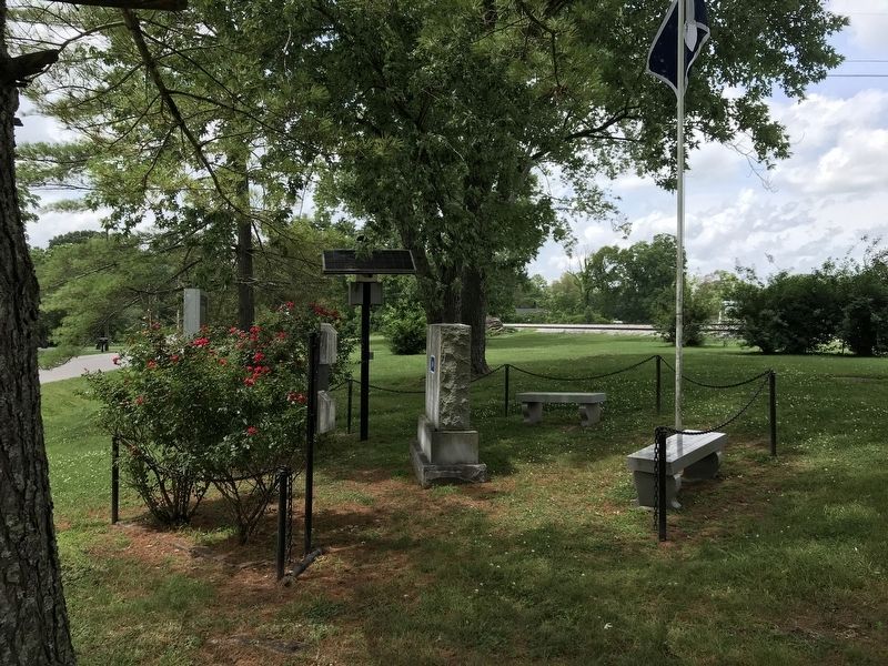
Other nearby markers. At least 8 other markers are within 2 miles of this marker, measured as the crow flies. Skirmish at Liberty Gap (here, next to this marker); "Dedicated to Those Brave & Gallant Soldiers in Butternut & Gray"! (here, next to this marker); Andrew Jackson (a few steps from this marker); Strolling Jim (about 500 feet away, measured in a direct line); Skirmish at Wartrace (approx. 0.2 miles away); Wartrace (approx. 0.2 miles away); Valley Home (approx. 1.2 miles away); Beechwood Plantation (approx. 1½ miles away). Touch for a list and map of all markers in Wartrace.
Credits. This page was last revised on July 16, 2020. It was originally submitted on July 16, 2020, by Duane and Tracy Marsteller of Murfreesboro, Tennessee. This page has been viewed 388 times since then and 32 times this year. Photos: 1, 2, 3. submitted on July 16, 2020, by Duane and Tracy Marsteller of Murfreesboro, Tennessee. • Bernard Fisher was the editor who published this page.


