Near Petersburg in Dinwiddie County, Virginia — The American South (Mid-Atlantic)
The Attack Begins
The Breakthrough Trail
— Pamplin Historical Park —
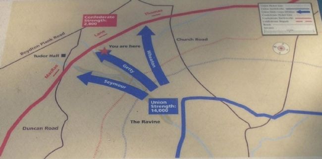
Major General Horatio G. Wright deployed the 14,000 attackers of his Sixth Corps in a wedge-shaped formation. Although the entire battle front extended for nearly a mile, the point of the wedge was here, manned by the Vermont Brigade commanded by Brigadier General Lewis A. Grant. Some 2,200 Vermonters stepped out at 4:40 a.m. to lead the assault, their left flank hugging the ravine to your left. The rest of the Sixth Corps formed to the left and right of the Vermonters but somewhat behind them. At the sound of a signal gun, the entire Sixth Corps arose and moved forward, invisible in the misty darkness but making a noise “like a strong breeze blowing through the swaying boughs and dense foliage of some great forest.”
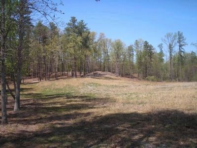
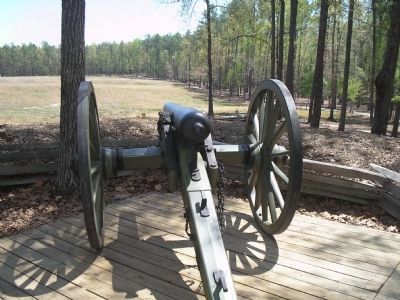
The new Confederate picket line fell quickly, but the graycoats behind the main line of fortifications soon realized what was happening. The earthworks in front of you erupted with orange sheets of flame as rifles and cannon wielded by the alerted Southerners poured a deadly fire across this naked field. Could the Vermonters sustain their momentum?
Erected by Pamplin Historical Park.
Topics. This historical marker is listed in this topic list: War, US Civil.
Location. 37° 10.792′ N, 77° 28.435′ W. Marker is near Petersburg, Virginia, in Dinwiddie County. Marker can be reached from Duncan Road (Virginia Route 670), on the left when traveling south. Marker is in Pamplin Historical Park, on the Breakthrough Trail. Touch for map. Marker is in this post office area: Petersburg VA 23803, United States of America. Touch for directions.
Other nearby markers. At least 8 other markers are within walking distance of this marker. Sergeant John E. Buffington (within shouting distance of this marker); The Hart Farm (within shouting distance of this marker); “The Strongest Line of Works Ever Constructed” (about 300 feet away, measured in a direct line); Lieutenant Colonel George B. Damon (about 300 feet away); McGowan’s South Carolina Brigade (about 300 feet away); The Confederate Fortifications (about 400 feet away); Petersburg Breakthrough Battlefield (about 400 feet away); Brother vs. Brother (about 500 feet away). Touch for a list and map of all markers in Petersburg.
More about this marker. The bottom right of the marker features a photograph of Major General Horatio G. Wright. The top of the marker contains a battle map of the April 2 action. It includes the caption “The Sixth Corps utilized a wedge-shaped attack formation with their units ‘in echelon’ to create the maximum drive and momentum necessary to pierce the Confederate fortifications. The point of the wedge belonged to the Vermont Brigade
of the Second Division, which advanced using the ravine to your left as a guide.”
Also see . . .
1. Breakthrough at Petersburg. The American Civil War website. (Submitted on January 14, 2009, by Bill Coughlin of Woodland Park, New Jersey.)
2. The Final Assault. The Civil War Siege of Petersburg. (Submitted on January 14, 2009, by Bill Coughlin of Woodland Park, New Jersey.)
Credits. This page was last revised on February 2, 2023. It was originally submitted on January 14, 2009, by Bill Coughlin of Woodland Park, New Jersey. This page has been viewed 1,121 times since then and 45 times this year. Photos: 1, 2, 3, 4. submitted on January 14, 2009, by Bill Coughlin of Woodland Park, New Jersey.


