Near Burkittsville in Frederick County, Maryland — The American Northeast (Mid-Atlantic)
Brownsville Pass: Semmes’ Gamble
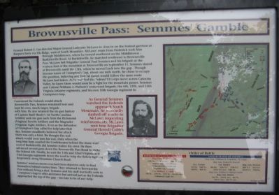
General Robert E. Lee directed Major General Lafayette McLaws to close in on the Federal garrison at Harper’s Ferry via Elk Ridge, west of South Mountain. McLaws’ route from Frederick took him through Middletown, where he turned southwest on the Middletown-Burkittsville Road. At Burkittsville, he marched southwest to Brownsville Pass. McLaws left Brigadier General Paul Semmes and his brigade at the western foot of the mountain at Brownsville on September 11. Semmes stayed at Brownsville until the 13th, when he moved back into the gap. Though Semmes knew of Crampton’s Gap, about one mile north, he chose to occupy this position, believing any Federal thrust would follow the same route McLaws had taken. As he watched the Federal VI Corps move across Catoctin Valley, he knew there would soon be a fight for the mountain passes. Semmes sent Colonel William A. Parham’s undersized brigade, the 6th, 12th, and 16th Virginia Infantry regiments, and his own 10th Georgia regiment to Crampton’s Gap.
Convinced the Federals would attack Brownsville Pass, Semmes remained here and kept his own, much larger, brigade with him. He also retained the six-gun battery of Captain Basil Manly’s 1st North Carolina Artillery and one gun each from the Richmond (Virginia) Fayette Artillery and the Magruder (Virginia) Light Artillery. Even as the defenders of Crampton’s Gap called for help later that day, Semmes steadfastly belived the attack there was only a feint. He thought the real attack would soon turn his way. Only when the long blue lines assailed the Confederates behind the stone wall west of Burkettsville did Semmes realize his error. He then advanced several guns down the Brownsville Pass Road to strike the Federal left. Finally, he sent the 15th and 32nd Virginia and 53rd Georgia regiments down the road to help the Rebels fighting desperately along Mountain Church Road.
Semmes’ reinforcements reached their objective only to find themselves behind enemy lines. They returned to Brownsville Pass without firing a shot. Semmes and his staff hurriedly rode to Crampton’s Gap to offer assistance but arrived just as the Federals approached the top of the gap—too late to be of any help.
(Quote): As General Semmes watched the Federals approach South Mountain, he worriedly dashed off a note to McLaws requesting reinforcements. McLaws sent him Brigadier General Howell Cobb’s Georgia Brigade.
Order of Battle
Confederate States of America
Brig. Gen. Paul Semmes
10th Ga., 53rd Ga. (nc), 32nd Va. (nc), 1st N.C. Arty., Richmond (Va.) Fayete Art., Magruder (Va.) Light Art.
Col. William A. Parham
6th Va., 12th Va., 16th Va., 41st Va. (nc), Portsmouth Light Art.
United States of America
Maj. Gen. William B. Franklin, VI Corps
Maj. Gen. Henry W. Slocum
Col. Torbert
1st N.J., 2nd N.J., 3rd N.J., 4th N.J.
Col. Bartlett
5th Me., 16th N.Y., 27th N.Y., 121st N.Y.(nc), 96th Pa.
Brig. Gen. Newton
18th N.Y., 31st N.Y., 32nd N.Y., 95th Pa.
Maj. Gen. William F. (Baldy) Smith
Brig. Gen. Brooks
2nd Vt., 3rd Vt. (nc), 4th Vt., 5th Vt. (nc), 6th Vt (nc)
(nc) noncombatants
Erected by Blue & Gray Educational Society / State of Maryland Department of Natural Resources.
Topics. This historical marker is listed in this topic list: War, US Civil. A significant historical month for this entry is September 1847.
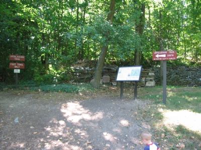
Location. 39° 24.27′ N, 77° 38.436′ W. Marker is near Burkittsville, Maryland, in Frederick County. Marker is at the intersection of Gapland Road and Arnoldstown Road, on the left when traveling west on Gapland Road. Located behind the south parking lot in Gathland State Park, along side the Appalachian Trail. Touch for map. Marker is in this post office area: Burkittsville MD 21718, United States of America. Touch for directions.
Other nearby markers. At least 8 other markers are within walking distance of this marker. The 15th North Carolina (within shouting distance of this marker); GATH: The Man and His Mountain (about 300 feet away, measured in a direct line); Mell Rifles & Troup Light Artillery
(about 400 feet away); Troup Light Artillery (about 400 feet away); Padgett’s Field: Confederate Last Stand (about 400 feet away); Burial: A Most Disagreeable Task (about 400 feet away); The Stage is Set (about 400 feet away); Bartlett Leads the Way (about 400 feet away). Touch for a list and map of all markers in Burkittsville.
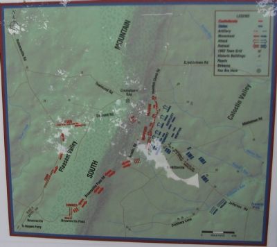
More about this marker. The marker displays portraits of Generals Semmes and McLaws. A map illustrates the movements described in the text.
Also see . . . Paul J. Semmes. Civil War in the East website entry (Submitted on February 27, 2022, by Larry Gertner of New York, New York.)
Credits. This page was last revised on February 27, 2022. It was originally submitted on August 24, 2007, by Craig Swain of Leesburg, Virginia. This page has been viewed 2,257 times since then and 25 times this year. Last updated on July 18, 2020, by Bradley Owen of Morgantown, West Virginia. Photos: 1, 2, 3. submitted on August 24, 2007, by Craig Swain of Leesburg, Virginia. 4. submitted on November 29, 2008, by Mike Stroud of Bluffton, South Carolina. • J. Makali Bruton was the editor who published this page.


