Cumberland Township near Gettysburg in Adams County, Pennsylvania — The American Northeast (Mid-Atlantic)
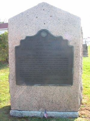
Battery B, Fourth U.S. Artillery
Artillery Brigade - First Corps
— Army of the Potomac —
Inscription.
First Corps
Artillery Brigade
Battery B Fourth U.S. Artillery
Six 12 pounders
Lieut. James Stewart commanding
July 1 In position about 200 yards south of the Lutheran Theological Seminary until 3 p.m. when ordered to support the Second Division First Corps and took position on Seminary Ridge half of the Battery in command of Lieut. James Davison between the Chambersburg Pike and Railroad cut. The other half north of the cut in corner of the woods was actively engaged. The Battery afterwards retired with the troops to Cemetery Hill and went into position on the Baltimore Pike opposite Evergreen Cemetery commanding the approach from the town two guns on the pike and two in the field two having been disabled.
Casualties killed 2 men, wounded 2 officers and 29 men, missing 3 men. Total 36.
Erected 1912 by Gettysburg National Military Park Commission.
Topics. This historical marker is listed in this topic list: War, US Civil. A significant historical month for this entry is July 1896.
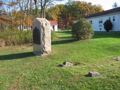
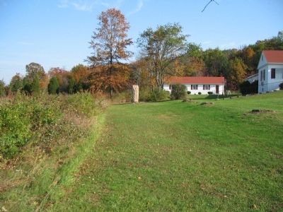
Location. 39° 50.14′ N, 77° 14.752′ W. Marker is near Gettysburg, Pennsylvania, in Adams County. It is in Cumberland Township. Marker is on Chambersburg Pike (U.S. 30), on the right when traveling west. Located beside the Gettysburg Quality Inn, adjacent to Gettysburg National Military Park. Touch for map. Marker is in this post office area: Gettysburg PA 17325, United States of America. Touch for directions.
Other nearby markers. At least 8 other markers are within walking distance of this marker. Lee's Headquarters at Gettysburg (within shouting distance of this marker); a different marker also named Lee's Headquarters at Gettysburg (about 300 feet away, measured in a direct line); Headquarters of the Army of Northern Virginia (about 300 feet away); a different marker also named Lee's Headquarters at Gettysburg (about 300 feet away); a different marker also named Lee's Headquarters at Gettysburg (about 400 feet away); Salem Virginia Artillery (about 400 feet away); a different marker also named Lee's Headquarters at Gettysburg (about 400 feet away); Lee's Headquarters At Gettysburg (about 400 feet away). Touch for a list and map of all markers in Gettysburg.
Related markers. Click here for a list of markers that are related to this marker. Stewart's Battery at Gettysburg.
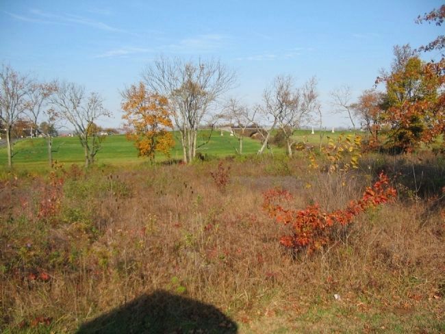
Photographed By Craig Swain, November 1, 2008
4. Davidson's View of the 2nd Railroad Cut
Looking from the tablet location (note the shadow on the ground) toward the 2nd railroad cut, under the bridge just right of center. Davidson's gunners fired upon portions of Daniel's Confederate Brigade in the afternoon fighting. Later when Scales' Confederate Brigade advanced down the Chambersburg Pike, Davidson's guns fired on the 38th North Carolina in the open fields in front of the cut.
Photographed By Craig Swain, December 29, 2016
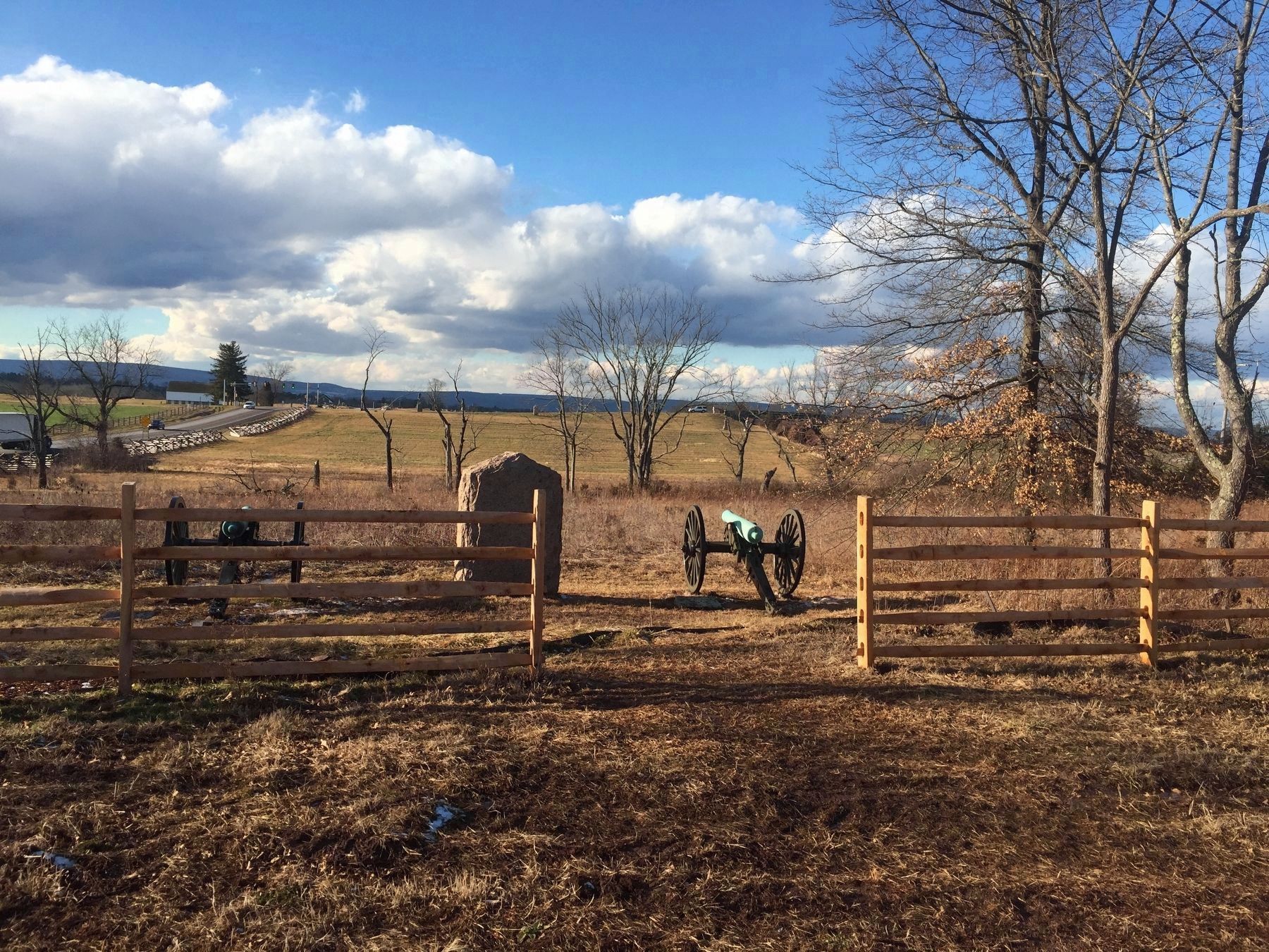
5. Cannon restored to location
In 2016, following restoration of the Thompson House/Lee's Headquarters, two 12-pdr Napoleons returned to the position, representing the battery at this location. Around mid-day on July 1, 1863, one section of three guns directly under Stewart was deployed on the north side of the railroad line. A second section, also of three guns, under Lt. Davison, was posted "just west of Ms. Thompson's dooryard." This section extended from the Chambersburg Pike to about where the monument is today. From that position, the 12-pdr Napoleons fired on Confederate troops to their front, in and around the railroad cut. Later in the afternoon, Davison's section wheeled forward to the left, fronting the Pike (left side of photo) to fire upon Confederate infantry attacking towards Seminary Ridge. Under pressure, the section withdrew through Gettysburg and reformed.
Credits. This page was last revised on February 7, 2023. It was originally submitted on January 14, 2009, by Craig Swain of Leesburg, Virginia. This page has been viewed 1,292 times since then and 22 times this year. Photos: 1, 2, 3, 4. submitted on January 14, 2009, by Craig Swain of Leesburg, Virginia. 5. submitted on January 25, 2017, by Craig Swain of Leesburg, Virginia.
