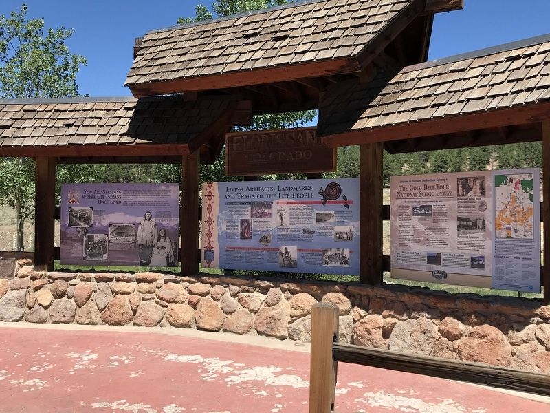
Near Florissant in Teller County, Colorado — The American Mountains (Southwest)
Living Artifacts, Landmarks and Trails of the Ute People
Inscription.
Living Artifacts
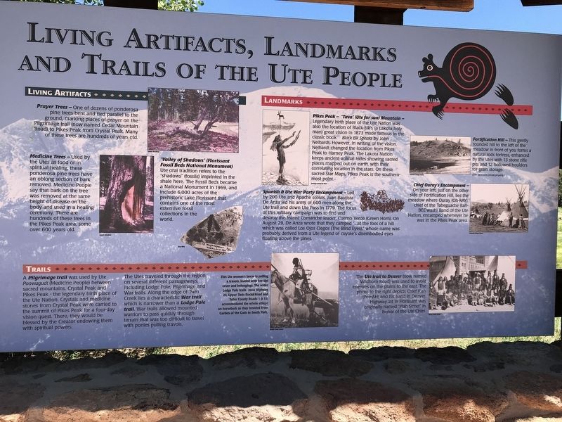
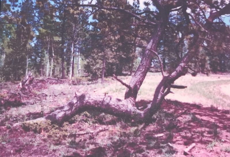
Prayer Trees — One of dozens of ponderosa pine trees bent and tied parallel to the ground, marking places of prayer on the Pilgrimage trail (now named Cedar Mountain Road) to Pikes Peak from Crystal Peak. Many of these trees are hundreds of years old.
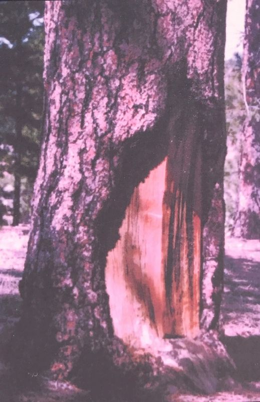
Medicine Trees — Used by the Utes as food or in spiritual healing, these ponderosa pine trees have an oblong section of bark removed. Medicine People say that bark on the tree was removed at the same height of disease on the body and used in a healing ceremony. There are hundreds of these trees in the Pikes Peak area, some over 600 years old.
"Valley of Shadows” (Florissant Fossil Beds National Monument) — Ute oral tradition refers to the "shadows” (fossils) imprinted in the shale here. The Fossil Beds became a National Monument in 1969, and include 6,000 acres of the prehistoric Lake Florissant that contains one of the most extensive fossil collections in the world.
Landmarks
Pikes Peak — "Tava” (Ute for sun) Mountain — Legendary birth place of the Ute Nation was also the location of Black Elk's (a Lakota holy man) great vision in 1873 made famous in the classic book Black Elk Speaks by John Neihardt. However, in writing of the vision, Neihardt changed the location from Pikes Peak to Harney Peak. The Lakota Nation keeps ancient animal hides showing sacred places mapped out on earth, with their correlating location in the stars. On these sacred Star Maps, Pikes Peak is the southern-most point.
Fortification Hill — This gently rounded hill to the left of the meadow in front of you forms a natural rock fortress, enhanced by the Utes with 13 stone rifle pits and 12 hollowed boulders for grain storage. (This site is now private property.)
Spanish & Ute War Party Encampment — Led by 200 Ute and Apache scouts, Juan Bautista De Anza led his army of 600 men along the Ute trail and down Ute Pass in 1779. The focus of this military campaign was to find and destroy the feared Comanche leader, Cuerno Verde (Green Horn). On August 29, De Anza wrote that they camped "..at the foot of a hill which was called Los Ojos Ciegos (The Blind Eyes),” whose name was probably derived from a Ute legend of coyote's disembodied eyes floating above the pines.
Chief Ouray's Encampment — On your left, just on the other side of Fortification Hill, lies the meadow where Ouray (Oh-RAY), chief of the Tabeguache (tah- BEE-wash) Band of the Ute Nation, encamped whenever he was in the Pikes Peak area.
Trails
A
Pilgrimage trail was used by Ute Poowagudt (Medicine People) between
sacred mountains, Crystal Peak and Pikes Peak - the legendary birth place of the Ute Nation. Crystals and medicine stones from Crystal Peak were carried to the summit of Pikes Peak for a four-day vision quest. There, they would be blessed by the Creator endowing them with spiritual powers.
The Utes traveled through the region on several different passageways, including Lodge Pole, Pilgrimage and War trails. Along the edge of Twin Creek lies a characteristic War trail which is narrower than a Lodge Pole trail. War trails allowed mounted warriors to pass quickly through terrain that was too difficult to travel with ponies pulling travois.
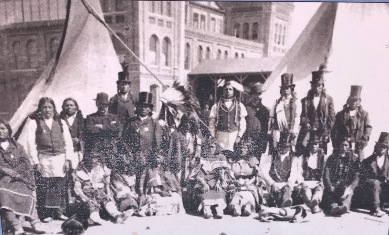
The Ute trail to Denver (now named Wildhorn Road) was used to avoid enemies on the plains to the east. The photo to the right depicts Chief Piah (Pee-AH) and his band in Denver. Highway 24 in Florissant was originally named "Piah Street” in honor of the Ute Chief.
Caption
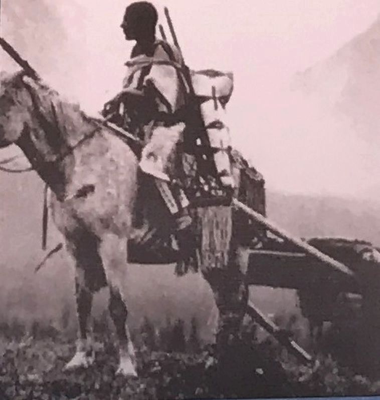
Bottom center: This Ute woman's horse is pulling a travois, loaded with her tipi cover and belongings. The wider Lodge Pole trails (now Highway 24, Upper Twin Rocks Road and Teller County Roads 1 & 31) accommodated the whole village on horseback as they traveled from Garden of the Gods to South Park.
Topics. This
historical marker is listed in these topic lists: Churches & Religion • Native Americans • Roads & Vehicles.
Location. 38° 56.888′ N, 105° 16.961′ W. Marker is near Florissant, Colorado, in Teller County. Marker is on U.S. 24, 0.1 miles west of County Road 45, on the right when traveling west. Marker is located in a pullout with ample parking. Touch for map. Marker is in this post office area: Florissant CO 80816, United States of America. Touch for directions.
Other nearby markers. At least 8 other markers are within 3 miles of this marker, measured as the crow flies. You are Standing Where the Ute Indians Once Lived (here, next to this marker); Welcome to Florissant, the Northern Gateway to The Gold Belt Tour National Scenic Byway (here, next to this marker); A Tale of Two Neighbors (approx. 1˝ miles away); Charlotte Hill (approx. 2.1 miles away); The Big Stump (approx. 2.1 miles away); Fierce Competition (approx. 2.1 miles away); What If? (approx. 2.2 miles away); Life Zones (approx. 2.4 miles away). Touch for a list and map of all markers in Florissant.
Denver Public Library
4. Living Artifacts, Landmarks and Trails of the Ute People Marker Detail
This Ute woman's horse is pulling a travois, loaded with her tipi
cover and belongings. The wider Lodge Pole trails (now Highway 24, Upper Twin Rocks Road and Teller County Roads 1 & 31) accommodated the whole village on horseback as they traveled from Garden of the Gods to South Park.
Credits. This page was last revised on July 20, 2020. It was originally submitted on July 20, 2020, by Duane and Tracy Marsteller of Murfreesboro, Tennessee. This page has been viewed 566 times since then and 95 times this year. Photos: 1, 2, 3, 4, 5, 6. submitted on July 20, 2020, by Duane and Tracy Marsteller of Murfreesboro, Tennessee. • Andrew Ruppenstein was the editor who published this page.
