Near Florissant in Teller County, Colorado — The American Mountains (Southwest)
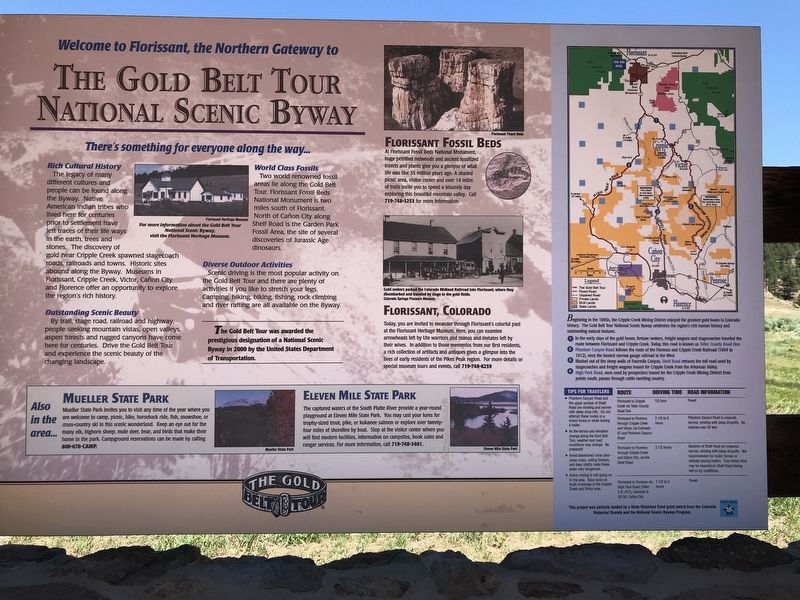
Welcome to Florissant, the Northern Gateway to The Gold Belt Tour National Scenic Byway
There's something for everyone along the way..
Inscription.
Rich Cultural History
The legacy of many different cultures and people can be found along the Byway. Native American Indian tribes who lived here for centuries prior to settlement have left traces of their life ways in the earth, trees and stones. The discovery of gold near Cripple Creek spawned stagecoach roads, railroads and towns. Historic sites abound along the Byway. Museums in Florissant, Cripple Creek, Victor, Cañon City and Florence offer an opportunity to explore the region's rich history.
Outstanding Scenic Beauty
By trail, stage road, railroad and highway, people seeking mountain vistas, open valleys, aspen forests and rugged canyons have come here for centuries. Drive the Gold Belt Tour and experience the scenic beauty of the changing landscape.
World Class Fossils
Two world renowned fossil areas lie along the Gold Belt Tour. Florissant Fossil Beds National Monument is two miles south of Florissant. North of Cañon City along Shelf Road is the Garden Park Fossil Area, the site of several discoveries of Jurassic Age dinosaurs.
Diverse Outdoor Activities
Scenic driving is the most popular activity on the Gold Belt Tour and there are plenty of activities if you like to stretch your legs. Camping, hiking, biking, fishing, rock climbing and river rafting are all available on the Byway.
Florissant Fossil Beds
At Florissant Fossil Beds National Monument, huge petrified redwoods and ancient fossilized insects and plants give you a glimpse of what life was like 35 million years ago. A shaded picnic area, visitor center and over 14 miles of trails invite you to spend a leisurely day exploring this beautiful mountain valley. Call 719-748-3253 for more information.
Florissant, Colorado
Today, you are invited to meander through Florissant's colorful past at the Florissant Heritage Museum. Here, you can examine arrowheads left by Ute warriors and manos and metates left by their wives. In addition to those mementos from our first residents, a rich collection of artifacts and antiques gives a glimpse into the lives of early residents of the Pikes Peak region. For more details or special museum tours and events, call 719-748-8259.
Also in the area...
Mueller State Park
Mueller State Park invites you to visit any time of the year where you are welcome to camp, picnic, hike, horseback ride, fish, snowshoe, or cross-country ski in this scenic wonderland. Keep an eye out for the many elk, bighorn sheep, mule deer, bear, and birds that make their home in the park. Campground reservations can be made by calling 800-678-CAMP.
Eleven Mile State Park
The captured waters of the
South Platte River provide a year-round playground at Eleven Mile State Park. You may cast your lures for trophy-sized trout, pike, or kokanee salmon or explore over twenty-four miles of shoreline by boat. Stop at the visitor center where you will find modern facilities, information on campsites, book sales and ranger services. For more information, call 719-748-3401.
Sidebar
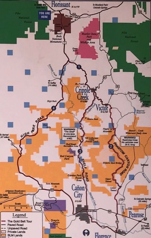
Beginning in the 1890s, the Cripple Creek Mining District enjoyed the greatest gold boom in Colorado history. The Gold Belt Tour National Scenic Byway celebrates the region's rich human history and outstanding natural features.
1. In the early days of the gold boom, fortune seekers, freight wagons and stagecoaches traveled the route between Florissant and Cripple Creek. Today, this road is known as Teller County Road One.
2. Phantom Canyon Road follows the route of the Florence and Cripple Creek Railroad (1894 to 1912), once the busiest narrow gauge railroad in the West
3. Blasted out of the steep walls of Fourmile Canyon, Shelf Road retraces the toll road used by stagecoaches and freight wagons bound for Cripple Creek from the Arkansas Valley.
4. High Park Road, once used by prospectors bound for the Cripple Creek Mining District from points south, passes through cattle ranching country.
Tips for travelers
• Phantom
Canyon Road and the upper portion of Shelf Road are winding and narrow with steep drop-offs. Do not attempt these routes in a motor home or while towing a trailer.
• As the terrain and elevation change along the Gold Belt Tour, weather and road conditions may change. Be prepared!
• Avoid abandoned mine sites — loose rocks, rotting timbers, and deep shafts make these areas very dangerous.
• Active mining is still going on in the area. Slow down at truck crossings in the Cripple Creek and Victor area.
Route: Florissant to Cripple Creek via Teller County Road One Driving time: ½ hour Road information: Paved
Route: Florissant to Florence through Cripple Creek and Victor, via Colorado 67 and Phantom Canyon Road Driving time: 2½ to 3 hours Road information: Phantom Canyon Road is unpaved, narrow, winding with steep dropoffs. No vehicles over 25 feet
Route: Florissant to Florence through Cripple Creek and Cañon City, via the Shelf Road Driving time: 2½ hours Road information: Sections of Shelf Road are unpaved, narrow, winding with steep dropoffs. Not recommended for motor homes or vehicles towing trailers. Four-wheel drive may be required on Shelf Road during wet or icy conditions.
Route: Florissant to Florence via High Park Road (Teller C.R. #11), Colorado 9, US 50, Cañon City Driving time: 1½ to 2 hours Road information: Paved
Captions
Top left: For more information about the Gold Belt Tour National Scenic Byway, visit the Florissant Heritage Museum. Florissant Heritage Museum
Center: Gold seekers packed the Colorado Midland Railroad into Florissant, where they disembarked and traveled by stage to the gold fields. Colorado Springs Pioneers Museum
Topics. This historical marker is listed in these topic lists: Paleontology • Parks & Recreational Areas • Roads & Vehicles • Settlements & Settlers.
Location. 38° 56.886′ N, 105° 16.963′ W. Marker is near Florissant, Colorado, in Teller County. Marker is on U.S. 24, 0.1 miles west of County Road 45, on the right when traveling west. Marker is in a pullout with ample parking. Touch for map. Marker is in this post office area: Florissant CO 80816, United States of America. Touch for directions.
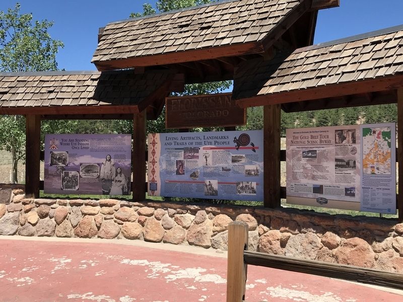
Other nearby markers. At least 8 other markers are within 3 miles of this marker, measured as the crow flies. You are Standing Where the Ute Indians Once Lived (here, next to this marker); Living Artifacts, Landmarks and Trails of the Ute People (here, next to this marker); A Tale of Two Neighbors (approx. 1½ miles away); Charlotte Hill (approx. 2.1 miles away); The Big Stump (approx. 2.1 miles away); Fierce Competition (approx. 2.1 miles away); What If? (approx. 2.2 miles away); Life Zones (approx. 2.4 miles away). Touch for a list and map of all markers in Florissant.
Credits. This page was last revised on July 21, 2020. It was originally submitted on July 20, 2020, by Duane and Tracy Marsteller of Murfreesboro, Tennessee. This page has been viewed 565 times since then and 32 times this year. Photos: 1, 2, 3. submitted on July 20, 2020, by Duane and Tracy Marsteller of Murfreesboro, Tennessee. • Andrew Ruppenstein was the editor who published this page.


