Medical Mile in Grand Rapids in Kent County, Michigan — The American Midwest (Great Lakes)
Grand River Bridges
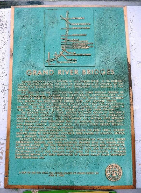
Grand Rapids is a city divided by the Grand River. In its earliest days, settlers crossed the river in small boats or canoes, or on frozen ice during the winter and temporary foot bridges in the summer.
The need to tie the city together led to three distinct periods of bridge building. During the first period, construction and operation were private undertakings. By the 1850’s, covered wooden toll bridges had been built at Bridge, Pearl, and Leonard Streets.
The coming of the railroad created the need for additional bridges. The first railroad bridge built north of Leonard Street in 1858, was followed by several others in the next three decades.
The second phase of street bridge building began in the 1880’s when the city assumed responsibility for building and operating bridges free of charge. The old wooden toll bridges were replaced with wrought iron structures built at Leonard, Fulton, Pearl, Sixth and Bridge streets. Of these, only the Sixth Street Bridge remains, now a designated historic landmark.
In the third bridge-building phase, during the early 1900’s, modern bridges made of reinforced concrete were placed at Wealthy, Bridge, Ann, Leonard, Pearl and Fulton.
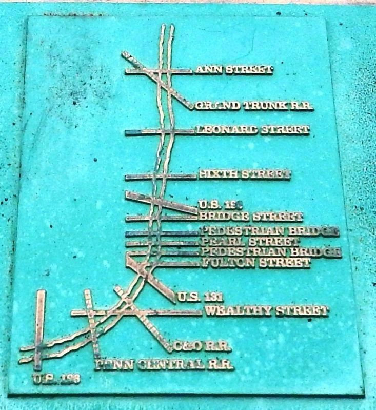
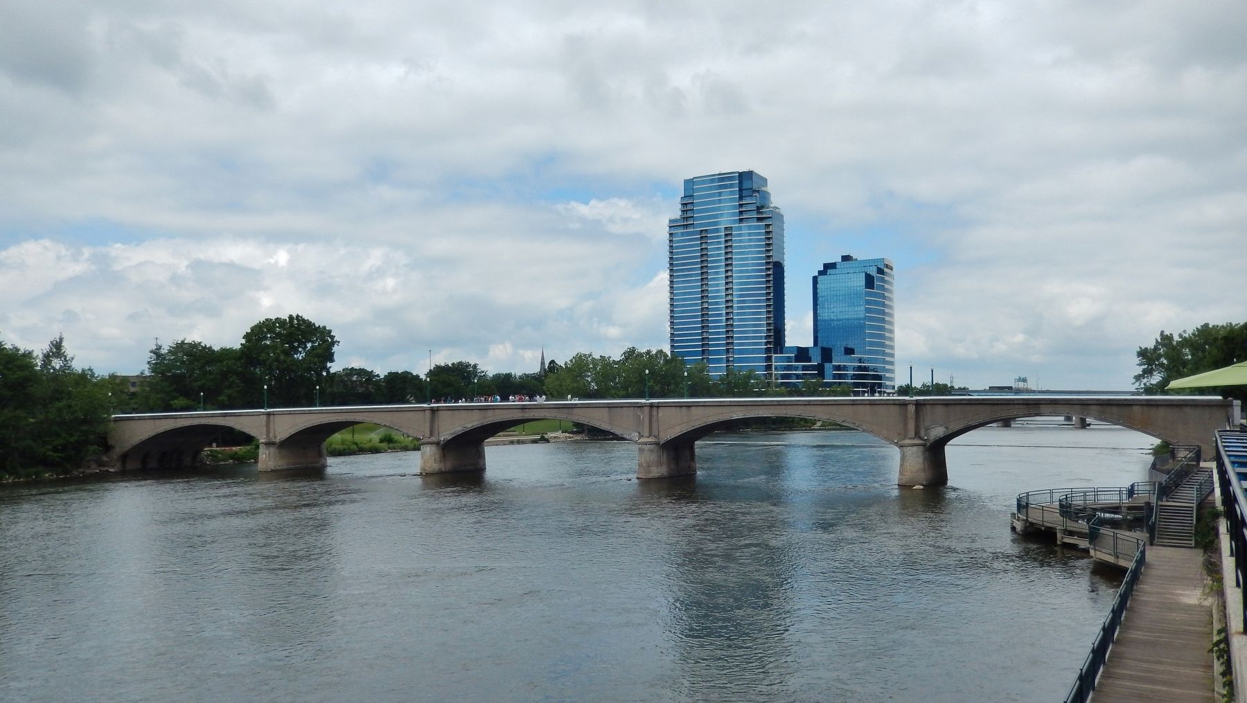
Today, seven street bridges, two pedestrian walkways, three expressway bridges, and three railroad bridges span the Grand River in Grand Rapids. The two pedestrian walkways have been adapted to their present use. The one on which you are standing was originally built for trolley cars, and, to the south, a former railroad bridge has been renovated by Grand Valley State University for pedestrian use.
Erected 1988 by The Junior League of Grand Rapids.
Topics. This historical marker is listed in these topic lists: Bridges & Viaducts • Railroads & Streetcars • Settlements & Settlers • Waterways & Vessels.
Location. 42° 58.058′ N, 85° 40.516′ W. Marker is in Grand Rapids, Michigan, in Kent County. It is in Medical Mile. Marker can be reached from Lyon Street Northwest, 0.1 miles west of Monroe Avenue Northwest. Marker is located at the center of the Richard M. Gillett Bridge, overlooking the Grand River to the south. Touch for map. Marker is at or near this postal address: 220 Lyon Street Northwest, Grand Rapids MI 49504, United States of America. Touch for directions.
Other nearby markers. At least 8 other markers are within walking distance of this marker. Log Jam of 1883 (about 400 feet away, measured in a direct line); Gerald R. Ford (about 500 feet away); Betty Ford (about 500 feet away); Final Resting Place of Gerald R. Ford (about 600 feet away); The Salvation Army (about 700 feet away); First Baptist Mission Station (about 800 feet away); Furniture Industry (approx. 0.2 miles away); German-English Schoolhouse (approx. 0.2 miles away). Touch for a list and map of all markers in Grand Rapids.
Also see . . .
1. Gillett Bridge. Closed-spandrel arch bridge over Grand River on Pedestrian walkway. Open to pedestrians only. (Submitted on July 21, 2020, by Cosmos Mariner of Cape Canaveral, Florida.)
2. Richard Gillett Bridge. Historic Bridges website entry:
This bridge crosses the Grand River at the approximate location of Devos Place and the Gerald R. Ford Museum, and as such received a fair amount of attention, even on national television, during the funeral of former president Gerald Ford, as most of the Grand Rapids events for the funeral revolved around this area. At 474 feet, this bridge appears to be the fourth longest concrete arch bridge in Michigan. The Belle Isle Bridge, Fulton Street, and Pearl Street take first, second, and third places. It is an earth-filled structure. In 1988 the bridge was apparently rededicated as the Gillett Bridge in honor of Richard M. Gillett, former president of the Old Kent Bank. (Submitted on July 21, 2020, by Cosmos Mariner of Cape Canaveral, Florida.)
Credits. This page was last revised on May 15, 2023. It was originally submitted on July 21, 2020, by Cosmos Mariner of Cape Canaveral, Florida. This page has been viewed 336 times since then and 33 times this year. Photos: 1, 2, 3, 4, 5, 6. submitted on July 21, 2020, by Cosmos Mariner of Cape Canaveral, Florida.


