Near Monticello in Jefferson County, Florida — The American South (South Atlantic)
Digging Deeper
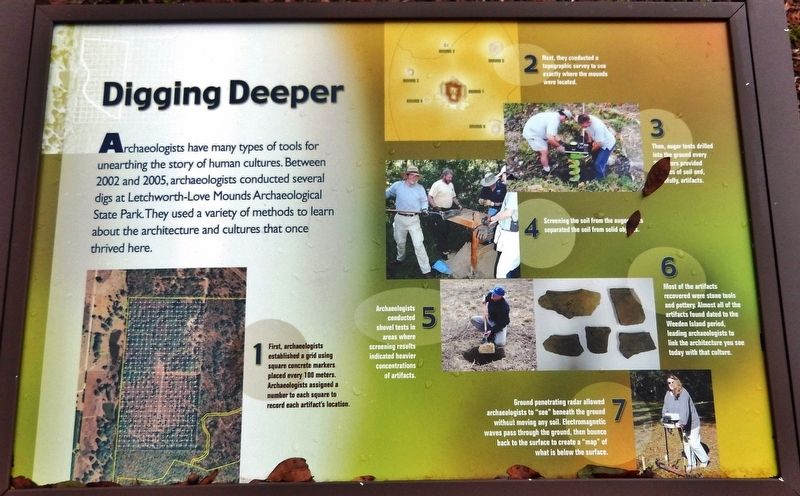
1. First, archaeologists established a grid using square concrete markers placed every 100 meters. Archaeologists assigned a number to each square to record each artifact's location.
2. Next, they conducted a topographic survey to see exactly where the mounds were located.
3. Then, auger tests drilled into the ground every 20 meters provided samples of soil and, carefully, artifacts.
4. Screening the soil from the auger bits separated the soil from solid objects.
5. Archaeologists conducted shovel tests in areas where screening results indicated heavier concentrations of artifacts.
6. Most of the artifacts recovered were stone tools and pottery. Almost all of the artifacts found dated to the Weeden Island period, leading archaeologists to link the architecture you see today with that culture.
7. Ground penetrating radar allowed archaeologists to “see” beneath the ground without moving soil. Electromagnetic waves pass through the ground, then bounce back to the surface to create a “map” of what is below the surface.
Erected by Letchworth-Love Mounds Archaeological State Park.
Topics. This historical marker is listed in these topic lists: Anthropology & Archaeology • Native Americans. A significant historical year for this entry is 2002.
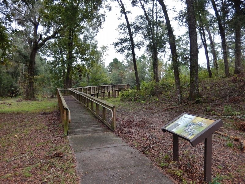
Location. 30° 31.125′ N, 83° 59.447′ W. Marker is near Monticello, Florida, in Jefferson County. Marker can be reached from Sunray Road, 0.6 miles south of Mahan Drive (U.S. 90), on the right when traveling south. Marker is located near the south end of the interpretive trail at Letchworth-Love Mounds Archaeological State Park. Touch for map. Marker is at or near this postal address: 4500 Sunray Road South, Monticello FL 32344, United States of America. Touch for directions.
Other nearby markers. At least 8 other markers are within 7 miles of this marker, measured as the crow flies. The Hunt for the Great Mound (about 300 feet away, measured in a direct line); Lasting Impressions (about 400 feet away); The Lay of the Land (about 500 feet away); Letchworth-Love Mounds Archaeological State Park (about 700 feet away); Miccosukee United Methodist Church (approx. 6 miles away); Village of Miccosukee (approx. 6 miles away); Constant Attack (approx. 6.8 miles away); Confederate Memorial (approx. 6.9 miles away). Touch for a list and map of all markers in Monticello.
Related markers. Click here for a list of markers that are related to this marker. Letchworth-Love Mounds Archaeological State Park
Also see . . .
1. Native American Ceremonial Mound. Artifacts have been recovered from as far back as 12,000 years, and archaeological research indicates the mounds were built between 200 - 900 AD by members of the Swift Creek and Weeden Island Native American cultures, a group of Native Americans who lived in North Florida between 450 and 900 A.D. Authorities however, have suggested the mounds were more of the style of Mississippians who were part of a later culture. (Submitted on July 22, 2020, by Cosmos Mariner of Cape Canaveral, Florida.)
2. Letchworth Mounds. For more information on the first phase of the Letchworth Mounds research project, contact the Florida Master Site File to request manuscript #8826 Results of the Letchworth Mounds (8JE337) Archaeological State Park Auger and Topographic Survey with Management Recommendations, Jefferson County, Florida, Tesar et al. (Submitted on July 22, 2020, by Cosmos Mariner of Cape Canaveral, Florida.)
Credits. This page was last revised on July 22, 2020. It was originally submitted on July 21, 2020, by Cosmos Mariner of Cape Canaveral, Florida. This page has been viewed 235 times since then and 18 times this year. Photos: 1, 2. submitted on July 22, 2020, by Cosmos Mariner of Cape Canaveral, Florida.

