Pencader Hundred near Glasgow in New Castle County, Delaware — The American Northeast (Mid-Atlantic)
Mason Dixon Line & the Boundaries of Delaware
Photographed by Don Morfe, September 8, 2019
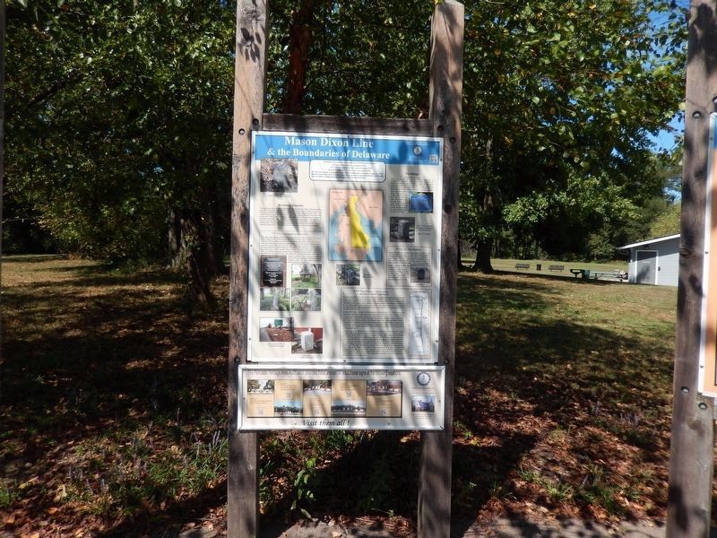
1. Mason Dixon Line & the Boundaries of Delaware Marker
Inscription.
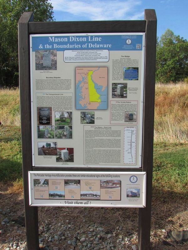
Delaware boundaries are made up of three distinct lines.
* The 12-mile radius, surveyed 1701.
** The Transpeninsular Line, surveyed 1751.
*** The Mason-Dixon Line, surveyed 1763.
All the lines were completed even before Delaware became a state in 1776. Mason and Dixon didn't survey their famous line to separate North and South but to settle a disagreement between colonial landowners.
Boundary Disputes
The land we know as the State of Delaware and the State of Maryland was granted to George Calvert, first Lord Baltimore in 1632 by King Charles I of England. William Penn was granted the land north of Maryland in 1681, now called Pennsylvania. In 1682 the Duke of York granted William Penn the land known as the “The Lower Counties on the Delaware.” This resulted in a dispute because that land was covered under the charter grant to Lord Baltimore. Calvert lost this land when he failed to have it surveyed or establish any settlements. The dispute continued between Penn and Calvert families but started to take form in 1731 when the Transpeninsular Line was established.
** The Transpeninsular Line
The line stretched
Click or scan to see this page online
straight across the Delmarva Peninsula from Fenwick Island west to the Chesapeake Bay. The location was agreed upon by the Penns of Pennsylvania and the Calverts of Maryland after a long-standing fight over the ownership of what is now Delaware. It is ironic that the agreed location was from Cape Henlopen yet the map used was incorrect since it showed Fenwick Island instead of Cape Henlopen. If a correct map had been used, Delmarva would be about 1,000 square miles smaller. The land had been surveyed in 1751 by colonial surveyors measuring a distance of just over 600 miles. Once the distance was determined, the surveyors marked the center with a stone called a Middle Point. That point became the southwest corner of Delaware and the starting point for the north-south line known as the Trangent Line.
The Wedge Description of Stones
The original stones are limestone quarried in Doneshire, England. They ranged from three-and-a-half to five feet long and 12 inches square. All four sides were fluted with horizontal and vertical lines. Every five miles the stone displayed the Coat of Arms of Lord Baltimore on the west side and William Penn
Photographed by Bill Coughlin, October 12, 2019
2. Mason Dixon Line & the Boundaries of Delaware Marker
on the east side. The stones at the other mile points had an M on the west side and a P on the east side. The letters were carved inside a flat circle. From the Middle Point to the in-state corner marker totaled 87 miles with a stone placed every mile.
* The 12-Mile Radius
Delaware’s unique northern boundary, known as the 12-mile circle, originated in 1681 when King Charles II of England granted William Penn land 12 miles north of New Castle. In 1701, Isaac Taylor of Chester County, PA and Thomas Pierson of New Castle County, DE were appointed as surveyors. The survey resulted in an arc, westbound from the Delaware River, 120 degrees or two-thirds of a semicircle ending due west of New Castle. The survey was not approved by Pennsylvania until 1715 and by Delaware in 1719.
*** The Mason-Dixon Line also known as the Tangent Line
For the satisfaction of both families, the best possible surveyors and equipment were needed to complete the north-south “tangent” line. James Bradley, royal astronomer at the Greenwich Observatory was consulted. Charles Mason and Jeremiah Dixon were recommended by Bradley. Mason had been an assistant
Photographed by Don Morfe, September 8, 2019
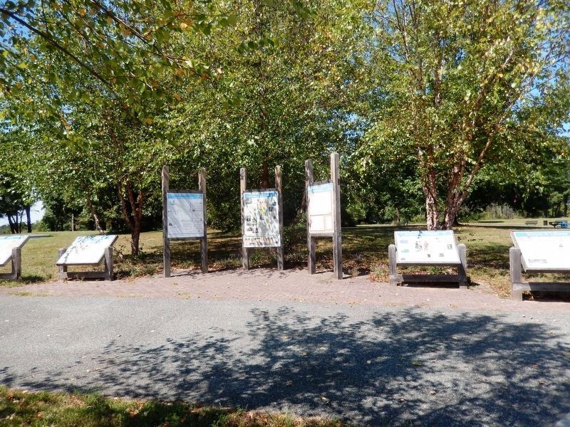
3. Mason Dixon Line & the Boundaries of Delaware Marker
at the Greenwich Observatory and Dixon was described as a competent surveyor. The two men received payment of one pound, one shilling daily for the duration of the survey.
Mason and Dixon arrived in Philadelphia on November 13, 1763 and soon received instructions from the commissioners of Maryland and Philadelphia. They brought along state of the art equipment for the survey. The equipment needed was not just for measuring distance such as a 65-foot long Gunter chain and a precision brass measure to calibrate that chain, but also instruments to measure the movement of the stars to determine ground location. Some of the equipment, such as a newly designed zenith sector and a new astronomical clock were so delicate they were transported on a mattress laid on a cart with a spring suspension.
On June 18, 1764, Mason and Dixon headed south to the Middle Point. Along the way they hired axmen, a steward, land keepers, tent keepers, cooks, and chain carriers, amounting to 39 workers in all. For several weeks, after reaching the Middle Point, the two surveyors worked their way north (3’36’6’ west) on a preliminary survey to mark the main points
Photographed by Don Morfe, September 8, 2019
4. Mason Dixon Line & the Boundaries of Delaware Marker
to another point they determined intersected the 12-mile circle. They then resurveyed south, back to the Middle Point, reaching it on September 25. During the resurvey, they found they were only two feet, two inches off. The north tangent line bisected the 12-mile circle at mile post 82. From that point, Mason and Dixon were instructed to extend the line an additional five miles straight north to latitude 39’43’ north, establishing the west line at marker 87, called the in-state corner marker. When the line was surveyed it crossed to the inside of the arc line. The bulge created by the arc circle gave an additional 13 acres to Delaware.
Erected by Pencader Heritage Area Association.
Topics. This historical marker is listed in this topic list: Colonial Era.
Location. 39° 36.462′ N, 75° 43.612′ W. Marker is near Glasgow, Delaware, in New Castle County. It is in Pencader Hundred. It is on Pulaski Highway (U.S. 40). The marker is located in Glasgow Park. Touch for map. Marker is at or near this postal address: 2275 Pulaski Highway, Newark DE 19702, United States of America. Touch for directions.
Regionally, this marker is in Greater Wilmington and in Greater Philadelphia. It is also in the American Mid-Atlantic, on the Delmarva Peninsula, and on the Eastern Seaboard. Globally, it is in the North Atlantic Region, North America, the Western Hemisphere, the Western World, and the Anglosphere. Historically, it finds itself in what was once New Netherland and also one of the original Thirteen Colonies.
Other markers no longer nearby. Delaware Militia (was here, next to this marker but has been confirmed missing); Marquis de Lafayette (was here, next to this marker but has been confirmed missing).
Credits. This page was last revised on May 20, 2026. It was originally submitted on September 26, 2019, by Don Morfe of Baltimore, Maryland. This page has been viewed 2,768 times since then and 213 times this year. Last updated on July 29, 2020, by Carl Gordon Moore Jr. of North East, Maryland. Photos:1. submitted on September 26, 2019, by Don Morfe of Baltimore, Maryland. 2. submitted on October 12, 2019, by Bill Coughlin of Woodland Park, New Jersey. 3, 4. submitted on September 26, 2019, by Don Morfe of Baltimore, Maryland. • Bill Pfingsten was the editor who published this page.