La Crosse in La Crosse County, Wisconsin — The American Midwest (Great Lakes)
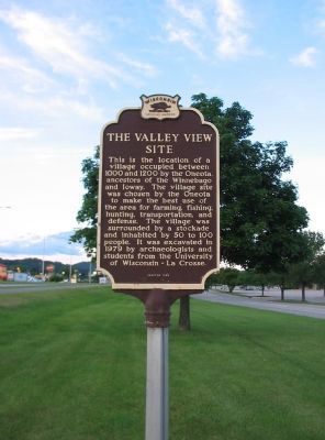
The Valley View Site
Erected 1980 by the Wisconsin Historical Society. (Marker Number 267.)
Topics and series. This historical marker is listed in these topic lists: Native Americans • Notable Places. In addition, it is included in the Wisconsin Historical Society series list.
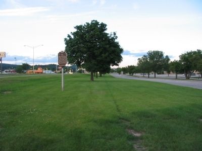
Location. 43° 52.056′ N, 91° 12.078′ W. Marker is in La Crosse, Wisconsin, in La Crosse County. Marker can be reached from State Highway 16, 0.3 miles north of State Highway 157, on the right when traveling east. Marker is located along State Highway 16 and can be reached from the Valley View Mall shopping center parking lot. Touch for map. Marker is at or near this postal address: 3800 State Highway 16, La Crosse WI 54601, United States of America. Touch for directions.
Other nearby markers. At least 8 other markers are within 4 miles of this marker, measured as the crow flies. Tim Gullikson (approx. 1.3 miles away); Campbell Cemetery G.A.R. Memorial (approx. 1.6 miles away); George and Gohres (approx. 2.3 miles away); Red Cloud Park (approx. 2.9 miles away); The Development of Copeland Avenue (approx. 3.3 miles away); Group of Indian Mounds (approx. 3.4 miles away); Myrick Park Mounds (approx. 3.4 miles away); Wisconsin Veterans Memorial Highway (approx. 3˝ miles away). Touch for a list and map of all markers in La Crosse.
Credits. This page was last revised on October 31, 2021. It was originally submitted on January 18, 2009, by Keith L of Wisconsin Rapids, Wisconsin. This page has been viewed 1,568 times since then and 34 times this year. Photos: 1, 2. submitted on January 18, 2009, by Keith L of Wisconsin Rapids, Wisconsin. • Kevin W. was the editor who published this page.

