Near Winchester in Frederick County, Virginia — The American South (Mid-Atlantic)
Rutherford's Farm
In the Path of Battle
November 28, 2008
1. Rutherford's Farm Marker
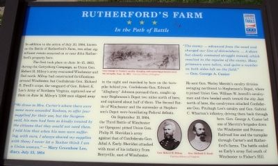
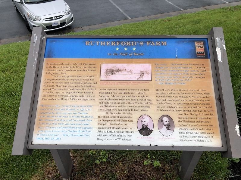
The first took place on June 14-15, 1863, during the Gettysburg Campaign, as Union Gen. Robert H. Milroy’s army evacuated Winchester and fled north. Milroy had constructed fortifications around Winchester, but Confederate Gen. Richard S. Ewell’s corps, the vanguard of Gen. Robert E. Lee’s Army of Northern Virginia, captured one of them on June 14. Milroy’s 7,000 men slipped away in the night and marched by here on the turnpike behind you. Confederate Gen. Edward “Allegheny” Johnson pursued them, caught up near Stephenson’s Depot two miles north of here, and captured about half of them. The Second Battle of Winchester and the surrender at Stephenson’s Depot were humiliating Federal defeats.
On September 19, 1864, the Third Battle of Winchester (or Opequon) pitted Union Gen. Philip H. Sheridan’s army against that of Confederate Gen. Jubal A. Early. Sheridan attacked with most of his infantry from Berryville, east of Winchester. He sent Gen. Wesley Merritt’s cavalry
this page online
“We drove to Mrs. Carter’s where there were some more wounded Yankees, to offer [our supplies] for their use, but the Surgeon said, his men had been so kindly treated by the citizens that they would not need them. I told him that when his men were suffering, with ours, I always shared my supplies with them; I never let a Yankee think I am a Union woman.”
– Mary Greenhow Lee, diary, July 23, 1864
“The enemy … advanced from the wood and charged our line of skirmishers. … A short but closely contested struggle ensued, which resulted in the repulse of the enemy. Many prisoners were taken, and quite a number on both sides left on the field.”
Photographed by Keith Yoder, November 28, 2008
2. Rutherford's Farm Marker
Erected by Virginia Civil War Trails.
Topics and series. This historical marker is listed in this topic list: War, US Civil. In addition, it is included in the Virginia Civil War Trails series list. A significant historical month for this entry is June 2003.
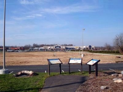
Location. This marker has been replaced by another marker nearby. It was located near 39° 13.241′ N, 78° 7.854′ W. Marker was near Winchester, Virginia, in Frederick County. It was on Martinsburg Pike (U.S. 11), on the right when traveling south. Touch for map. Marker was at or near this postal address: 1876 Martinsburg Pike, Winchester VA 22603, United States of America. Touch for directions.

Regionally, this marker was in the Shenandoah Valley. It was also in the American South, specifically in the Upper South, and in the Mid-Atlantic. Globally, it was in North America, the Western Hemisphere, the Western World, and the Anglosphere. Historically, it found itself in what was once the territory of the Mississippian Culture, one of the original Thirteen Colonies, one of the Confederate States of America, and the Antebellum South.
Other nearby markers. At
Photographed by Devry Becker Jones (CC0), May 28, 2020
3. Rutherford's Farm Marker
The marker has experienced weather damage.
Other markers no longer nearby. Battle of Rutherford's Farm (was here, next to this marker but has been replaced with another marker now near it); John Rutherford's Farm (was here, next to this marker but has been replaced with another marker now near it); Three Battlefields (was approx. 0.7 miles away but has been replaced with another marker now near it).
More about this marker. On the upper middle of the marker is a sketch captioned, Gen. George A. Custer's cavalry charging and capturing prisoners near the turnpike, Sept. 19, 1864. On the lower right of the marker are portraits of Gen. Robert H. Milroy and Gen. Richard S. Ewell.
Related marker. Click here for another marker that is related to this marker. New CWT Markers At This Location titled "Run or Die".
Credits. This page was last revised on November 26, 2024. It was originally submitted on December 1, 2008, by Keith Yoder of Centreville, Virginia. This page has been viewed 2,244 times since then and 61 times this year. Last updated on July 31, 2020, by Bradley Owen of Morgantown, West Virginia. Photos: 1, 2. submitted on December 1, 2008. 3. submitted on May 28, 2020, by Devry Becker Jones of Washington, District of Columbia. • Bernard Fisher was the editor who published this page.
