Elkmont in Limestone County, Alabama — The American South (East South Central)
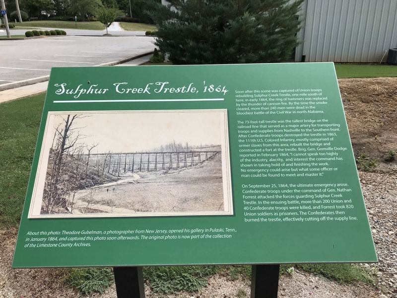
Sulphur Creek Trestle, 1864
The 73-foot-tall trestle was the tallest bridge on the railroad line that served as a major artery for transporting troops and supplies from Nashville to the Southern front. After Confederate troops destroyed the trestle in 1863, the 111th U.S. Colored Infantry, mostly comprised of former slaves from this area, rebuilt the bridge and constructed a fort at the trestle. Brig. Gen. Grenville Dodge reported in February 1864, "I cannot speak too highly of the industry, alacrity, and interest the command has shown in taking hold of and finishing the work. No emergency could arise but what some officer or man could be found to meet and master it."
On September 25, 1864, the ultimate emergency arose. Confederate troops under the command of Gen. Nathan Forrest attacked the forces guarding Sulphur Creek Trestle. In the ensuing battle, more than 200 Union and 40 Confederate troops were killed, and Forrest took 820 Union soldiers as prisoners. The Confederates then burned the trestle, effectively cutting off the supply line.
Caption: About this photo: Theodore Gubelman, a photographer from New Jersey, opened his gallery in Pulaski, Tenn., in January 1864, and captured this photo soon afterwards. The original photo is now part of the collection of the Limestone County Archives.
Topics. This historical marker is listed in these topic lists: Bridges & Viaducts • Railroads & Streetcars • War, US Civil. A significant historical year for this entry is 1864.
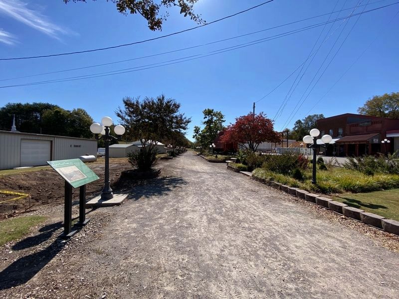
Location. 34° 55.739′ N, 86° 58.392′ W. Marker is in Elkmont, Alabama, in Limestone County. Marker is on Upper Fort Hampton Road (County Road 49) east of Railroad Street, on the right when traveling east. Marker is located near Elkmont Town Hall. Touch for map. Marker is at or near this postal address: 18890 Upper Fort Hampton Road, Elkmont AL 35620, United States of America. Touch for directions.
Other nearby markers. At least 8 other markers are within 4 miles of this marker, measured as the crow flies. Limestone County's First High School / The Delmore Brothers (a few steps from this marker); Elkmont, Alabama / Tenn. & Ala. Central Railroad (within shouting distance of this marker); Elkmont Pride: Family-School-Church (within shouting distance of this marker); Commerce (within shouting distance of this marker); Downtown Scenes (within shouting distance of this marker); Battle of Sulphur Creek Trestle (approx. 1˝ miles away);
Old New Garden Cemetery / New Garden Cumberland Presbyterian Church (approx. 1.8 miles away); Pettusville (approx. 3.8 miles away). Touch for a list and map of all markers in Elkmont.
Credits. This page was last revised on October 10, 2022. It was originally submitted on August 3, 2020, by Duane and Tracy Marsteller of Murfreesboro, Tennessee. This page has been viewed 411 times since then and 36 times this year. Photos: 1. submitted on August 3, 2020, by Duane and Tracy Marsteller of Murfreesboro, Tennessee. 2. submitted on October 10, 2022, by Darren Jefferson Clay of Duluth, Georgia. • Bernard Fisher was the editor who published this page.

