Spokane in Spokane County, Washington — The American West (Northwest)
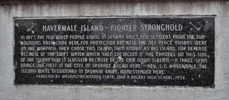
Havermale Island — Pioneer Stronghold
A three-span bridge, the first in the city of Spokane began here.
Rev. S.G. Havermale, the second white missionary in Spokane Falls, homesteaded here.
Erected 1958 by Washington History Class, John R. Rogers High School.
Topics. This historical marker is listed in these topic lists: Native Americans • Settlements & Settlers • Wars, US Indian. A significant historical year for this entry is 1877.
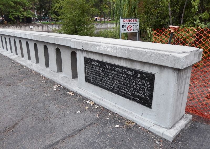
Location. 47° 39.671′ N, 117° 25.27′ W. Marker is in Spokane, Washington, in Spokane County. Marker can be reached from North Howard Street, 0.3 miles south of West Mallon Avenue, on the right when traveling south. Marker is mounted on the west railing of the Howard Street Bridge (now a dedicated pedestrian walkway) at the south end of Havermale Island (Riverfront Park). Touch for map. Marker is in this post office area: Spokane WA 99201, United States of America. Touch for directions.
Other nearby markers. At least 8 other markers are within walking distance of this marker. Early Spokane (within shouting distance of this marker); Spokane County Conservation Futures Program (about 500 feet away, measured in a direct line); Great Northern Railway Passenger Depot Clock Tower (about 500 feet away); The Great Fire of 1889 (about 600 feet away); Post Street Substation (about 600 feet away); Spokane's Electric Streetcars (about 600 feet away); City Hall (about 700 feet away); Canada Island Resolution (approx. 0.2 miles away). Touch for a list and map of all markers in Spokane.
Also see . . .
1. Then and Now: Havermale Island. Rev. Samuel Havermale, a Methodist preacher and businessman, rode through the tiny settlement of Spokane Falls in May 1875. He fell in love with the landscape and moved his family here, one of the first five white families in Spokane. He filed a homestead claim on 120 acres that included the islands in the middle of the Spokane River, where he intended to live. (Submitted on August 5, 2020, by Cosmos Mariner of Cape Canaveral, Florida.)
2. Riverfront Park Spokane. During an 1877 battle with the Nez Perce Indians, the island served as a refuge to the citizens of Spokane due to its natural
barriers. It offered refuge once again during Spokane’s Great Fire of 1889, which devastated the rest of downtown Spokane. (Submitted on August 5, 2020, by Cosmos Mariner of Cape Canaveral, Florida.)
3. Nez Perce War (Wikipedia). The Nez Perce War was an armed conflict that pitted several bands of the Nez Perce tribe of Native Americans and their allies against the United States Army. The conflict, fought between June and October 1877, stemmed from the refusal of several bands of the Nez Perce to give up their ancestral lands in the Pacific Northwest and move to an Indian reservation in Idaho. (Submitted on August 5, 2020, by Cosmos Mariner of Cape Canaveral, Florida.)
Credits. This page was last revised on August 5, 2020. It was originally submitted on August 5, 2020, by Cosmos Mariner of Cape Canaveral, Florida. This page has been viewed 402 times since then and 59 times this year. Photos: 1, 2, 3. submitted on August 5, 2020, by Cosmos Mariner of Cape Canaveral, Florida.


