Near Crestline in San Bernardino County, California — The American West (Pacific Coastal)
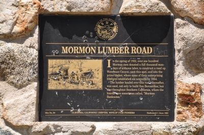
Mormon Lumber Road
The lumber hauled over this road, thereafter, was used, not only to build San Bernardino, but also throughout Southern California, where the boards were sometimes called, "Mormon Banknotes."
Erected 1991 by Glendora California Chapter, Sons of Utah Pioneers. (Marker Number 96.)
Topics and series. This historical marker is listed in these topic lists: Horticulture & Forestry • Roads & Vehicles • Settlements & Settlers. In addition, it is included in the California Historical Landmarks, and the Sons of Utah Pioneers series lists. A significant historical year for this entry is 1852.
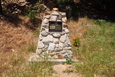
Location. 34° 14.01′ N, 117° 17.628′ W. Marker is near Crestline, California, in San Bernardino County. Marker can be reached from Rim of the World Highway (California Route 18) 0.3 miles west of Highway 138, on the right when traveling west. Marker is located via an access road heading north from the highway. Touch for map. Marker is in this post office area: San Bernardino CA 92404, United States of America. Touch for directions.
Other nearby markers. At least 8 other markers are within 6 miles of this marker, measured as the crow flies. Donald S. Wieman (approx. 3.2 miles away); Garces-Smith Monument (approx. 3˝ miles away); Lake Arrowhead Veterans Monument (approx. 4.4 miles away); The Daley Road (approx. 4˝ miles away); The Arrowhead Landmark (approx. 4.6 miles away); Mountain History Museum (approx. 5.1 miles away); Las Flores Ranch / Mojave Trail (approx. 5.6 miles away); Las Flores Ranch Barn (approx. 5.6 miles away).
More about this marker. This is California Historical Landmark No. 96.
California Historical Landmark Statement of Significance:
When the Mormons came to the San Bernardino valley in 1851 they needed suitable lumber to construct their homes and stockade. To bring in lumber from the mountains they built an 11-mile wagon road that required about a thousand days' labor to complete.
Additional keywords. California Historical Landmark No. 96
Credits. This page was last revised on August 14, 2020. It was originally submitted on January 2, 2012, by Michael Kindig of Elk Grove, California. This page has been viewed 1,371 times since then and 74 times this year. Last updated on August 7, 2020, by Craig Baker of Sylmar, California. Photos: 1, 2, 3. submitted on January 2, 2012, by Michael Kindig of Elk Grove, California. • Andrew Ruppenstein was the editor who published this page.


