Middleborough in Plymouth County, Massachusetts — The American Northeast (New England)
Old Fort
Inscription.
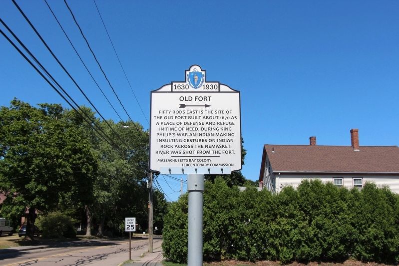
Fifty rods east is the site of the Old Fort built about 1670 as a place of defense and refuge in time of need. During King Philip’s War an Indian making insulting gestures on Indian Rock across the Nemasket River was shot from the fort.
Erected 1930 by Massachusetts Bay Colony Tercentenary Commission.
Topics. This historical marker is listed in these topic lists: Colonial Era • Forts and Castles • Native Americans. A significant historical year for this entry is 1670.
Location. 41° 53.719′ N, 70° 54.349′ W. Marker is in Middleborough, Massachusetts, in Plymouth County. Marker is at the intersection of North Main Street (Massachusetts Route 105) and Barrows Street, on the right when traveling north on North Main Street. The marker is on front lawn of The Memorial Early Childhood Center. Touch for map. Marker is at or near this postal address: 219 N Main St, Middleboro MA 02346, United States of America. Touch for directions.
Other nearby markers. At least 8 other markers are within walking distance of this marker. Revolutionary War Memorial (approx. 0.3 miles away); Middleborough Civil War Monument (approx. 0.4 miles away); Vietnam Era Veterans Memorial (approx. 0.4 miles away); Disabled American Veterans Post 36 (approx. 0.4 miles away); Military Women (approx. 0.4 miles away); Middleborough Veterans Monument (approx. 0.4 miles away); Wayne M. Caron (approx. 0.4 miles away); American Legion Post 64 Memorial (approx. 0.4 miles away). Touch for a list and map of all markers in Middleborough.
Credits. This page was last revised on August 14, 2020. It was originally submitted on August 9, 2020, by Stephen St. Denis of Worcester, Massachusetts. This page has been viewed 464 times since then and 76 times this year. Photo 1. submitted on August 9, 2020, by Stephen St. Denis of Worcester, Massachusetts. • Michael Herrick was the editor who published this page.
Editor’s want-list for this marker. Close-up photo of marker with readable text. • Can you help?
