Groveton near Alexandria in Fairfax County, Virginia — The American South (Mid-Atlantic)
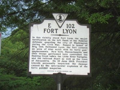
Fort Lyon
Erected 1998 by Department of Historic Resources. (Marker Number E-102.)
Topics and series. This historical marker is listed in these topic lists: Forts and Castles • War, US Civil. In addition, it is included in the Defenses of Washington, the Former U.S. Presidents: #16 Abraham Lincoln, and the Virginia Department of Historic Resources (DHR) series lists. A significant historical date for this entry is June 10, 1863.
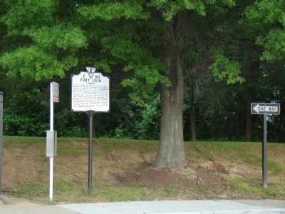
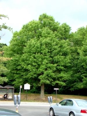
Location. 38° 47.567′ N, 77° 4.588′ W. Marker is near Alexandria, Virginia, in Fairfax County. It is in Groveton. Marker can be reached from North Kings Highway (Virginia Route 241) 0.7 miles north of Richmond Highway (U.S. 1), on the right when traveling north. It is in the upper Kiss & Ride parking lot of the Huntington Avenue Metro station. Touch for map. Marker is in this post office area: Alexandria VA 22303, United States of America. Touch for directions.
Other nearby markers. At least 8 other markers are within walking distance of this marker. Parapet and Gun Platforms (approx. 0.3 miles away); Mount Eagle Mansion (approx. 0.3 miles away); Fairview – Caught in History's Crossfire (approx. 0.7 miles away); The Cameron Valley (approx. 0.7 miles away); Hubert N. ("Dutch") Hoffman, Jr. (approx. ¾ mile away); Belle Haven Park (approx. ¾ mile away); Defenses of Washington (approx. 0.8 miles away); Fort Willard (approx. 0.9 miles away). Touch for a list and map of all markers in Alexandria.
Additional commentary.
1. Fort Lyon Particulars
From Mr. Lincoln's Forts: A Guide to the Civil War Defenses of Washington, by Benjamin Franklin Cooling III and Walton H. Owen II:
The fort was laid out in September 1861 by Major John Newton. The fort became the second largest in the system. Covering an area of nine acres with a perimeter of 937 yards, it was placed on a plateau spur with a commanding view of Hunting Creek and Telegraph Road. The main function of the fort was to prevent Confederate occupation of the high ground (near the modern Metro stop) from which Alexandria could be shelled.
The fort was built mostly by the work of the 27th New York Volunteer Infantry. In addition elements of the 16th New York Infantry, 26th New York Infantry, 34th Massachusetts Infantry, 3rd Battalion New York Artillery, 107th New York Infantry, and 142nd Ohio National Guard occupied the fort at different times during the war.
The armament consisted of ten 32-pounder guns, ten 24-pounder guns, seven 6-pdr guns, two 10-inch mortars, and four 24-pounder mortars. These were arranged in five bastions.
— Submitted May 31, 2008, by Craig Swain of Leesburg, Virginia.
2. The Magazine Explosion
The explosion noted occurred on June 9, 1863. A detail from the 3rd New York Artillery Battalion was managing ammunition and happened to be refilling shells with powder. The process required the existing powder, which had been exposed to moisture, to be removed with wooden spoons. The detail commander, concerned at the slow progress, issued metal priming wires to speed the removal. A spark from one of the priming wires rubbing against the cast iron shell case set off the explosion. Twenty-one were killed in the blast and another ten injured.
Remains of the magazines are reported to stand nearby.
— Submitted May 31, 2008, by Craig Swain of Leesburg, Virginia.
Credits. This page was last revised on January 27, 2023. It was originally submitted on May 31, 2008, by J. J. Prats of Powell, Ohio. This page has been viewed 3,354 times since then and 97 times this year. Last updated on August 10, 2020, by Bradley Owen of Morgantown, West Virginia. Photos: 1, 2, 3. submitted on May 31, 2008, by J. J. Prats of Powell, Ohio. 4. submitted on September 12, 2020, by Allen C. Browne of Silver Spring, Maryland. 5. submitted on January 15, 2011.
