Claremont in Arlington in Arlington County, Virginia — The American South (Mid-Atlantic)
Original Federal Boundary Stone, District of Columbia, Southwest 5
Photographed by Allen C. Browne, April 13, 2014
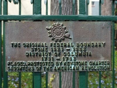
1. Original Federal Boundary Stone SW 5 Marker
Stone 1921 - 1952
District of Columbia
Placed 1791-1792
Protected by Keystone Chapter
Daughters of the American Revolution
Erected by Keystone Chapter, Daughters of the American Revolution.
Topics and series. This historical marker is listed in this topic list: Man-Made Features. In addition, it is included in the Daughters of the American Revolution (DAR), and the Original Federal Boundary Stones series lists. A significant historical year for this entry is 1921.
Location. 38° 50.524′ N, 77° 6.404′ W. Marker is in Arlington, Virginia, in Arlington County. It is in Claremont. It is on South Walter Reed Drive, on the right when traveling west. Marker is in Lucky Run Park, just west of Route 7. Touch for map. Marker is in this post office area: Arlington VA 22206, United States of America. Touch for directions.

Regionally, this marker is in the Washington Metropolitan Area and in Northern Virginia. It is also in the American South, specifically in the Upper South, in the Mid-Atlantic, and on the Eastern Seaboard. Globally, it is in the North Atlantic Region, North America, the Western
this page online
Other nearby markers. At least 8 other markers are within walking distance of this marker: Milley (approx. half a mile away); Harry (approx. half a mile away); Battery Garesché (approx. 0.6 miles away); Outlying Gun Battery (approx. 0.7 miles away); Welcome to Fort Reynolds Park (approx. ¾ mile away); Fort Reynolds (approx. ¾ mile away); Profile of the Fort (approx. 0.8 miles away); a different marker also named Rifle Trench (approx. 0.8 miles away). Touch for a list and map of all markers in Arlington.
Other markers no longer nearby. Outlying Gun Battery (was approx. 0.7 miles away but has been replaced with another marker now near it); Rifle Trench (was approx. 0.8 miles away but has been replaced with another marker now near it); Profile of Fort (was approx. 0.8 miles away but has been permanently removed).
Also see . . .
1. Boundary markers of the original District of Columbia.
Photographed by Allen C. Browne, April 13, 2014
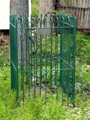
2. Original Federal Boundary Stone SW 5 Marker
2. Boundary Stones of the District of Columbia. (Submitted on April 16, 2014, by Allen C. Browne of Silver Spring, Maryland.)
Photographed by Allen C. Browne, April 13, 2014
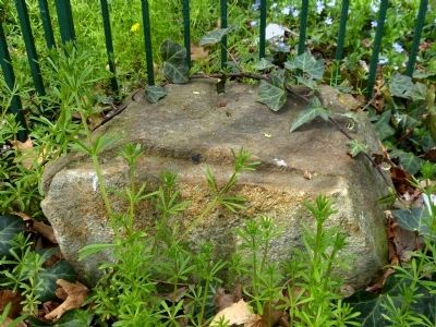
3. Stump of Boundary Stone SW 5
Photographed by Allen C. Browne
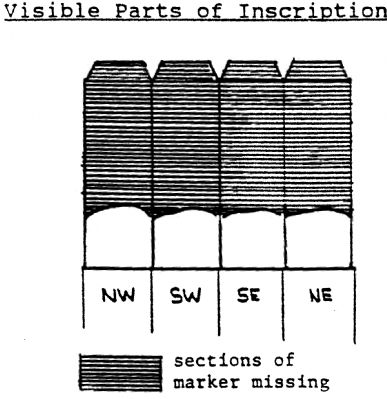
4. Visible Inscriptions
There are no visible inscriptions on this marker, as his diagram from Hynak's National Register Form shows.
Photographed by Allen C. Browne, April 13, 2014
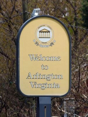
5. Welcome to Arlington County
This marker now sits on the boundary between Arlington County and the city of Alexandria.
Credits. This page was last revised on August 13, 2024. It was originally submitted on April 16, 2014, by Allen C. Browne of Silver Spring, Maryland. This page has been viewed 684 times since then and 34 times this year. Last updated on August 15, 2020, by Roberto Bernate of Arlington, Virginia. Photos: 1, 2, 3, 4, 5. submitted on April 16, 2014, by Allen C. Browne of Silver Spring, Maryland. • Devry Becker Jones was the editor who published this page.
