Chevy Chase in Montgomery County, Maryland — The American Northeast (Mid-Atlantic)
Original Federal Boundary Stone, District of Columbia, Northwest 7
Photographed by Allen C. Browne, January 20, 2008
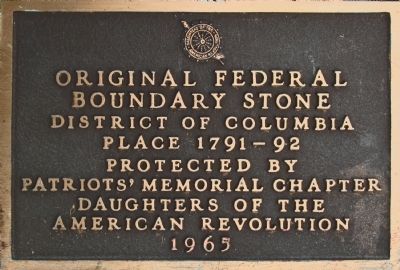
1. Original Federal Boundary Stone NW 7 Marker
Boundary Stone
District of Columbia
Place 1791 - 92
Protected by
Patriots' Memorial Chapter
Daughters of the
American Revolution
1965
Erected 1965 by The Patriots' Memorial Chapter Daughters of the American Revolution.
Topics and series. This historical marker is listed in these topic lists: Man-Made Features • Political Subdivisions. In addition, it is included in the Daughters of the American Revolution (DAR), and the Original Federal Boundary Stones series lists. A significant historical year for this entry is 1791.
Location. 38° 57.912′ N, 77° 4.825′ W. Marker is in Chevy Chase, Maryland, in Montgomery County. It can be reached from the intersection of Western Avenue and Cedar Parkway. Touch for map. Marker is at or near this postal address: 5600 Western Avenue, Chevy Chase MD 20815, United States of America. Touch for directions.

Regionally, this marker is in the Washington Metropolitan Area. It is also in the American Mid-Atlantic. Globally, it is in North America, the Western Hemisphere, the Western World, and the Anglosphere. Historically, it finds itself in what was
this page online
Other nearby markers. At least 8 other markers are within walking distance of this marker: Chevy Chase Theatre (approx. ¼ mile away in District of Columbia); Rock Creek Railway Streetcar (approx. ¼ mile away in District of Columbia); The Chevy Chase Land Company of Montgomery County, Maryland (approx. ¼ mile away in District of Columbia); Francis Griffith Newlands (approx. ¼ mile away in District of Columbia); Colonel Joseph Belt (approx. 0.3 miles away); A Man's Recollection (approx. 0.4 miles away in District of Columbia); Belmont, 1906 (approx. 0.4 miles away); "Oh, It's You, Welcome!" (approx. 0.4 miles away). Touch for a list and map of all markers in Chevy Chase.
Another marker is no longer nearby. What's in a Name? (was approx. ¼ mile away in District of Columbia but has been permanently removed).
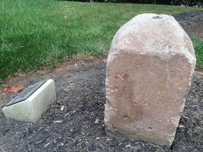
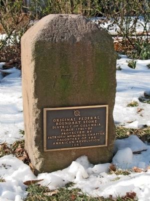
Regarding Original Federal Boundary Stone, District of Columbia, Northwest 7. The DAR fence was removed from this marker in the 1940s. The DAR plaque affixed directly to the stone was dedicated on January 13, 1965.
Photographed by J. Makali Bruton, September 2, 2015
2. Original Federal Boundary Stone NW 7 Marker
Photographed by Allen C. Browne, January 20, 2008
3. Original Federal Boundary Stone NW 7 Marker
Photographed by J. Makali Bruton, September 2, 2015
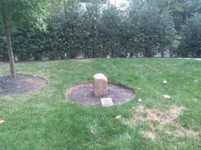
4. Original Federal Boundary Stone NW 7 Marker
The DAR marker has been removed from the boundary stone and affixed to a small cement pedestal. The bushes around the home have grown considerably.
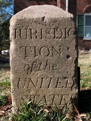
Photographed by Allen C. Browne, February 19, 2006
5. Original Federal Boundary Stone NW 7
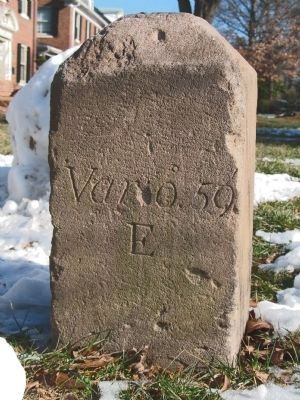
Photographed by Allen C. Browne, January 20, 2008
6. Original Federal Boundary Stone NW 7
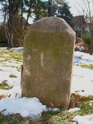
Photographed by Allen C. Browne, January 20, 2008
7. Original Federal Boundary Stone NW 7
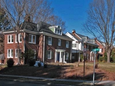
Photographed by Allen C. Browne, February 19, 2006
8. Corner of Cedar and Western
The marker is visible in the front yard of 5600 Western Avenue in this 2006 photo.
Photographed by Allen C. Browne, February 19, 2006
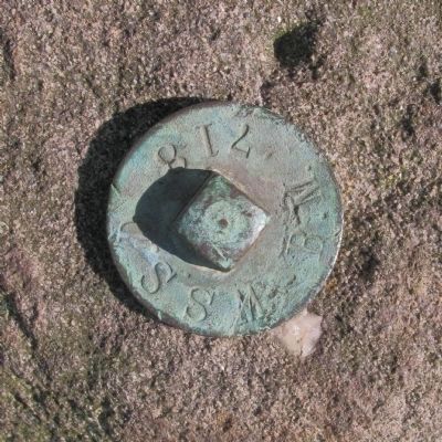
9. W S S D B. M. 718
This bench mark is bolted off center on the top of Boundary Stone NW 7.
Credits. This page was last revised on March 14, 2026. It was originally submitted on May 19, 2014, by Allen C. Browne of Silver Spring, Maryland. This page has been viewed 826 times since then and 36 times this year. Last updated on August 15, 2020, by Roberto Bernate of Arlington, Virginia. Photos: 1. submitted on May 19, 2014, by Allen C. Browne of Silver Spring, Maryland. 2. submitted on September 4, 2015, by J. Makali Bruton of Washington, District of Columbia. 3. submitted on May 19, 2014, by Allen C. Browne of Silver Spring, Maryland. 4. submitted on September 4, 2015, by J. Makali Bruton of Washington, District of Columbia. 5, 6, 7, 8, 9. submitted on May 19, 2014, by Allen C. Browne of Silver Spring, Maryland. • Devry Becker Jones was the editor who published this page.
