Near Henrico in Henrico County, Virginia — The American South (Mid-Atlantic)
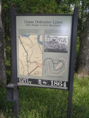
Union Defensive Lines
Fort Brady to Fort Burnham
| — | Fort Brady - 1864 | — |
Photographed by Bill Coughlin, April 24, 2007
1. Union Defensive Lines Marker
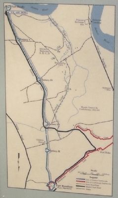
After capturing Fort Harrison on September 29, 1864, Federal troops built a 2½-mile line of fortifications connecting the Union position from Fort Harrison (later renamed Fort Burnham) to Fort Brady here on the James River.
Once the fortifications were completed, Union soldiers, including United States Colored Troops shown in this 1865 photograph, occupied these earthworks until the end of the war.
Erected by Richmond National Battlefield Park - National Park Service.
Topics. This historical marker is listed in this topic list: War, US Civil. A significant historical month for this entry is September 2003.
Location. This marker has been replaced by another marker nearby. 37° 23.526′ N, 77° 21.647′ W. Marker is near Henrico, Virginia, in Henrico County. It is on Hoke Brady Road, on the left when traveling south. Marker is in the parking lot of Fort Brady Unit of Richmond National Battlefield Park. Touch for map. Marker is in this post office area: Henrico VA 23231, United States of America. Touch for directions.

Regionally, this marker is in the Piedmont, in Central Virginia, and in the Richmond Metropolitan Area. It is also
this page online
Other nearby markers. At least 8 other markers are within one mile of this location, measured as the crow flies: Fort Brady Trail (a few steps from this marker); Fort Brady (within shouting distance of this marker); Battle of Trent's Reach (about 300 feet away, measured in a direct line); Powder Magazine (about 300 feet away); a different marker also named Powder Magazine (about 400 feet away); Guns of Fort Brady (about 400 feet away); Guarding the James (about 400 feet away); The Bermuda Hundred Campaign (approx. 1.1 miles away). Touch for a list and map of all markers in Henrico.
Other markers no longer nearby. Inside Fort Brady (was about 300 feet away but has been replaced with another marker now near it); Guarding the River
Photographed by Bill Coughlin, April 24, 2007
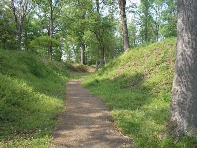
2. Walking Trail at Fort Brady
The marker is located at the beginning of the walking trail through Fort Brady on the James River.
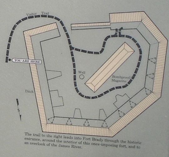
More about this marker. The right of the marker contains the war-time photograph mentioned in the marker text. Below this is a map of a walking trail through Fort Brady. The left side of the marker features a map of the line of Union fortifications from Fort Brady (site of the marker) to Fort Burnham (site of Confederate Fort Harrison).
Regarding Union Defensive Lines. This marker was replaced by a new one named Fort Brady Trail (See nearby markers).
Also see . . . Battlefield Tour - Ft Gilmer to Ft Brady. Richmond National Battlefield Park website. (Submitted on January 20, 2009, by Bill Coughlin of Woodland Park, New Jersey.)
Photographed by Bill Coughlin, April 24, 2007
3. Richmond National Battlefield Park
Marker is in the Fort Brady Unit of Richmond National Battlefield Park.
Photographed by Bill Coughlin, April 24, 2007
4. Map of Union Fortifications Near Richmond
Photographed by Bill Coughlin, April 24, 2007
5. Map of Fort Brady Walking Trail
Credits. This page was last revised on January 6, 2025. It was originally submitted on January 20, 2009, by Bill Coughlin of Woodland Park, New Jersey. This page has been viewed 1,055 times since then and 28 times this year. Photos: 1, 2, 3, 4, 5. submitted on January 20, 2009, by Bill Coughlin of Woodland Park, New Jersey.
