Belle View near Alexandria in Fairfax County, Virginia — The American South (Mid-Atlantic)
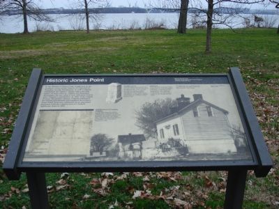
Historic Jones Point
Mount Vernon Trail
— George Washington Memorial Parkway, National Park Service —
Photo Caption: Original District of Columbia Boundary—A 1791 map drawn by Andrew Ellicott, who conducted the land survey for the nation’s capital with Benjamin Banneker. The shaded area, originally part of the District of Columbia, was returned to Virginia in 1846.
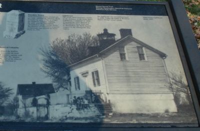
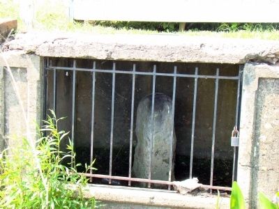
Photo Caption: Boundary Stones—Forty boundary stones, erected one per mile, outlined the District. Each included the year (1791 or 1792), the magnetic compass reading, the state, and the inscription “Jurisdiction of the United States”. The District of Columbia’s original cornerstone was erected on Jones Point in 1791.
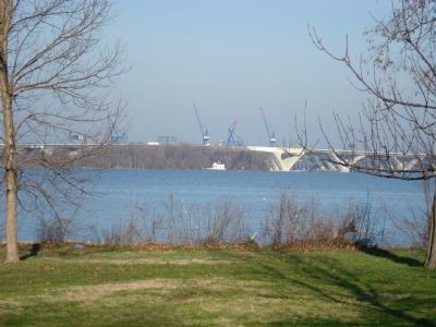
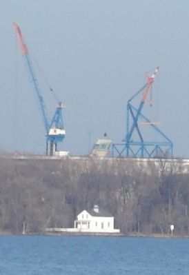
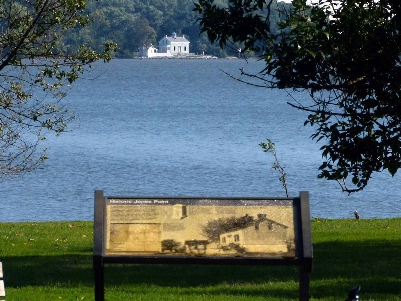
Photo Caption: Lighthouse—The small white structure, visible in the distance, is the Jones Point Lighthouse. Completed in 1856, it marked the river channel to Washington’s Navy Yard and to Alexandria, the third busiest seaport in the Chesapeake Bay region. The lighthouse was decommissioned in 1926. Today the lights of the Woodrow Wilson Bridge orient vessels. Jones Point Lighthouse about 1929.
Erected by National Park Service, U.S. Department of the Interior.
Topics and series. This historical marker is listed in these topic lists: Colonial Era • Landmarks • Waterways & Vessels. In addition, it is included in the Former U.S. Presidents: #01 George Washington, the Lighthouses, and the Original Federal Boundary Stones series lists. A significant historical year for this entry is 1790.
Location. 38° 46.809′ N, 77° 3.118′ W. Marker is near Alexandria, Virginia, in Fairfax County. It is in Belle View. Marker can be reached from George Washington Memorial Parkway (near Mile Marker 7.0). Located near the first parking lot of Belle Haven Park. Exit parkway on unnamed road to Belle Haven Marina and then take left turn into parking areas. Marker is along the Mount Vernon Bicycle trail very near the restrooms which are east and north of the parking lot. Touch for map. Marker is in this post office area: Alexandria VA 22307, United States of America. Touch for directions.
Other nearby markers. At least 8 other markers are within walking distance of this marker. Colonial Fort (about 300 feet away, measured in a direct line); These Trees (about 700 feet away); Wasteland or Wetland? (approx. 0.2 miles away); A Place to Rest—or Nest (approx. 0.4 miles away); Anatomy of a Tidal Marsh (approx. 0.7 miles away); Defenses of Washington (approx. 0.8 miles away); Fort Willard (approx. 0.8 miles away); a different marker also named Fort Willard (approx. 0.8 miles away). Touch for a list and map of all markers in Alexandria.
Also see . . . Jones Point Lighthouse. (Submitted on December 31, 2006, by Roger Dean Meyer of Yankton, South Dakota.)
Additional keywords. Original Federal Boundary Stones Historical Markers; Boundary Markers
Credits. This page was last revised on January 27, 2023. It was originally submitted on December 31, 2006, by Roger Dean Meyer of Yankton, South Dakota. This page has been viewed 2,845 times since then and 99 times this year. Last updated on August 17, 2020, by Roberto Bernate of Arlington, Virginia. Photos: 1, 2, 3, 4, 5. submitted on December 31, 2006, by Roger Dean Meyer of Yankton, South Dakota. 6, 7. submitted on June 21, 2008, by J. J. Prats of Powell, Ohio. 8. submitted on December 15, 2020, by Allen C. Browne of Silver Spring, Maryland. • Devry Becker Jones was the editor who published this page.
