History of Chatham Lighthouse
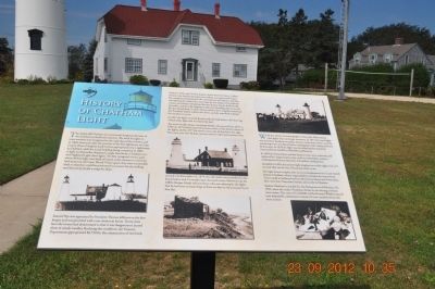
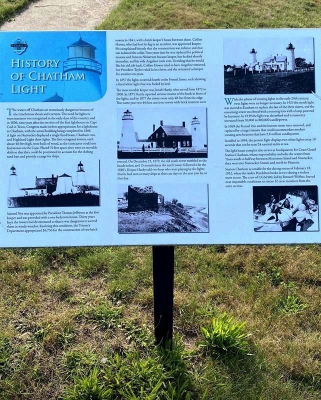
Samuel Nye was appointed by President Thomas Jefferson as the first keeper and was provided with a one-bedroom house. Thirty years later the towers had deteriorated so that it was dangerous to ascend them in windy weather. Realizing this condition the Treasury Department appropriated $6,750 for construction of two brick towers in 1841, with a brick keeper's house between
this page online
In 1857 the lights received fourth-order Fresnel lenses, each showing a fixed white light that was fueled by lard.
The most notable keeper was Josiah Hardy, who served from 1872 to 1900. In 1875 Hardy reported serious erosion of the bank in front of the lights, and by 1877 the towers were only 48 feet from the edge. The same year two 44 foot cast iron towers with brick interiors were erected. On December 15, 1879, the old south tower tumbled to the beach below, and 15 months later the north tower followed it. In the 1880's, Keeper Hardy told two boys who were playing by the lights that he had seen as many ships as there are days
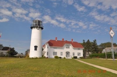
With the advent of rotating lights in the early 20th century, twin lights were no longer necessary. In 1923 the north light was moved to Eastham to replace the last of the three sisters, and the remaining tower was fitted with a rotating lens with a lamp powered by kerosene. In 1939 the light was electrified and its intensity increased from 30,000 to 800,000 candlepower.
In 1969 the Fresnel lens and the lantern room were removed, and replaced by a larger lantern that could accommodate modern rotating aero beacons that have 2.8 million candlepower.
Installed in 1994, the present light display two white lights every 10 seconds that can be seen 24 nautical miles at sea.
The light house complex also serves as headquarters for the Coast Guard Station Chatham, whose responsibility includes the water from Truro south to halfway between Monomoy Island and Nantucket, then west into Nantucket Sound, and north to Hyannis. Station Chatham is notable for the daring rescue of February 18, 1952, when the tanker Pendelton broke in two during a violent snow storm. The crew of CG36500, led by Bernard Webber, braved
Topics and series. This historical marker is listed in these topic lists: Landmarks • Waterways & Vessels. In addition, it is included in the Former U.S. Presidents: #12 Zachary Taylor, and the Lighthouses series lists. A significant historical date for this entry is February 18, 1620.
Location. 41° 40.28′ N, 69° 56.964′ W. Marker is in Chatham, Massachusetts, in Barnstable County. It is on Main Street. Touch for map. Marker is in this post office area: Chatham MA 02633, United States of America. Touch for directions.

Regionally, this marker is on Cape Cod. It is also in the American Northeast, in New England, and on the Eastern Seaboard. Globally, it is in the North Atlantic Region, North America, the Western Hemisphere, the Western World, and the Anglosphere. Historically, it finds itself in what was once one of the original Thirteen Colonies.
Other nearby markers. At least 8 other markers are within walking distance of this marker: U.S. Coast Guard Steel 44-Foot Motor Life Boat CG44301 (within shouting distance of this marker); The Mayflower Story (within
Credits. This page was last revised on December 30, 2024. It was originally submitted on February 18, 2013. This page has been viewed 995 times since then and 66 times this year. Last updated on August 17, 2020, by Ray Gurganus of Washington, District of Columbia. Photos: 1, 2, 3. submitted on February 18, 2013, by Sandra Hughes Tidwell of Killen, Alabama, USA. 4. submitted on December 26, 2024, by Diane Murphy of Saint Cloud, Florida. • J. Makali Bruton was the editor who published this page.
